|
|
|
SEVERE STORMS DURING HEAT WAVE IN HAMPTON ROADS June 30, 2012: The heat wave that has gripped much of the nation this past week has also had Hampton Roads in its grip. Day time temps have ranged from the upper 90's to lower 100's with humidity levels making it feel like it was 110 degrees at times. The ridge of high pressure is set up in the center portion of the country and has moved little most of this week. Around the ridge coming out of the upper mid west and Canada has been storm systems developing in the heat and eventually moving east then east southeast. This has brought much needed breaks in the heat with storms moving into the area and dumping heavy rains. On Saturday evening, it was no different. Storms developed and were moving through Virginia with some of the stronger storms near the Richmond area with one being tornado warned around 7pm or 8pm. As these storms pushed their way into Hampton Roads they continued to intensify. Warnings were issued for all of the south eastern Virginia cities and portions of northeast North Carolina. Below are photos of the lightning produced by those storms as it lasted into the early morning hours of July 1st.
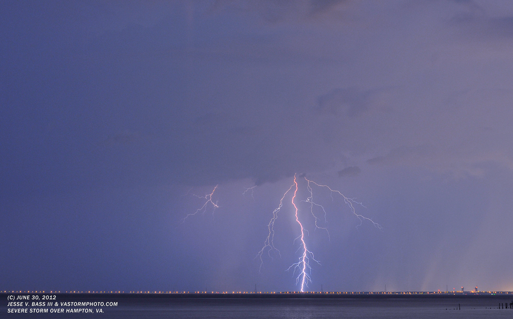
First line of storms dropping south from Hampton and Newport News into the Suffolk area. Taken from Tidewater Community College Suffolk campus.
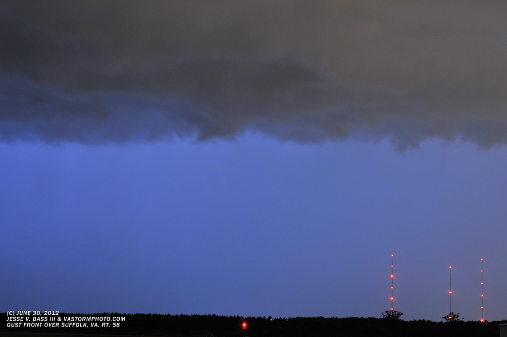
After leaving the T.C.C. campus, I headed westward on Rt. 58 to the Suffolk Airport. You can see the gust front just overhead with a continues lightning show behind it. Just minutes after tis shot, winds gusted to about 35-40mph and I packed up just before the rain started pouring.
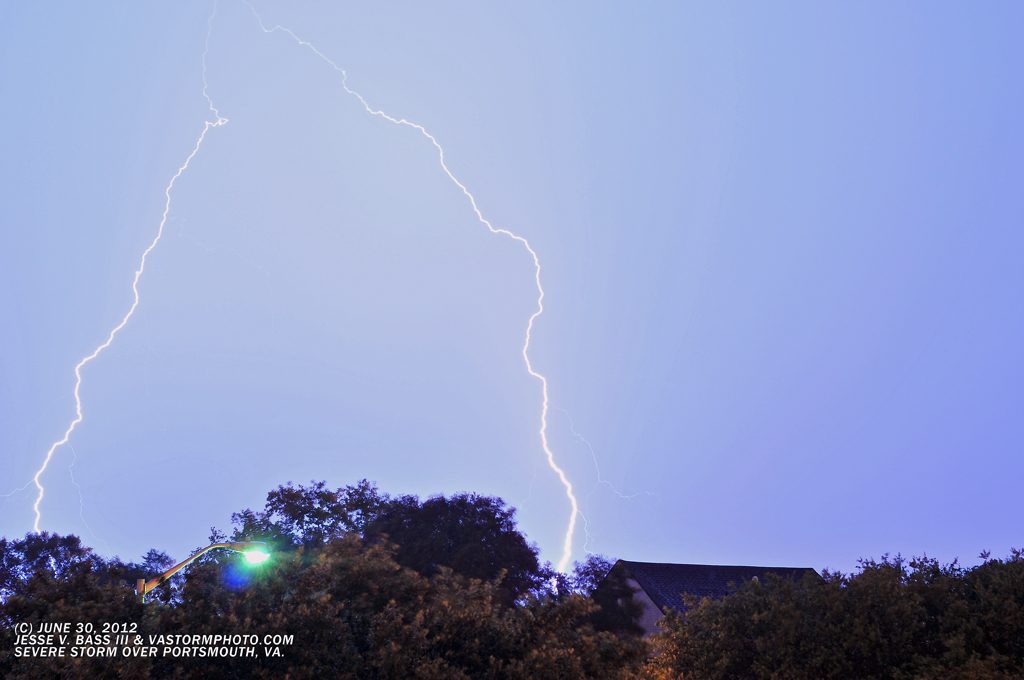
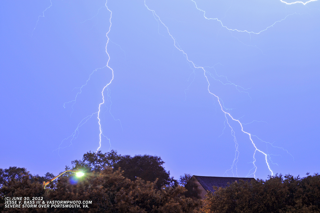
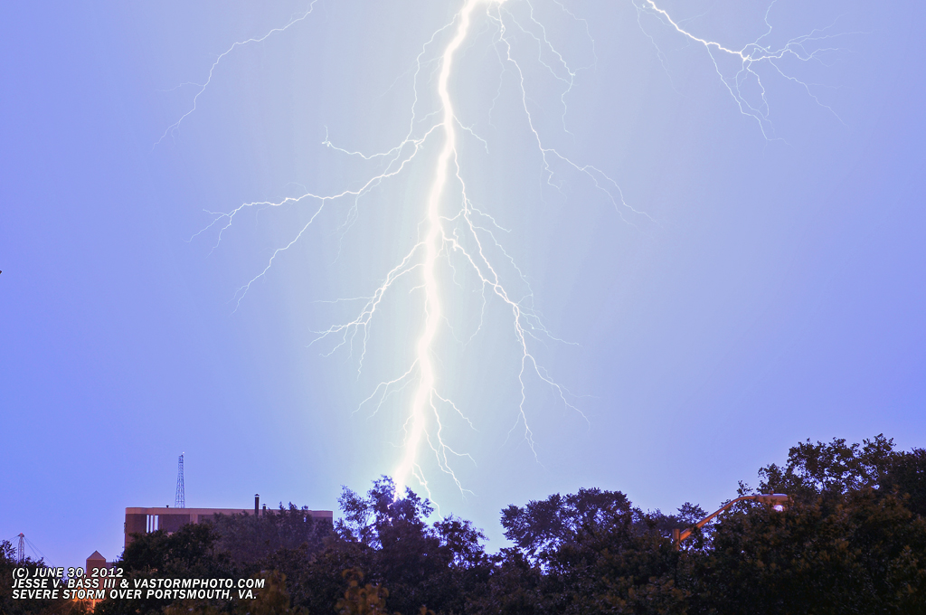
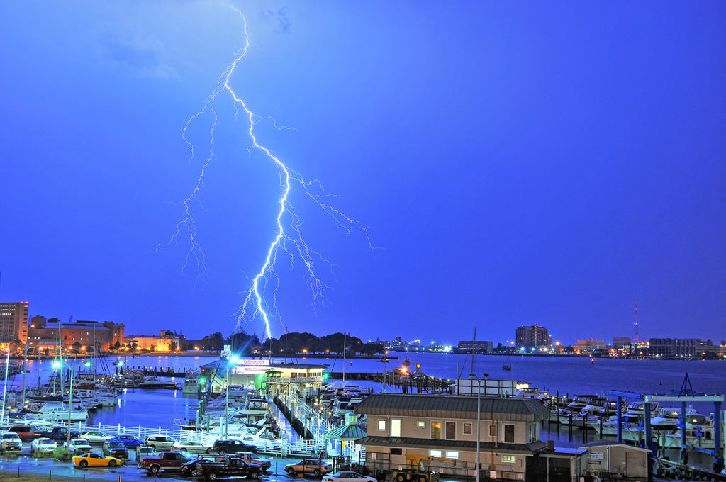
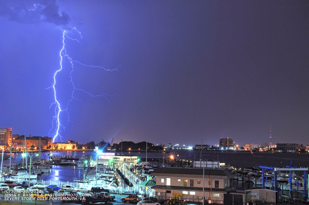
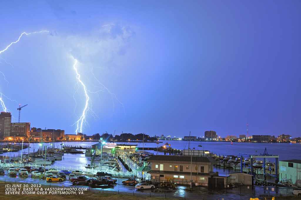
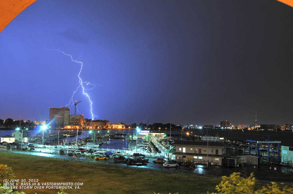
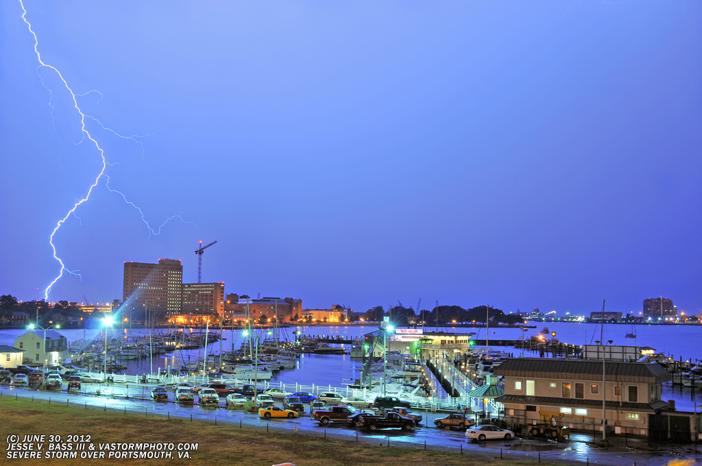
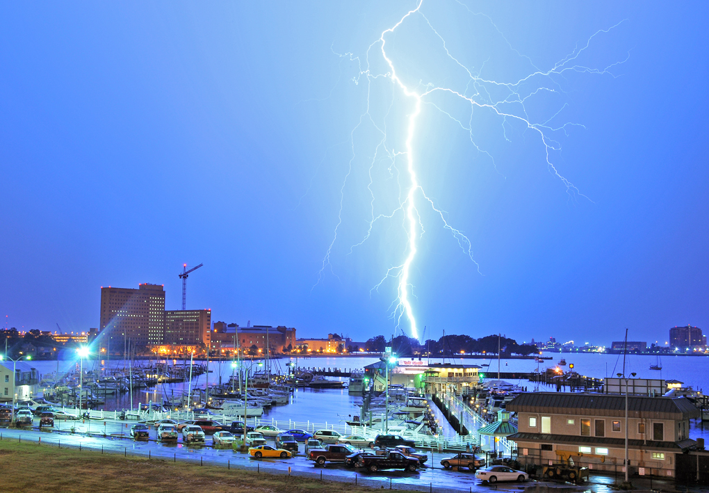
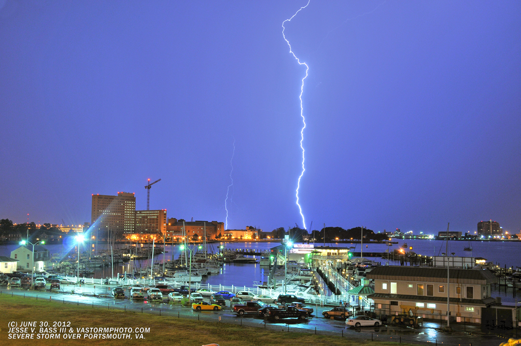
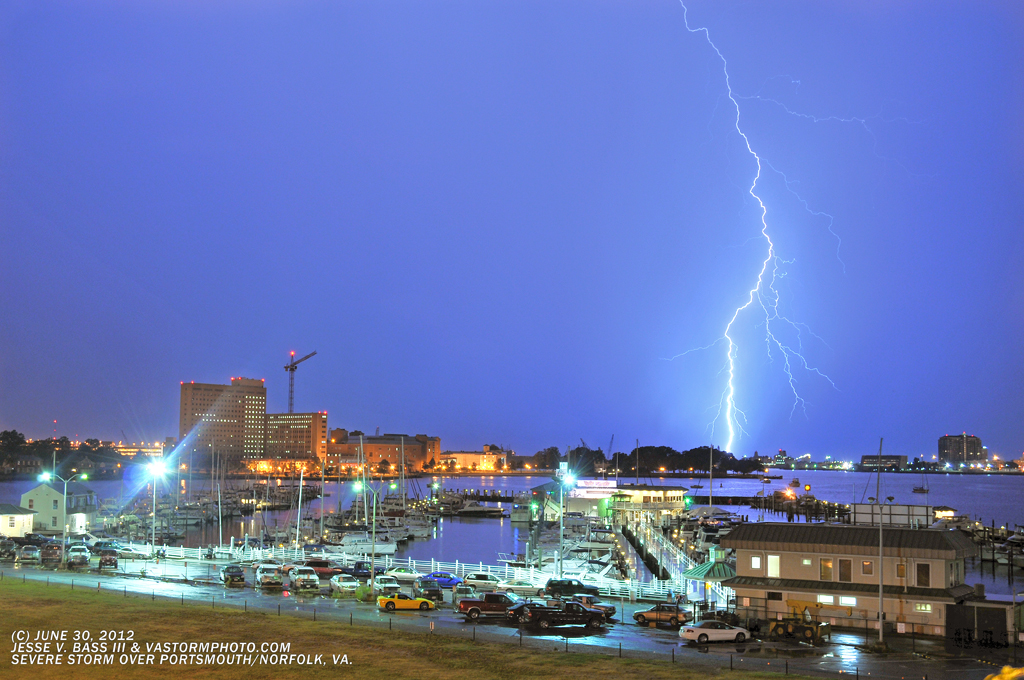
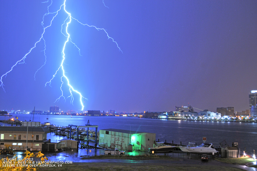
After getting to downtown Portsmouth, I shot these photos looking westward as the first line moved into Portsmouth. The last photo of the 3 is a bit blown out as I was not expecting any bolt that large or that close.
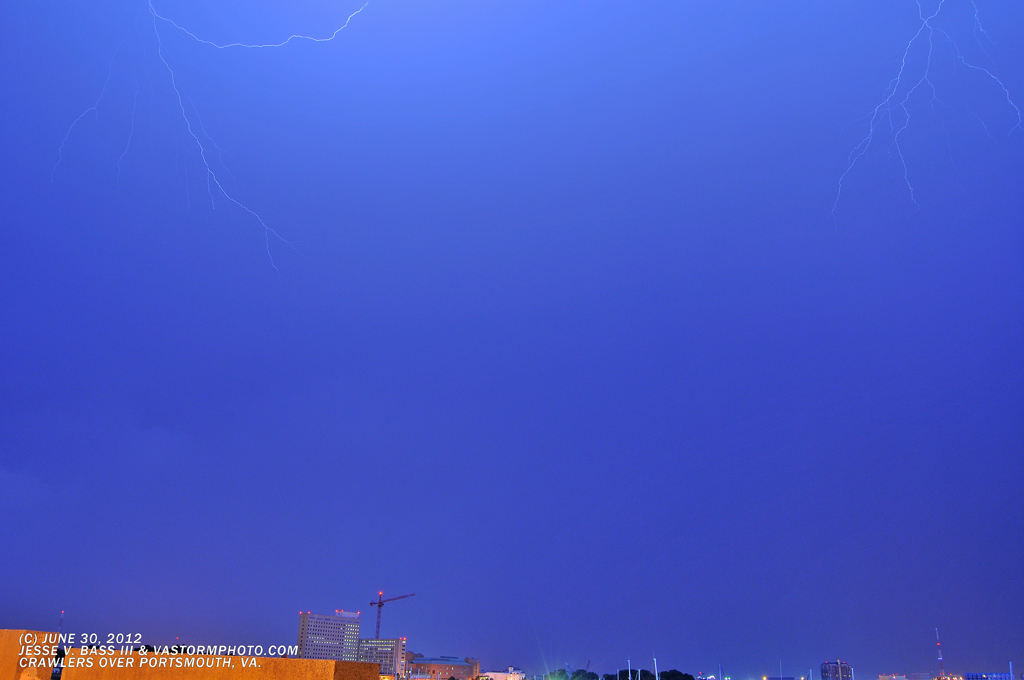
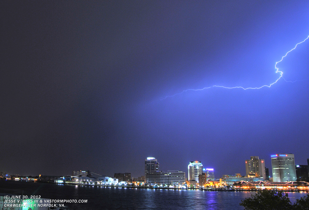
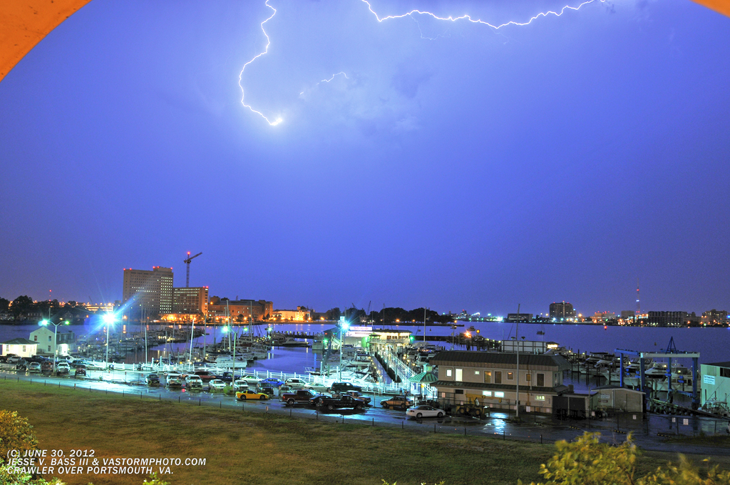
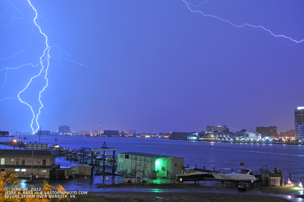
Just as the storms were moving off to the south, I noticed some crawler action behind me to my north. So I set up to catch a few of those crawlers when I caught one but in the next shot it threw out a big CG to the right. You can only see a little of the branching off that CG.
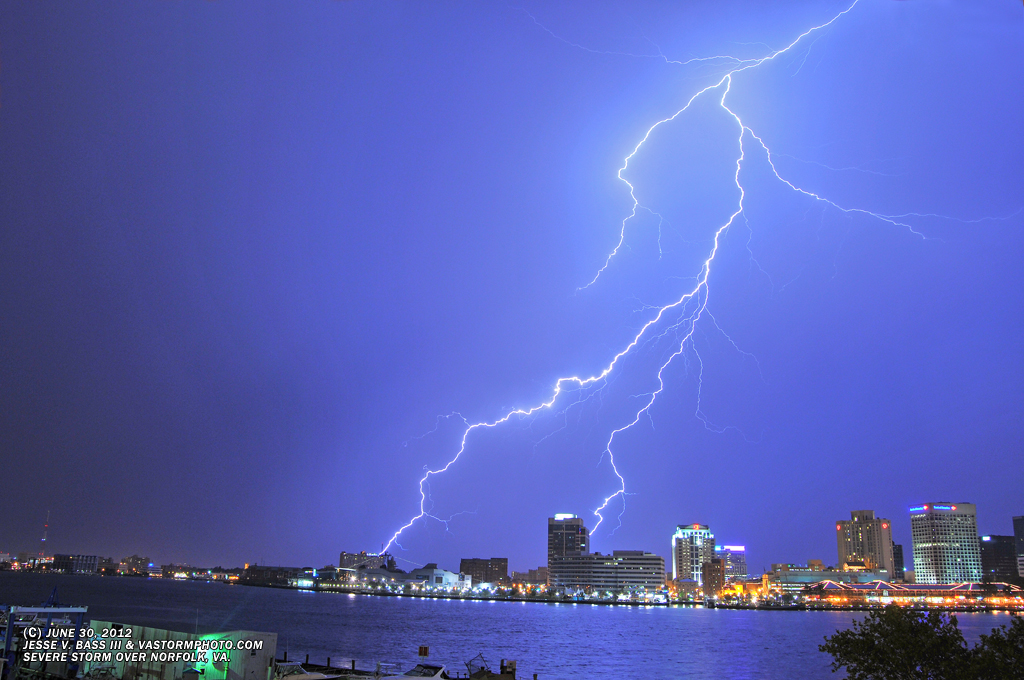
While trying to catch some crawlers over downtown Norfolk, this crawler actually connected making the double CG.
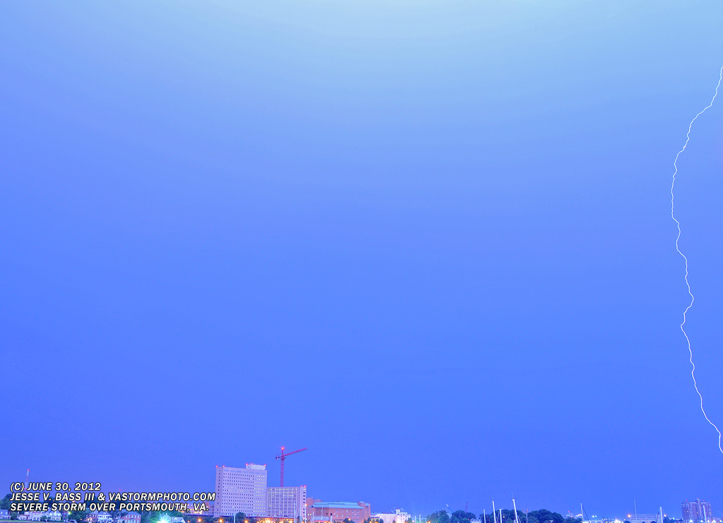
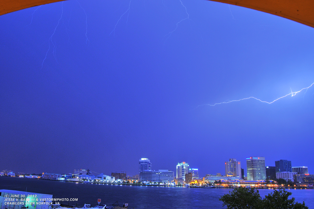
A little more of the crawler action over Norfolk. Nothing to really get excited over, but it was part of the same complex of storms and was part of a long evening.
Actually watch this connect from the ground up as some crawlers were running through the clouds and caught the leaders jumping up from behind the building to connect.
As the second wave of storms was moving into the area a few bigger crawlers started to leap out overhead.
Looking off to the north and west this cell started throwing out some nice, big CGs as it made its way eastward.
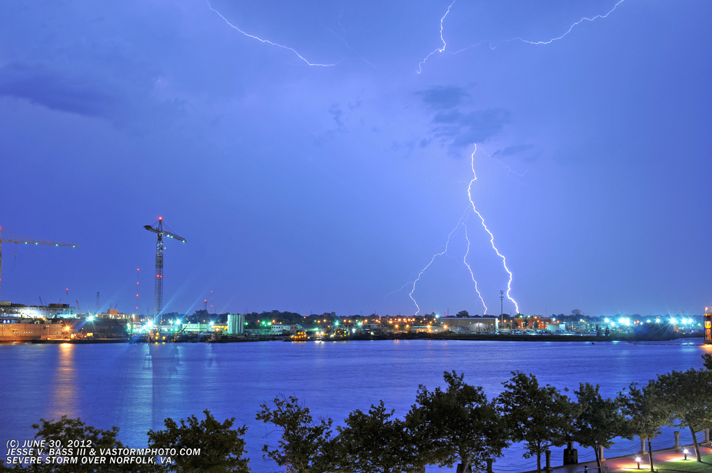
The second line/ cluster was now moving in. Managed to catch a couple of nice CGs as they approached from the west.
The 2 photos above are back to back images as the shutter was cycling this is the same bolt in the image above as the first one above it. You can notice that the channel is in the same place and the bolt looks the same only no branching. The second shot is of the return stroke a second later.
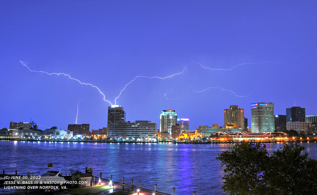
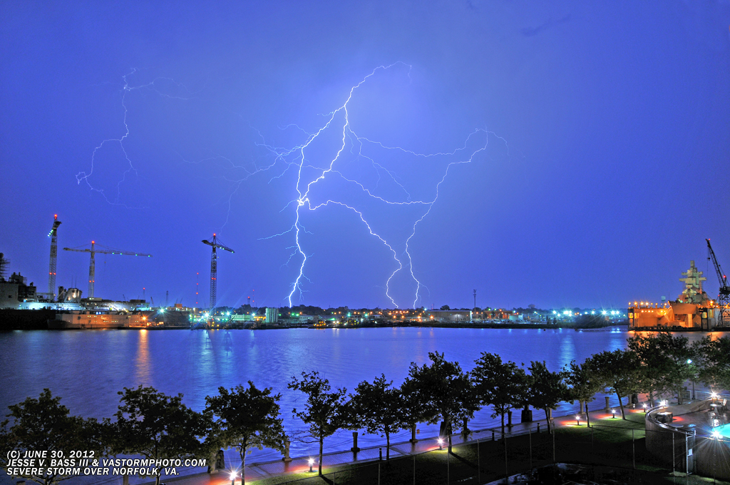
It appears in this shot that something in Norfolk took a direct hit. Nice big CG as most were Saturday night.
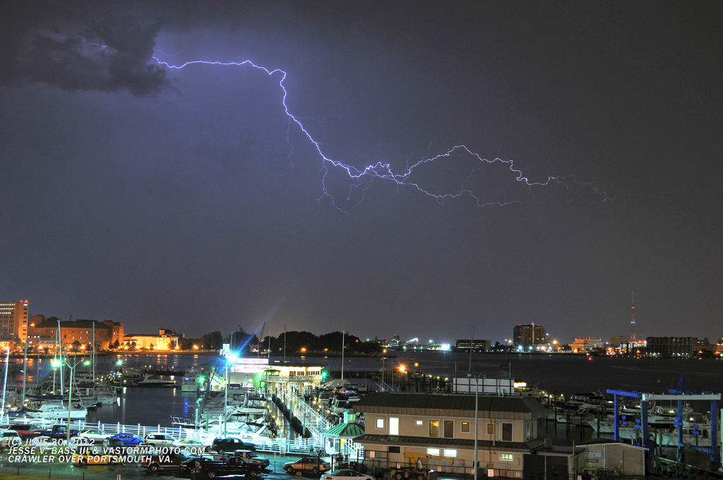
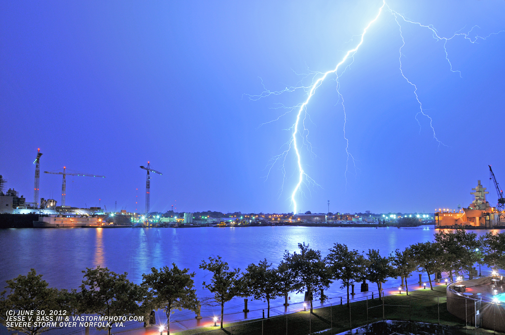
Now looking off to the east southeast after the storms had passed me, this nice CG came down maybe a few miles away over the shipyard in the foreground.
They look like they are dancing...?
All in all a good night for lightning photography. Anyone who knows me has herd me complain over the last year or 2 that events and chances like this have just not happened. Thankfully this time it held together and I was on top of it. With the heat wave and the ridge still in place, looks like we may have another chance late tonight (July 1st) and then another chance maybe tomorrow afternoon/ evening as well. All Images Copyright Jesse V. Bass III and
VaStormphoto.com Copyright 2012 All Rights Reserved
|