|
|
|
RETURN TO WAVELAND- DOCUMENTING THE DESTRUCTION OF A SMALL TOWN CONTINUED October 13, 2005 Once we left Gulfport, we headed westward along I-10 since the bridge across St. Louis Bay that is Hwy. 90 was destroyed during the hurricane. You will see photos of that below. Now, once in Waveland we went to the Waveland Fire Department where Mark and Mike were supposed to stay during the storm. They had traveled to Waveland and met up with the fire chief David Garcia who Mark and I met at the National Hurricane Conference a few years ago. He gave us his card and told us we were welcome to come there for any landfalling hurricane in the area. So Mark and Mike went to Waveland to check it out and see what the area was like as Katrina had become a category 5. They decided that they would return later in the evening after setting up a few cameras in and around Gulfport. As I said back on page 1, the later it got in the evening on Sunday night, they were worried that the roads may have washed out, or something like that could have happened while they were on the road so they had decided to stay in Gulfport for the duration. Well David was happy to see us when we arrived at the fire station and was ready to head out with us to take us on a tour of the town- or what was left of it. He just like everyone else in the town had lost just about everything during the storm. He told us about how several of his friends and neighbors stayed in their homes to ride out Katrina, four of them to be exact, and they all died in the massive storm surge that swept through the town. He talked about how they found the bodies of people who had been swept away, but he also talked about the several people who stayed and managed to survive this devastation. Two older women staying in the city's public works building were trapped in the elevator as the surge started to rise quickly. Luckily for these women, the fire station was going underwater and the entire department evacuated to that building just across the street. Several firefighters were able to free the women and they all took shelter on the second floor of the building. David talked to us about how the water was coming from the south with waves breaking through the trees and just washing through everything in the area nearly 3 miles inland from the Gulf. "The sight was incredible, unimaginable, and horrific" David said. "Somehow, I forgot to grab my camcorder!" David and the rest of the firefighters started counting the bricks on a nearby building to see how fast the water was rising. "After several hours, the water finally started to go down, and that's when we knew we were going to be ok. Our thoughts then turned to saving our people who decided to stay" said David. Once they were able to get out and into the town, they knew then that finding people alive was going to be a difficult task. Pretty soon he noted that once south of the railroad tracks and closer to the center of town, "We were not sure where we were at times. Landmarks, building that once stood in areas of Waveland for years were gone without a trace. We got lost in our own town." We were in utter amazement at what we were seeing. We know how bad hurricanes are and can be but never thought we would see this type of destruction in our lifetime. Below tells the story in pictures. There are several maps to go along with some of the photos as well as an explanation with each photo.
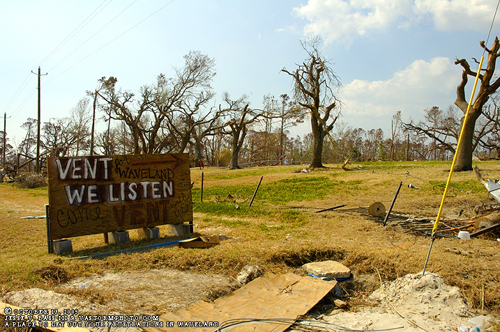
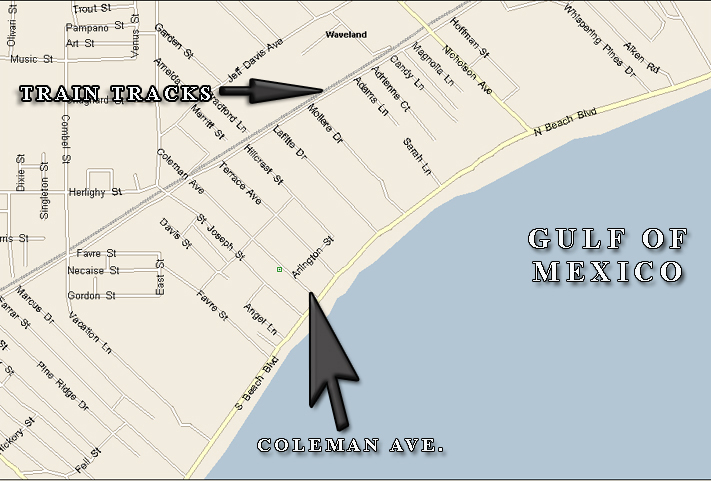
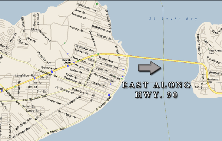
Near the Gulf Of Mexico just off Hwy. 90 was Coleman Ave. Just up the road was a tent where the folks of Waveland could vent about their frustrations in the lack of support and help they were receiving.
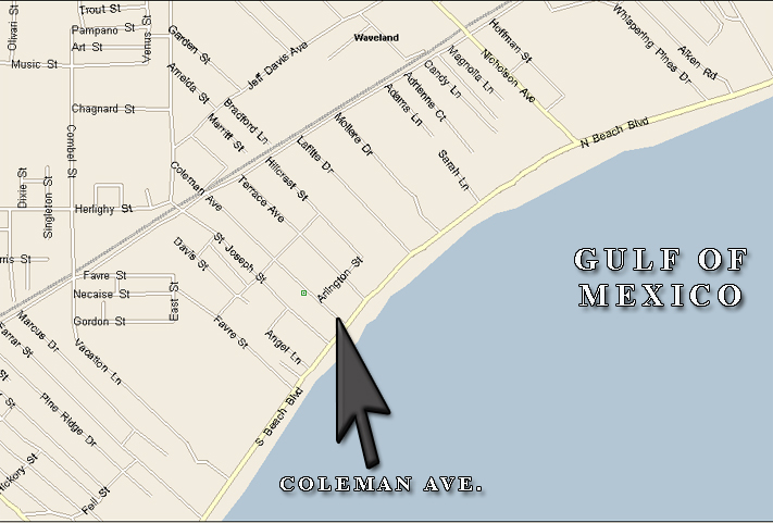
Here is a map of the town of Waveland and Coleman Ave.
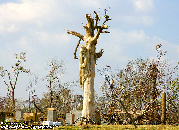
This tree left looking over the Gulf was spooky in appearance. David talked about how several folks who were coming into town to help with rescue efforts saw this tree and thought that someone was hanging from the tree.
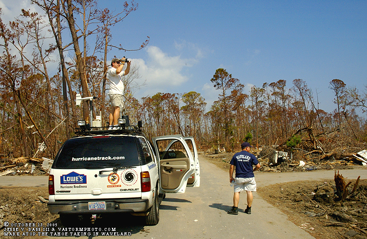
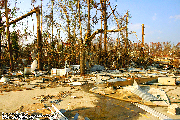
Up the road on Coleman we turned onto a side street and into a neighborhood where Mark climbed onto the roof of the Tahoe to overlook the neighborhood. There was nothing left standing anywhere in the area. As you can see in the background, no leaves on the trees, or what was there is brown and dead from the salt water. David Garcia is standing next to the Tahoe.
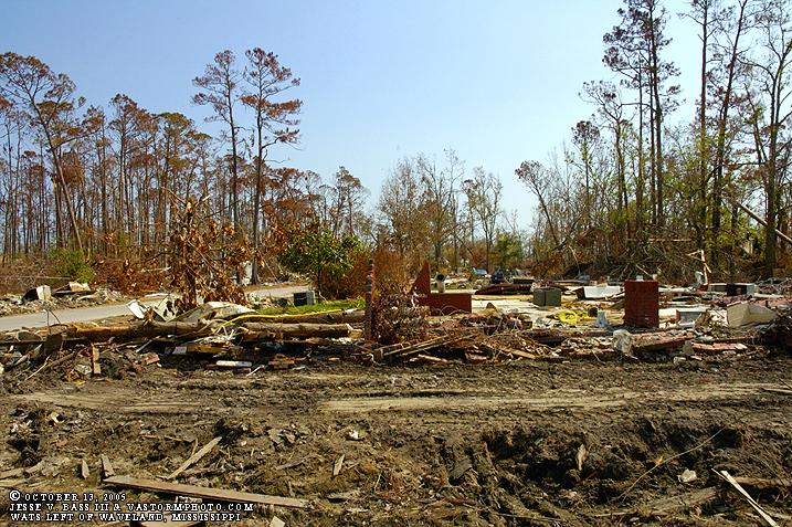
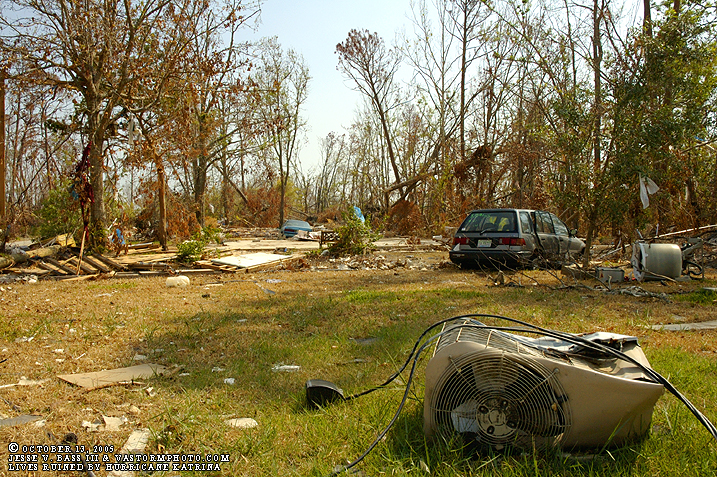
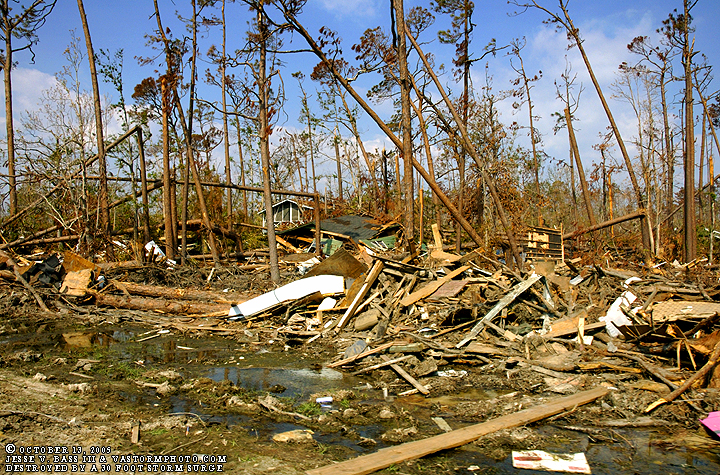
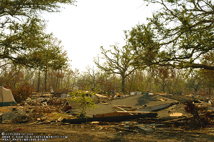
Here area a few photos from the place we were standing in the picture above with Mark on the roof of the Tahoe. You can see the foundations of homes, but that's about it. Debris litters the area with several vehicles still sitting in the same place they came to rest as the surge reseeded.
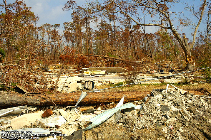
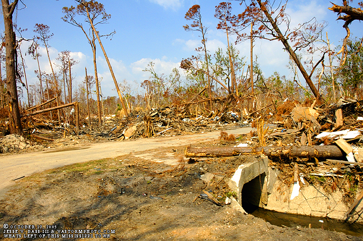
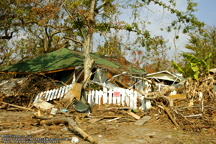
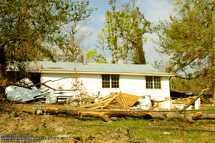
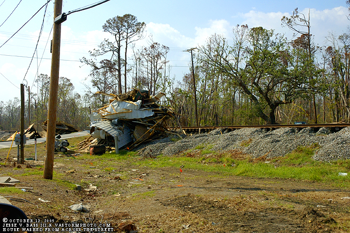
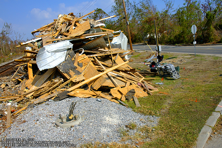
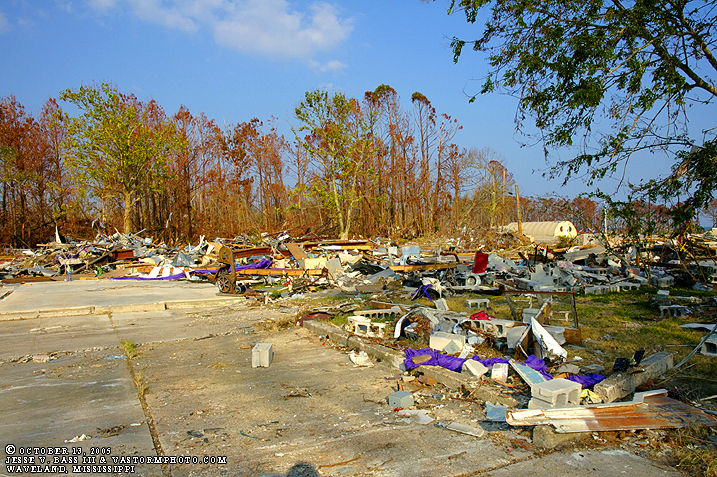
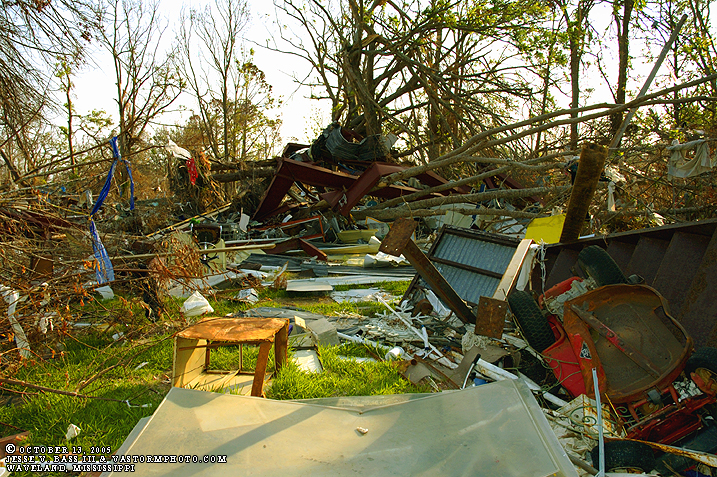
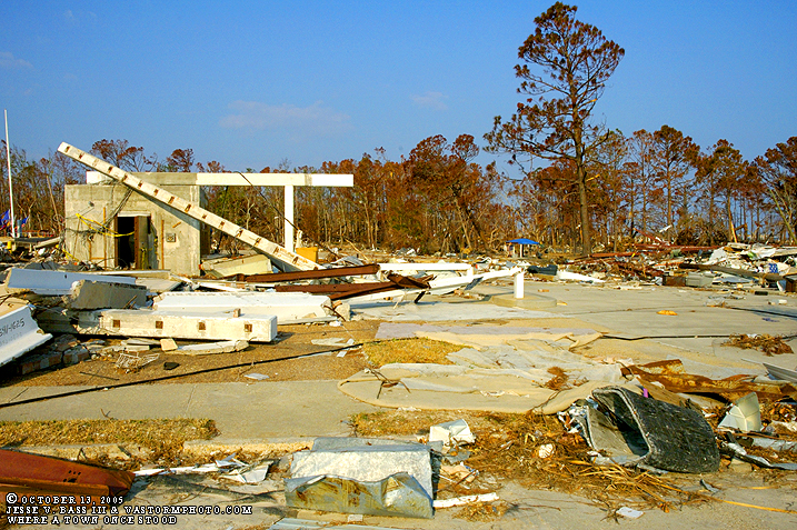
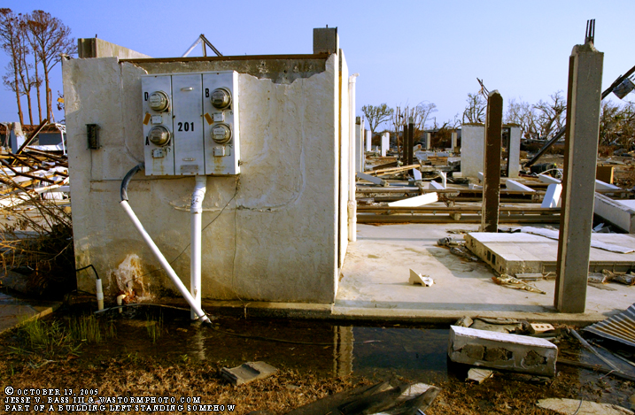
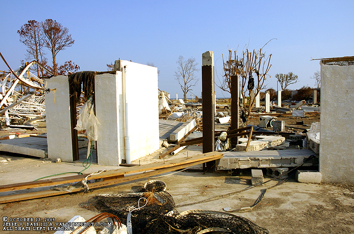
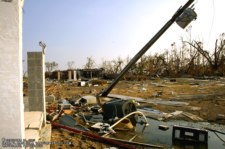
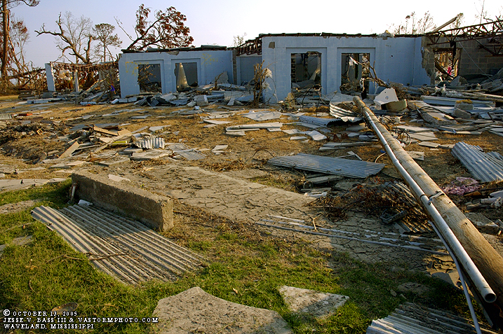
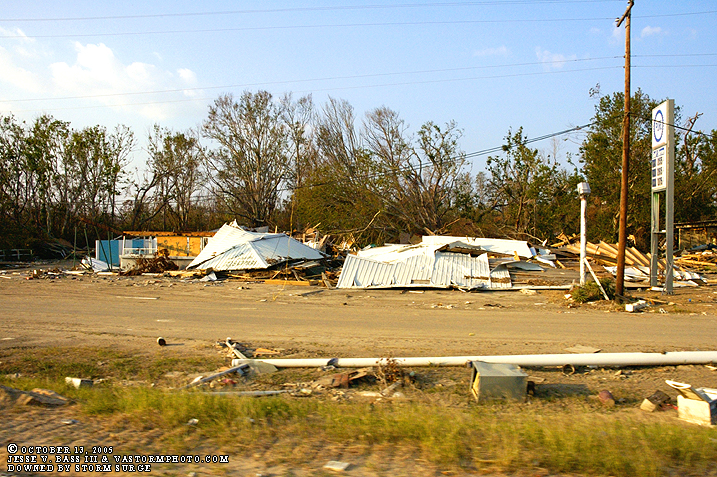
Utter devastation through the entire town. As you see in the photos above, some areas still had some structures standing- but just barely. These structures standing were further away from the Gulf and closer to the railroad tracks near the center of town.
Here is a map showing where the railroad tracks were located. In the two photos above this map, you see a house resting near the tracks. Of course this house floated from across the street and came to rest there in the heap you see in the photos.
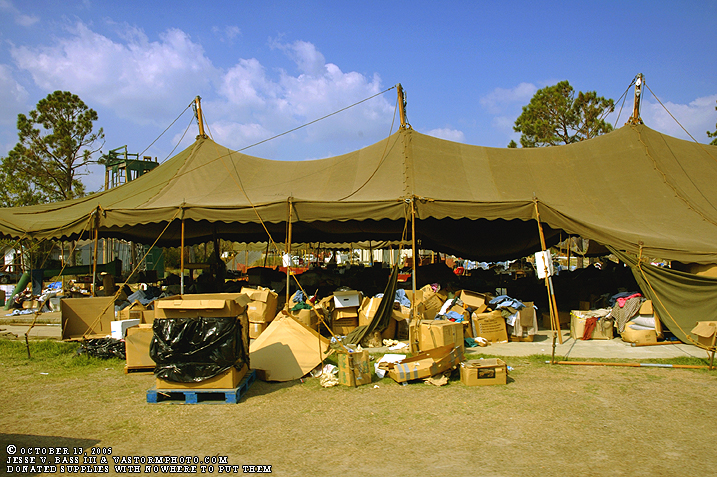
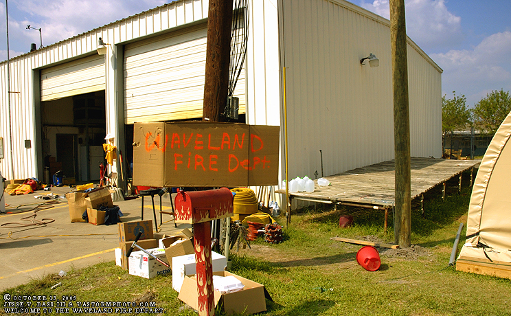
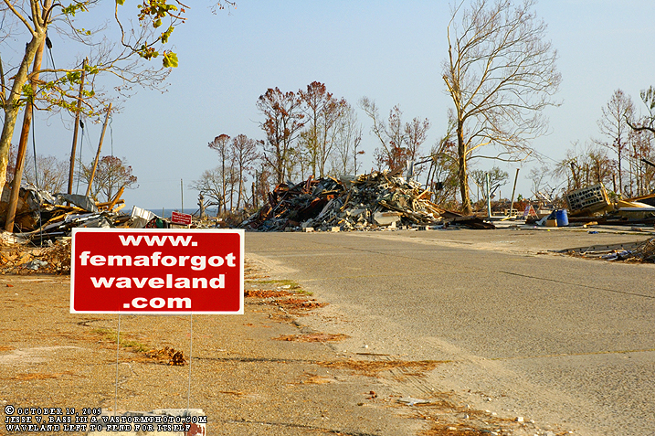
Back at the Waveland Fire Department, this tent was set up to receive the donations that were coming in from around the country. Unfortunately, there is no other place to put them, so they sit out in the elements getting wet if it rains.
This is a shot of the Waveland Fire Department. As you can see, the building still stands. One- it is north of the tracks- two, David told us that they changed the rivets and bolts that holds the sheet metal in place during the spring and it appeared to have tightened the sheet metal and they believe this may have helped it withstand the winds. Not a piece of sheet metal was missing. We dropped David off at the station as he was preparing for a meeting that afternoon. His deputy chief went back out with us to tour the area more extensively.
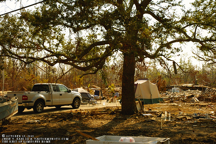
Back out in the town, we went into a few areas where there were people living in tents on their foundations. Here is what is left of their roof.
This scene was rare, but there were several others living in these tents where their homes once stood.
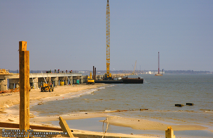
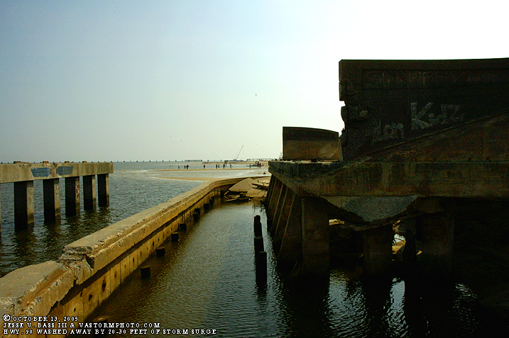
Along the beach road and the Gulf, there are two bridges, I am not sure which bridge this one is, but you can see the folks hard at work trying to rebuild the bridge to get the lifeline open to help usher in more supplies and aide.
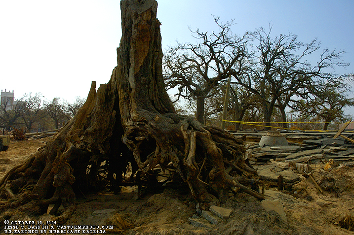
We can only assume that this massive tree was uprooted by Katrina's storm surge.
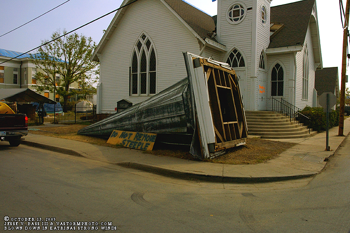
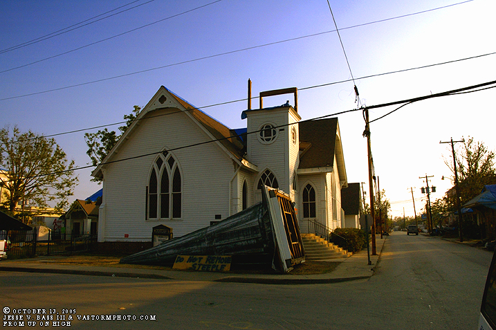
As we headed east a bit towards the town of Bay St. Louis, we saw this church's steeple laying on the side of the road which was blown off in Hurricane Katrina's strong cat 4 winds.
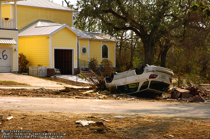
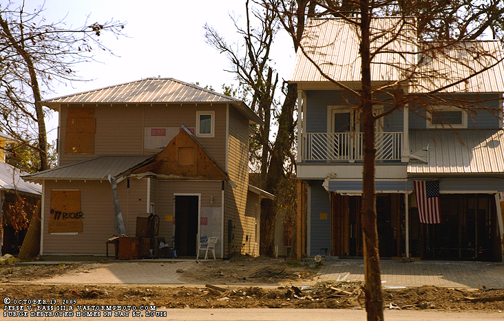
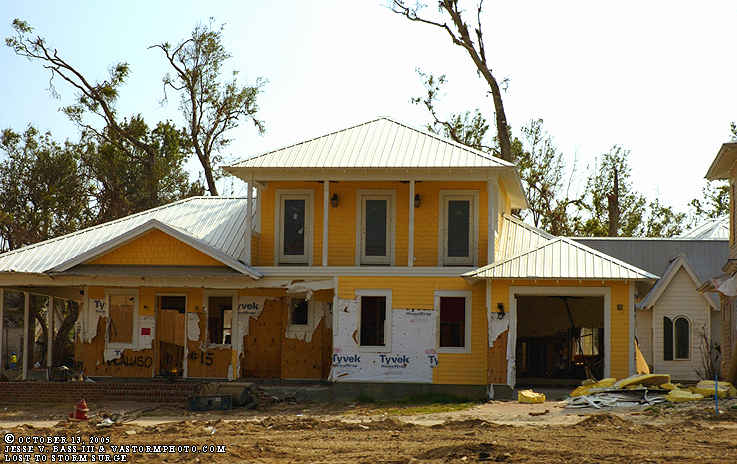
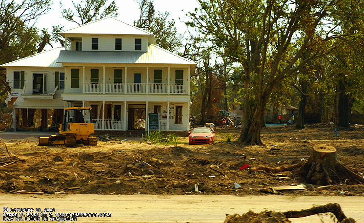
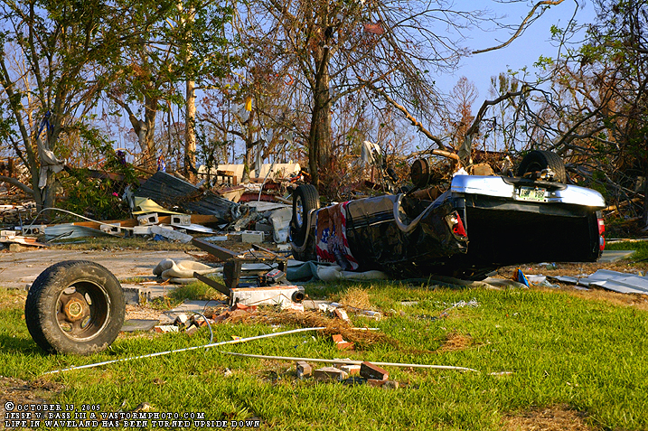
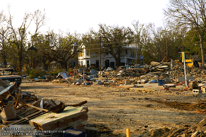
Once into Bay St. Louis we saw homes and businesses still standing however, the damage from the wind and storm surge was very evident across the town. In the photos above you can see the high water line by looking at the sheetrock that has been torn out to prevent mold, and the car turned upside down. This is a map looking east from the photos below.
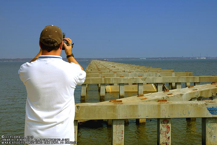
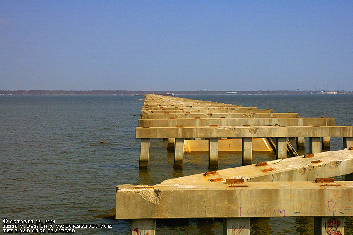
This is the main bridge from Gulfport into Bay St. Louis. This is Hwy. 90. As you can see all the spans of the bridge have been washed away during the storm. Mark and Mike traveled across this very bridge to get to and from Waveland the day before Katrina.
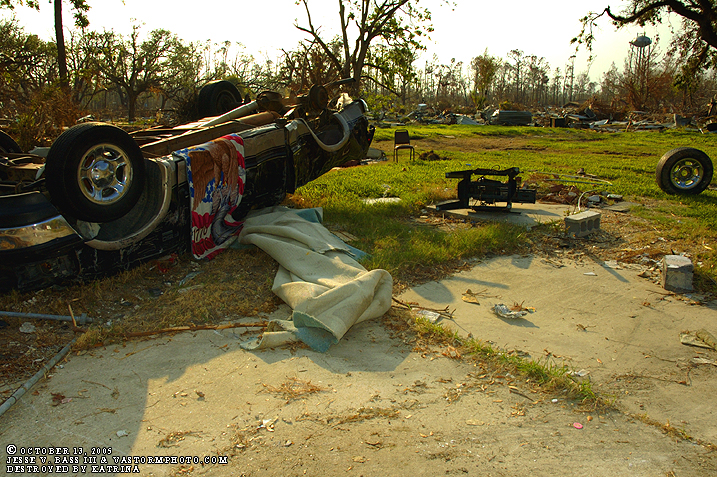
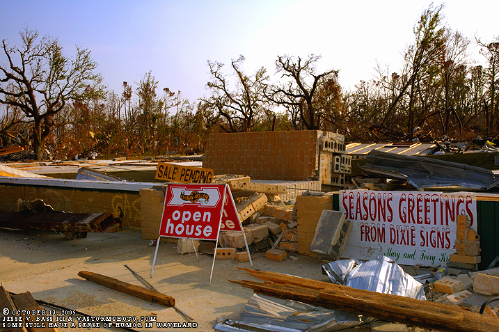
After spending some time at the fire station we prepared to leave but went back through Waveland once more. This time, I tried to get up close and personal with what we were seeing. Everything here is as it was the after Katrina accept for the rug hung to dry. I will let the next few photos speak for themselves.
At least some still had a sense of humor after loosing eveything.
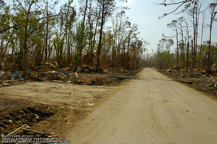
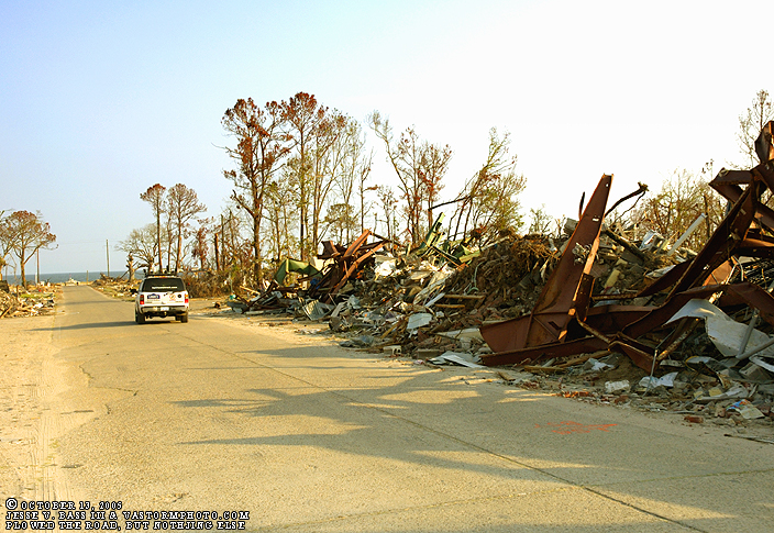
As Mark and Mike drive along headed south in the Tahoe, the debris on the side of the road was pushed there to clear the roads after the storm. This is pretty much the extent of the clean up efforts as of October 13, 2005.
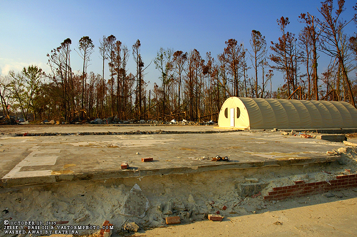
This tenet was placed in a pretty good spot. All that once stood here is in the trees behind it. So the tent was easy to place and erect- the foundation was already whipped clean. Notice the front of the foundation where the waves ate away at the base.
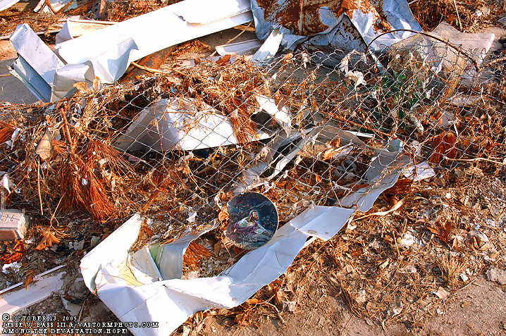
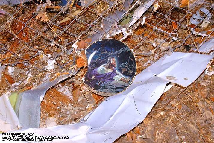
As I walked through the area shooting photos of what once was someone's life, I noticed the plate sitting in a pile of rubble as it is in the photo. To start I though the plate was not broken, but after looking closer, I saw a small area on the left hand side that had broken off. Praying for Waveland, and the rest of the Gulf Coast!
We noticed that several small areas of walls that once were store rooms or closets were still standing. In another situation, this could have been a good place to be during the storm, however with Katrina's estimated 30 foot storm surge, you would have drowned if you had stayed.
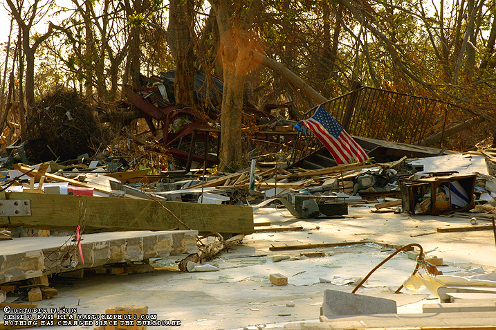
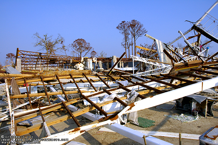
So as you can see, there really is nothing left of Waveland, Mississippi. It is going to take years to recover.
Headed back on the way east toward Bay St. Louis.
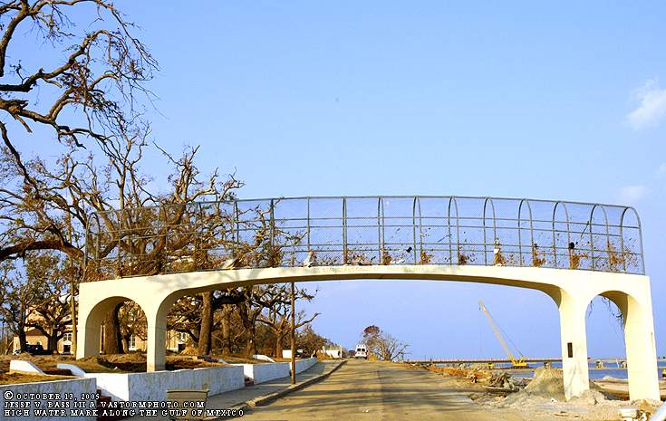
To me, this is one of the most impressive, and frightening things to see. Notice how the debris is woven into the fencing over the walkway. This is the high water line nearly fifteen feet up from the street we were on with the Gulf to the right.
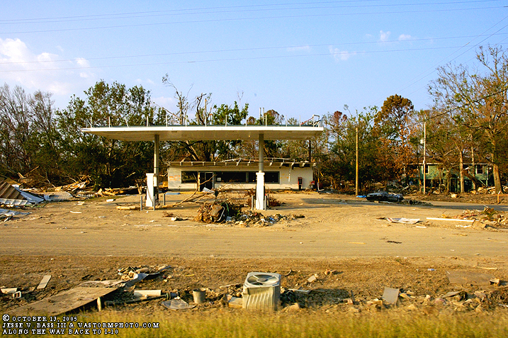
As we began to head back to I-10, all along the road in Bay St. Louis we could see destruction pretty much everywhere. The area was not leveled like Waveland, but it might as well have been. Notice the crushed vehicle on the right in the parking lot.
It seemed that every building and home in the area was in some way flooded or damaged by this massive, killer hurricane.
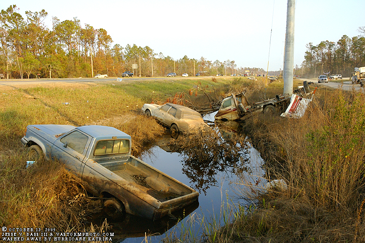
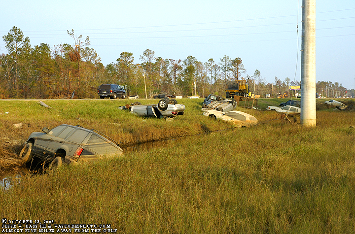
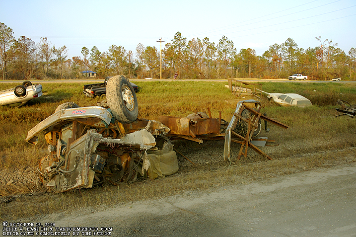
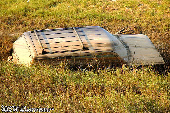
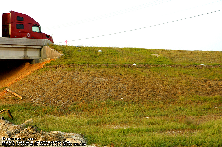
Now in this set of photos you see all these vehicles that were washed into the ditch from the flooding that took place. We were almost to I-10 nearly five miles away from the Gulf Of Mexico where this happened. We could not believe this happened from surge this far inland until...
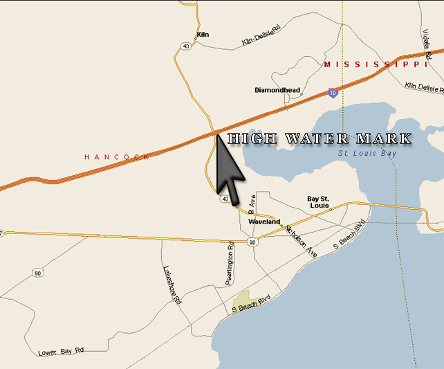
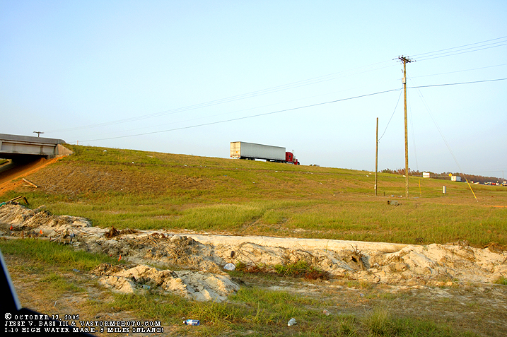
Looking at this map we noticed that St. Louis Bay cuts west almost to I-10. So this would explain the cars being washed into the ditch. little did we know, or expect to see a high water mark along the overpass of I-10. The photos are below.
If you look closely, you can see the high water mark near the top of the hill of the overpass. This is I-10 and five miles inland from the Gulf. This shows the true nature and power of wind swept water and what it can do in a storm this powerful. The bay filled from the Gulf and the Gulf over ran ran the coast and the two areas met in the middle. So this explained all the flooding damage we saw in the area of Bay St. Louis and Waveland.
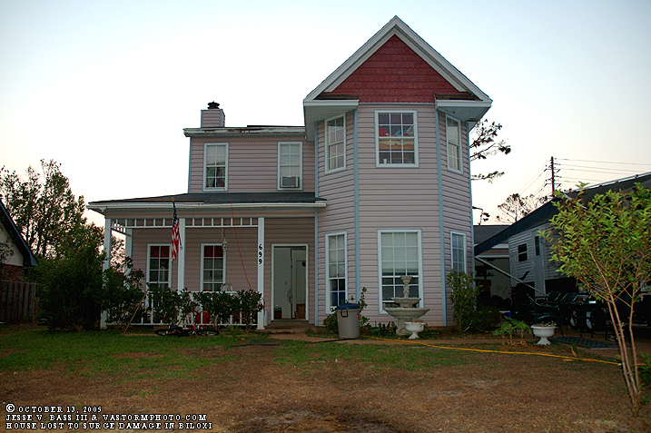
And on our way back to Florida and then home, we stopped by a house of some people Mark met after Katrina when on his way back into the area he stopped in this neighborhood in Biloxi. This area was also very close to a sound or small bay type area and pretty high above sea level as well. The lady that lives here said they could reach the water line from that second story window in front of the house. Over eight feet of water surrounded the house this far away from where Katrina slammed ashore. Her house is a total loss and will have to be completely torn down due to movement off the foundation along with the mold and other problems that have set in. Katrina: the costliest hurricane in American history and also claimed the largest amount of lives in many, many years. More than 1,300 people killed from Louisiana to Alabama. An early estimate of $100 Billion dollars in damage has been assessed. That is surly a low ball figure and will likely rise in the coming months. As we left Mississippi we were watching
the tropics for possible development. Once home, Wilma formed and would become
the strongest hurricane in the Atlantic basin ever recorded with a pressure
near 882mb shattering the old record of 888mb in 1988 by Hurricane Gilbert.
Since that time, we have continued to see storm after storm form in the
Atlantic and as of this writing, Tropical Storm Epsilon on December 1st is
nearing hurricane status in the open Atlantic. What a season to remember. Dr.
Bill Gray has been saying for several years now the the United States will see
a return of the hurricanes striking the coastline the likes of which we have
not seen since the last active period of the 1940s-1969. This is a sign and
this season and Hurricane Katrina should be a lesson learned that we are
vulnerable to these types of storms once again. Now that the season has
officially ended, now is the time to prepare. Begin making plans now of where
you will go if you need to evacuate and just what supplies you will need if
you decide to stay. Don't let this type of horrible situation happen to you in
the coming seasons. Be prepared now! Tomorrow could be to late.
All Images Copyright Jesse V. Bass III and
VaStormphoto.com Copyright 2005 All Rights Reserved |