|
|
|
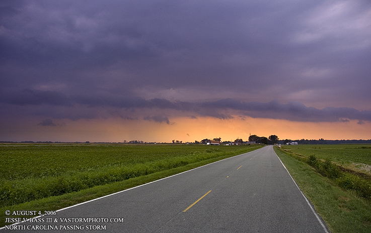
BREAK IN THE OPPRESSIVE HEAT WAVE, VIRGINIA AND NORTH CAROLINA August 4, 2006 After a week of oppressive heat and humidity along the east coast, a cold front approached the region on Friday afternoon of August 4th. Thunderstorms started to develop over northern portions of the Hampton Roads area in the late afternoon and make their way southwestward into the region. Several storms gained severe warnings as they moved into Hampton and Newport News and making their way into Norfolk, Portsmouth and Chesapeake, Va. Winds picked up as the rains began to fall over the James River as I was out at the T.C.C. campus near the Monitor- Merrimack Bridge. I had a 46mph gust near the waters edge as they pushed through quickly. Lightning in these storms was frequent, but mostly rain wrapped. I decided to head south into Chesapeake and maybe into North Carolina. As I headed to Chesapeake, I had to take back roads due to slow traffic and accidents along the interstates. I hit Rt. 17 south and blasted my way into North Carolina as new storms began to develop in the area. Several storms were developing west of me as a large storm that developed over portions of Chesapeake headed southeast. I set up at a new housing development along Rt. 17 and shot video across a field looking southeast. As the new storm continued to move in from the west-northwest, I decided to take shelter in a house under construction that had just had the roof shingled. So inside I was dry to shoot out the back door of the passing storms. That storm weakened as it moved into the area just hit by the larger storm from Chesapeake. I left the house and headed south as a huge storm developed and pushed southeast. I met the storm in Perquimans County in the town of Hertford. The scene was beautiful as the land was flat, the setting sun was behind the storm, and the scene looked like something out on the Great Plains. I managed to catch a few photos of lightning as the storm passed me by from a farmers driveway at a barn or shed. Below are the photos from the day. VIDEO CLIP: See the storms as they roll through the area breaking the heat wave. Lots of Lightning.
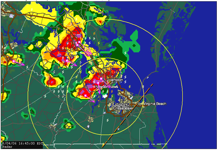
Here is a radar shot of the first storms as they moved southeastward into Suffolk where I was in the little white rectangle in the middle of the yellow rings.
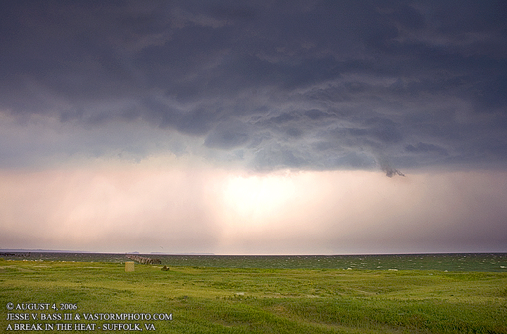
Looking northward towards Newport News from Suffolk. The sky look ominous and dangerous as the winds gusted to 40-46mph at this point.
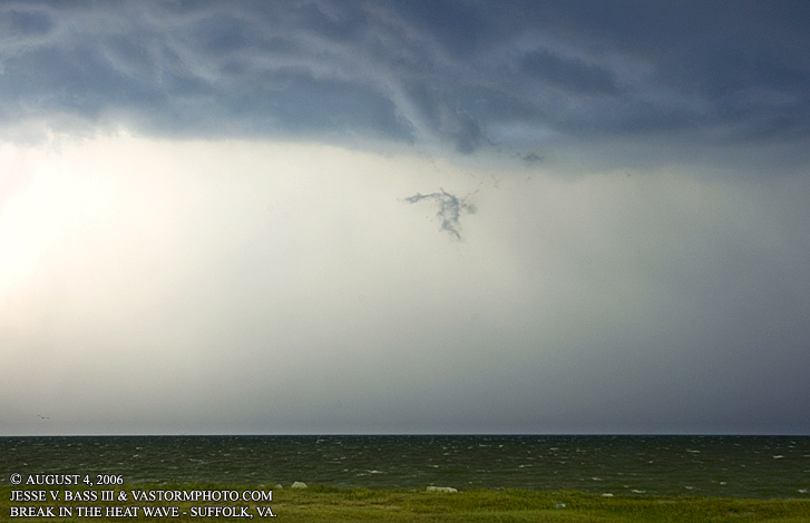
Scud cloud being pulled upward looked like a tornado or funnel just over the James River.
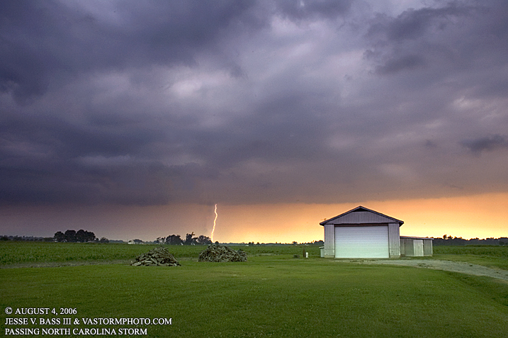
Here in Hertford, the land was open and great visibility as the inflow from the right was being pulled into the storm passing on the left. After finding this driveway, I set up the digital camera and started to shoot photos trying to capture some daytime lightning.
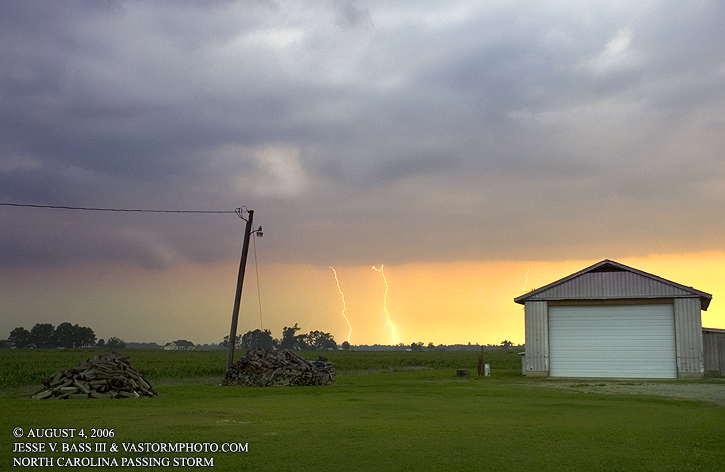
Another shot catching several bolts in the setting sun.
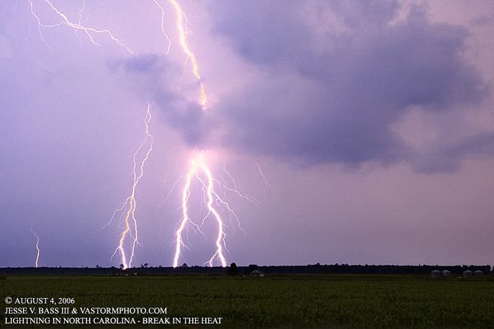
Looking to the east-southeast as the storm passed me by, caught this incredible set of bolts. This was the last big strike of the evening. All Images Copyright Jesse V. Bass III and
VaStormphoto.com Copyright 2006 All Rights Reserved |