|
|
|
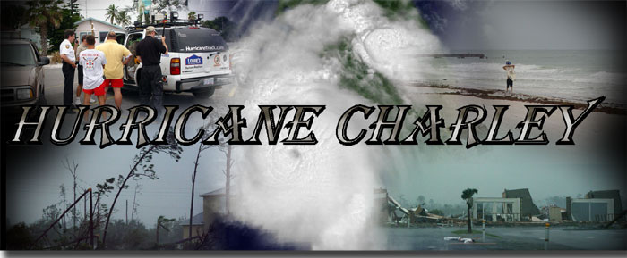
HURRICANE CHARLEY: PART 2 August 13, 2004 On the morning of August 13, 2004 Eddie Smith and I were up early, pretty much before Mark and John. We had the TV on and saw Hurricane Charley had crossed the island of Cuba and was looking better than we had seen in the previous few days. Charley was forecast to move to the north and into the eastern Gulf Of Mexico and make landfall somewhere near Tampa. After getting all the latest info on strength and track forecast, we loaded up the vehicles and headed south towards the Tampa Bay area. Along the way we came across a toll booth where the gates were open and you were allowed to drive right through without paying the toll. How many times has this happened to you? Not many. We stopped to do a video update for HurricaneTrack.com and then proceeded south. We made a stop in Sarasota and came upon a road block. The local police were stopping anyone from going out onto the barrier islands. After talking briefly with them, they let us proceed to shot photos and video of the area before the storm arrived. There we met some incredible folks. It was law enforcement and marine rescue of Bradenton Beach. As they were making their rounds up and down the coastline, they stopped in the parking lot where we were parked to check out the Tahoe and the equipment. They were very interested in the website and the way we would get all of our info on the storm and how we would get the data we collect to the website. Mark turned my laptop around with the Mobile Threat Net running and that became an instant topic of conversation. After talking with the guys for sometime, they told us about the Fire Station where they would be taking shelter during Charley's landfall and said we were more than welcome to set up in the parking lot to take our wind observations during the peak. Mark and Eddie left and went up the beach looking at the homes and roadway so close to the Gulf. John and I went to the station there on the island to check out what the news media was saying and to get some cold water. While we were outside taking photos, a person came up to the station and said that Charley had made a turn to the north northeast. John and I quickly ran inside to see the television report. Sure enough, Charley had made a turn and was approaching Punta Gorda and Charlotte Harbor. Not only had Charley turned but he had strengthened as well and the maximum sustained winds were now near 125mph and this was as of the 1pm. EDT position advisory. By 2pm, Charley's pressure had fallen from 964mb to 954mb the eye that was some 10-15 miles wide in diameter had shrunk to an estimated 5 miles in diameter and the winds were now at 145mph. This made Charley a strong category 4 hurricane on the Saffir-Simpson scale. As we quickly headed south to get into the direct path of Charley, the Tahoe was relatively quiet. There was a lot of thinking going on knowing how dangerous this would be and that people were going to parish in this monster storm. We reached I-75 South and neared the Charlotte Harbor area with about 30 minutes to spare. Charley slammed ashore near the 4pm hour with winds sustained at 145mph. The rain and wind started to quickly increase at our position just off I-75 under an overpass at exit 170. Before the worst of the storm moved over, we saw several roofs come off of some buildings to our south and the tops of trees get ripped out and sucked straight up into the air. The winds quickly increased to 70-80mph gusts and a top gust of 113mph. At this time we were sitting out in the open gathering as much wind data as possible. Within minutes, we were backing up under the overpass for protection when we received a wind gust on our 10 foot anemometer to 127mph and the 15 foot anemometer caught a 132mph gust. Rocks started flying off the road and slamming into the Tahoe's front windshield. During the height of the eyewall passage, I laid over in the backseat of the Tahoe to shield myself from the glass that would come flying in if the window got broken. It never did break but has a few chips in the glass from the rocks. Once we were inside the western part of the eye, our pressure reading on the Davis Weather Monitor II was 943.6mb. It didn't take long for the second half of the storm to move in. We estimated about 5 minutes or so that we were in the eye. The winds were not quiet as ferocious as the first part of the eyewall, however the winds were easily 100mph to 120mph with higher gusts. Being under the overpass did not allow us to get wind data to verify that. Once the winds backed off the a more manageable speed, we went out into the local area to video and photo some of the destruction. After a brief photo shoot, we headed north toward Orlando to meet Charley once again. By then it was dark and the rain was extremely heavy so we really did not shoot any footage at that point. The winds in Orlando were easily 100mph sustained in downtown Orlando. We finally let Charley go to catch a break and get some rest. It was a slow drive once to I-95 north and we finally found a room and someone with power once into Jacksonville. We got up the next morning and tried to head back to Wilmington before Charley moved back inland in that part of the world but just could not make it. Wilmington had some moderate damage to trees and power was out across the area. Below is the story in photos and a few video clips. These clips may be hard to see due to sitting in the backseat of the Tahoe and shooting through tinted windows as the daylight faded as the CDO moved overhead and rain picked up in intensity. CHARLEY VIDEO CLIP 1: As the eyewall moves in and conditions go down hill CHARLEY VIDEO CLIP 2: All hell breaks loose, visibility nears zero
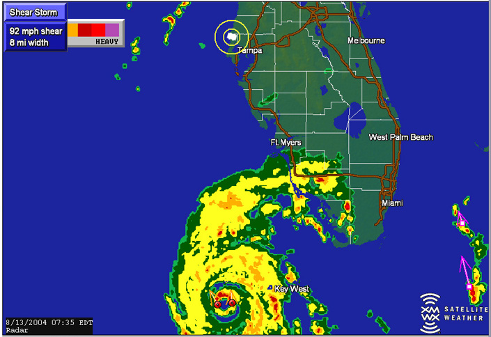
Here you can see in the early morning hours of the thirteenth, Charley was on his way northward and our GPS location was just northwest of Tampa. This would be Tarpon Springs.
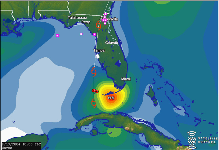
Near 10am, we were south of Tampa near Bradenton Beach. In this image you can see the large waves caused by Hurricane Charley on the Florida Keys.
Here in Tarpon Springs, north of Tampa, people were preparing for the worst Charley had to offer. People were taping up windows at their businesses and some homes along the way south. Surprisingly though, we saw very little in the way of preparations.
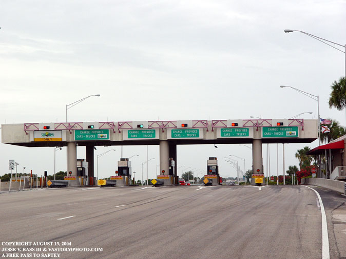
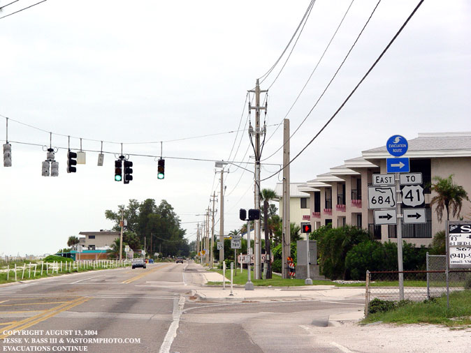
Just north of Tampa, we stopped at this toll both to do a video update. The gates were open and they toll was free for the people wanting to evacuate. No one was manning the tolls. The offices were all boarded up and just down the road was a rest stop. The storm shutters were in place and it was closed as well.
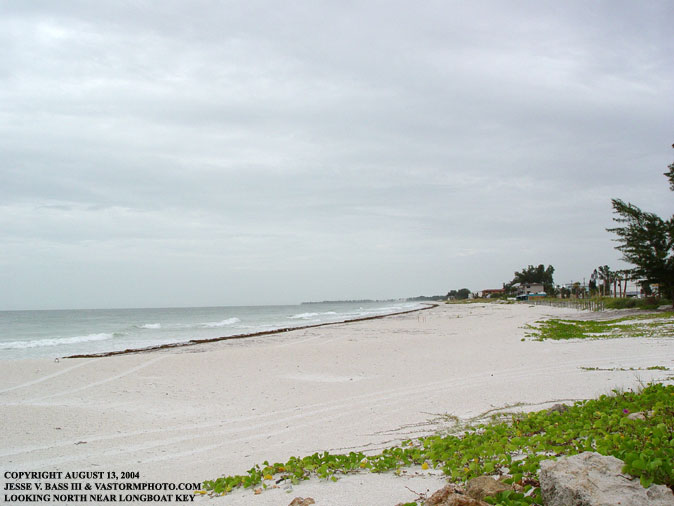
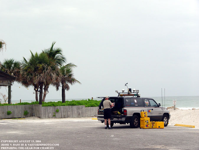
Once on Bradenton Beach we found a parking lot to set up the equipment for Charley's arrival later in the day. The first of these two photos is looking north up the beach. The second is looking south and the dark clouds in the background was Hurricane Charley's outer rainbands.
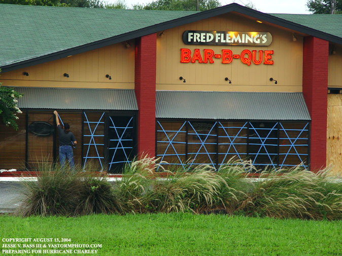
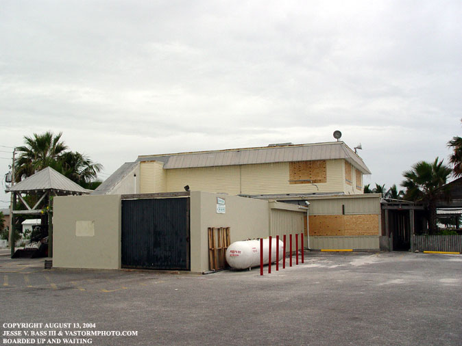
This business was ready and boarded up. Even the propane tank was chained to the building and the red poles in front to prevent it from washing away should the storm surge get to it.
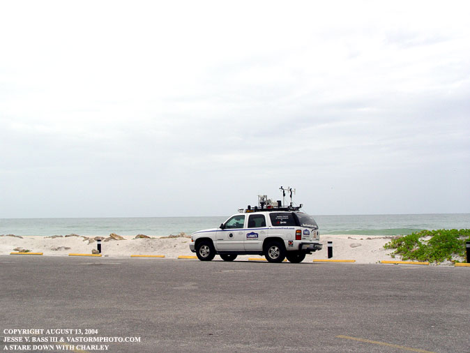
Mark stopped by the water in an open area to check the winds at the time. They were already sustained in the teens with gusts in the lower 20's.
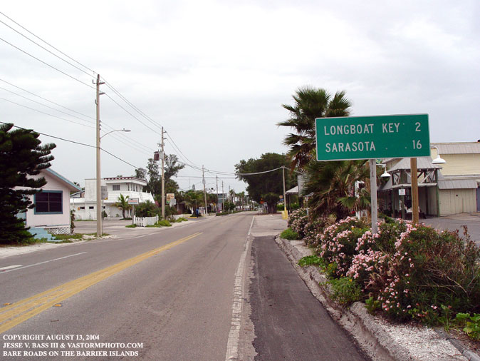
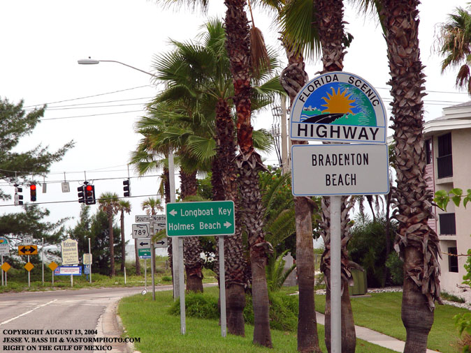
The long road to Sarasota and Longboat Key was empty and almost everyone had evacuated.
There were several people still evacuating the area, but for the most part the barrier islands were a ghost town.
Here team member John Van Pelt was rearranging his gear and had taken several photos of the great Storm Cases ready for action. Theses are great to protect all the video, photo and computer equipment from the elements.
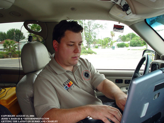
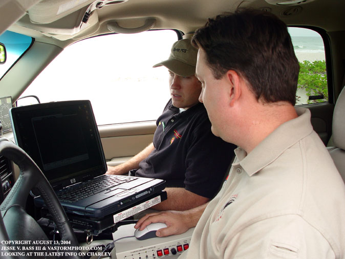
Here Mark and Eddie were checking the latest on Hurricane Charley as of the 11am advisory.
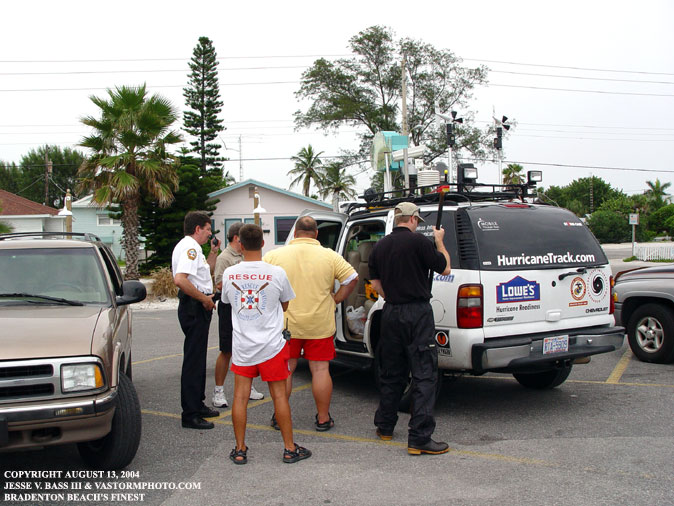
The great folks at the Bradenton Beach Police Station and the Marine Rescue unit saw our vehicles in the parking lot and stopped by to check out trucks and the equipment. We missed out on working with these great guys of Bradenton Beach, however I am sure they were glad to see us leave their area and head south.
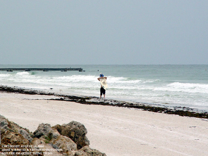
One person who decided not to evacuate and grab his board to catch a few was from Charley. Surprisingly the Gulf Of Mexico looks pretty calm for such a large hurricane to be drawing closer.
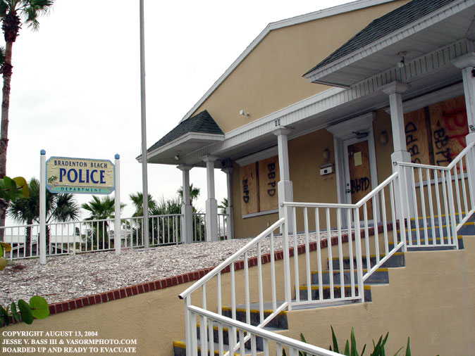
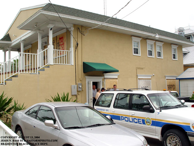
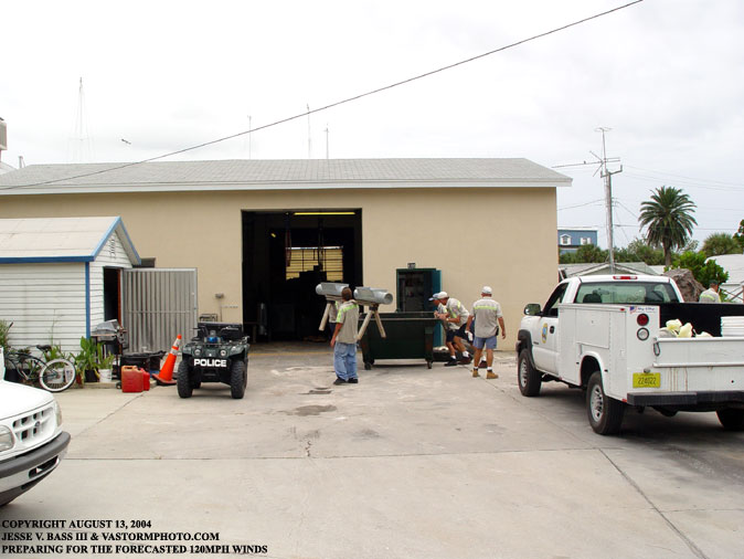
At the Bradenton Beach Police Station, the crews were bringing in any loose materials that could become flying debris in Charley's strong winds. The station as you could tell was boarded up well to weather the storm.
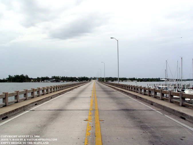
The empty bridge that leads to and from the barrier islands. This area would be spared the brunt of a strong category 4 hurricane... This Time!!
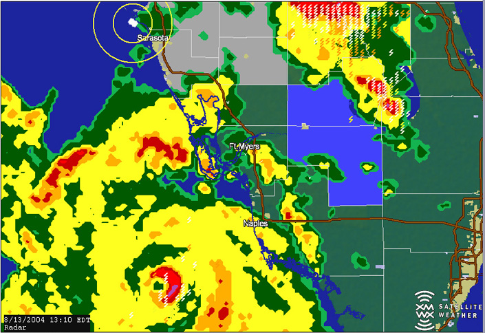
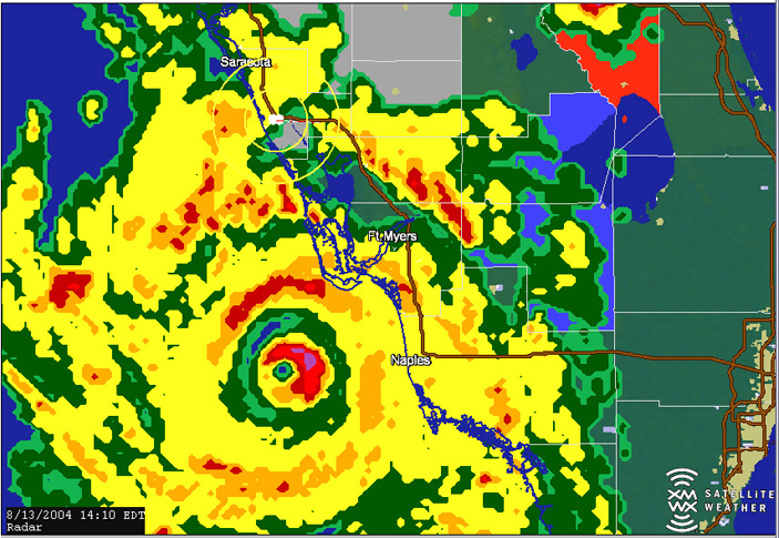
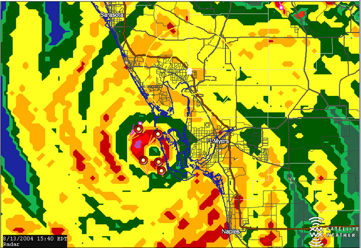
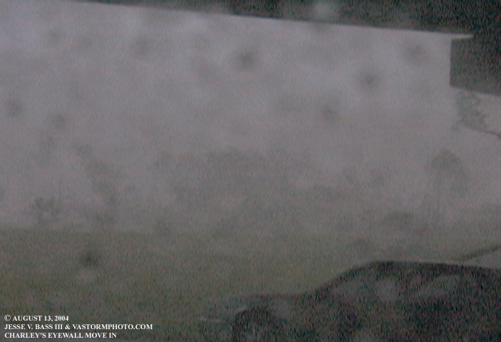
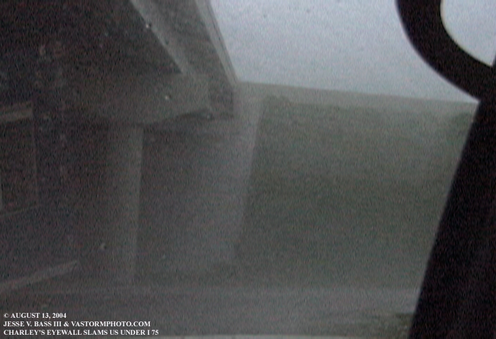
After finding out that Charley had turned to the northeast and was poised to make landfall further south, we quickly said farewell to the guys in Bradenton and headed south right into Charley's path. In these 3 images from Mobile Threat Net, you can see our location as we moved into place. We reached our location under I-75 at exit 170 just minutes before Charley slammed ashore packing winds of 145mph. This was the last image I was able to get before the landfall due to us being under the overpass. The XM Satellite feed was unable to connect to our antenna under the overpass. Since I was shooting video at this time, there are no stills from the event in progress. So here are a few video frame grabs as Charley slammed ashore.
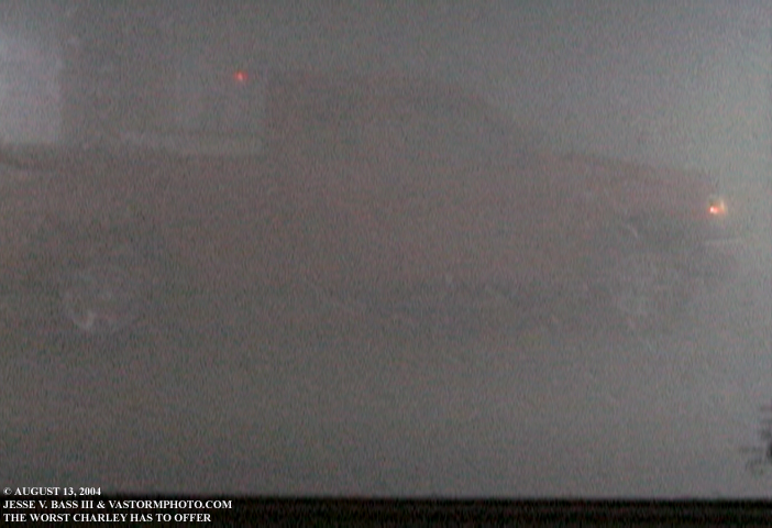
At this point, Charley was starting to make his presence felt. Just off the window to the right a roof lifted off a building in the distance. We had just pulled under the overpass to seek shelter as the winds were gusting to 130mph.
The wind was screaming past the vehicle now as the sustained winds were near 80-90mph with higher gusts.
This red truck across from us was bouncing and rocking in the wind, just like us. The eyewall had moved in over top of us now and the outside world was disappearing behind a curtain of wind, rain and debris.
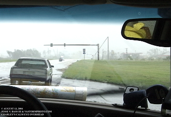
Here you can see we are in the dead calm of the eye of Hurricane Charley. Looking eastward we saw destruction like we have never seen before. I the distance to the left you can still see the wind blowing the trees, yet we were in still conditions.
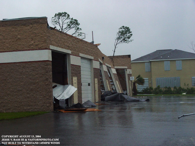
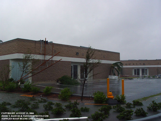
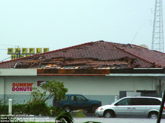
These photos were taken after the worst of Charley had passed. As you can see the brick walls had started to collapse from Charley's winds. In the far end of the photo, you can see where the roof had come off the building possible causing the walls to collapse. This is probably due to the weak metal doors allowing the wind to get inside the building at the height of the storm.
On this building you can see the storm shutters in place in a few areas. this may have helped in keeping the roof intact. Although anything on the roof surely came down in 145mph winds with higher gusts.
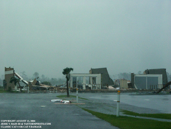
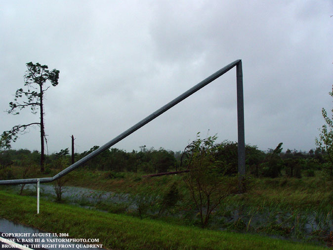
I think this photo speaks for itself.
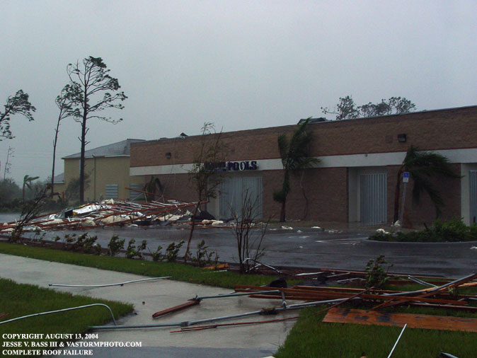
Here is part of the roof and building in the previous photo. It was blown across the parking lot.
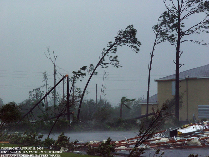
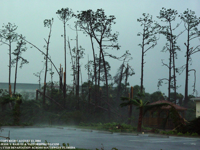
Tree damage was extensive across the area. The tops were ripped out of a lot of trees that become missiles in the wind.
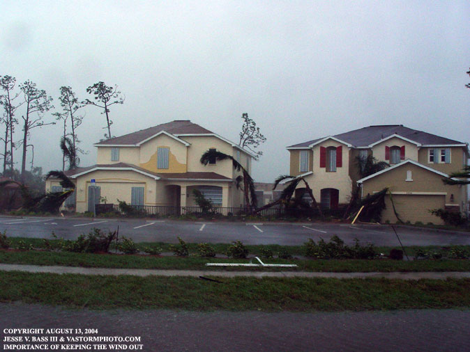
These two houses are facing to the east. This is where the initial blast from Charley came from in the northeast eyewall. With the shutters over the windows and doors and the hip roofs, this helped to keep the roofs on the houses and the houses sustained minimal roof damage from what we could see. There were shingles missing of course, but the roof stayed on and the houses were still standing after the storm.
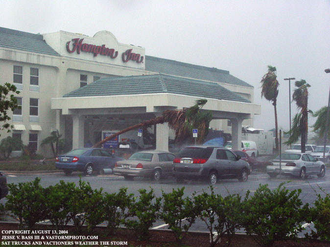
Several media trucks were in the area taking shelter at the Hampton Inn. As we road by I saw several news crews getting ready to do reports from the awning of the hotel. Several small palm trees were down and debris littered the parking lot.
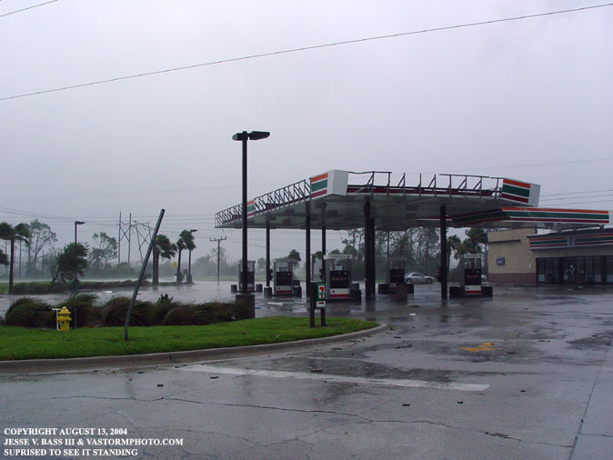
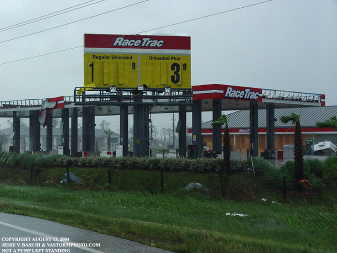
And of course the gas station canopies could not fight off the power of the wind. Surprisingly though, these two remained standing.
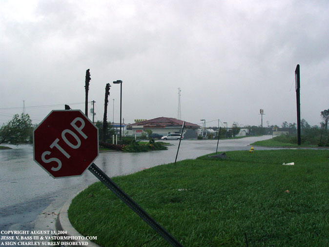
Signs were leaning, blown over or just plain gone from their poles after the storm. This roof above is in need of some serious repair. In the vehicles were several news organizations out shooting the damage.
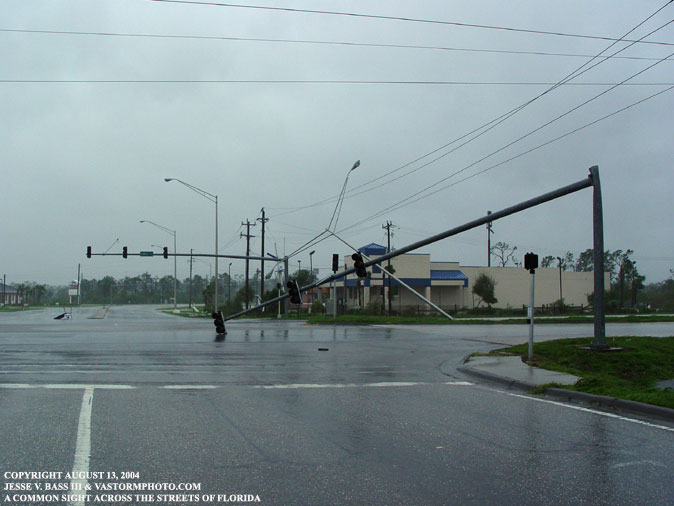
Toppled during the first shot of the eyewall, power was out and this was all to familiar scene.
After reaching I-4 east and tracking Charley down again, we met near a bridge in Orlando where the wind was screaming in excess of 100mph sustained. It was dark by now and the power was out as transformers exploded like lightning flashes. We were to busy watching for any debris, trees and the like as well as trying to maintain control of the Tahoe and John's Dodge to shoot and video. This was scarier than the initial landfall itself. At least we could see then. As you can see from the frame grab above, we had successfully penetrated the eyewall once again.
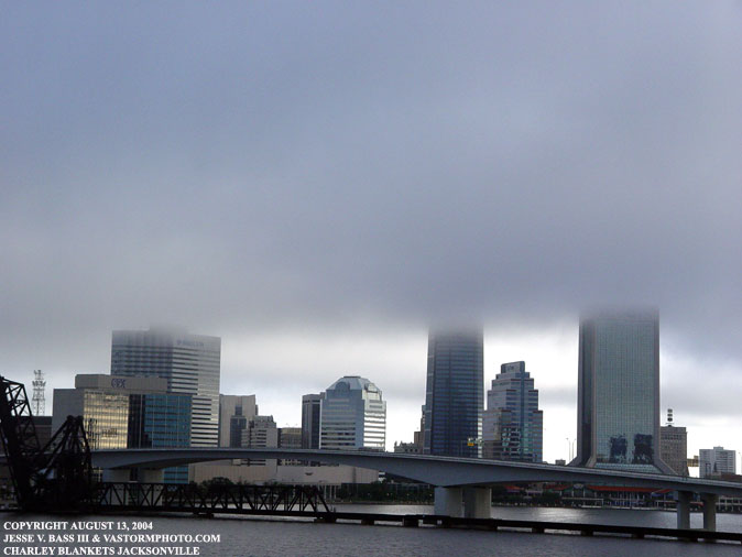
By morning, Charley was on his way to make landfall in the Carolinas. As we drove through Jacksonville, the remnants of Charley was like a blanket over the city.
Driving north to head off Charley in the Carolinas, we could see bucket trucks on their way to south Florida to help out in the clean up efforts. And at some point in the six hour drive back to Wilmington, we would pass more trucks just like these every thirty minutes or so. Then once into North Carolina, the trucks were heading for Wilmington.
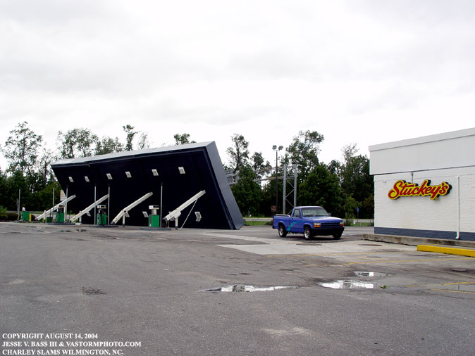
Along Hwy. 421 just outside of Wilmington, this gas station awning was blown over by Hurricane Charley. He crossed the coast in South Carolina with winds near 85mph. This was the only shot I stopped to take on my way home. It was not to far down the road from this area where a tornado had touched down when the remains of Bonnie passed through the area killing three people. I tried to race Charley home as it was forecast to pass right over my house here in Portsmouth as a tropical storm. The winds were weak and no damage that I herd about in the area other than a few spotted tornados. I wanted to get in the center before it left the coast one last time to take a pressure reading. I missed Charley as he moved into the Chesapeake Bay by about 5 minutes. I am still working on the video and hope to have a few clips and frame grabs here soon.
All Images Copyright Jesse V. Bass III and VaStormphoto.com Copyright 2004 All Rights Reserved |