|
|
|
2004 NATIONAL HURRICANE CONFERENCE Page 2:
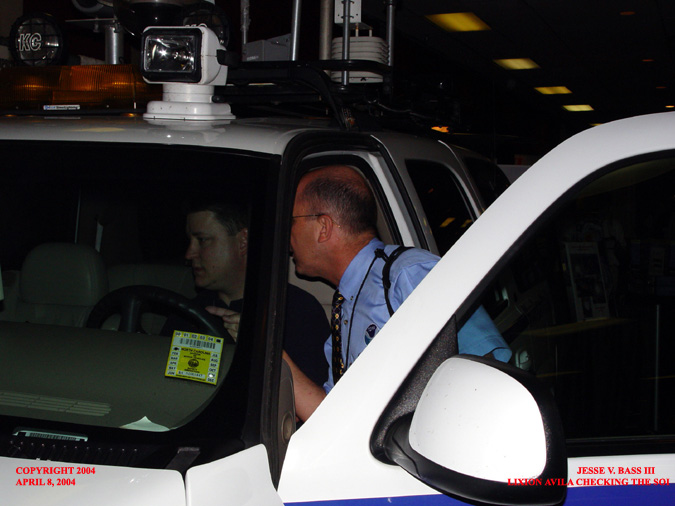
Hurricane Forecaster Lixion Avila stopped by the booth as well and stuck his head in to see the laptop. Lixion and Mark were looking for the SOI or Southern Oscillation Index. By looking at that, you can get a feel for whether we could see an El Nino, La Nina or neutral conditions.
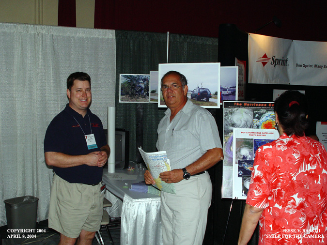
Mr. Arends, Crisis Manager from the island of Aruba, stopped to talk about his experiences with hurricanes and how they affect his island and way of life.
A quick photo op.
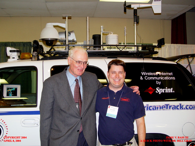
Also floating through the exhibit hall was Dr. William Gray. He seemed to be very interested in the vehicle and to learn that we send our data back to the Hurricane Center right from the vehicle in the heart of the storm. He was also very interested to hear about our plans for the upcoming season. Look closely at the laptop in the background. Big storms were passing through the Orlando area with gusty winds and some hail. As you can see, there was no way we could get out to see them.
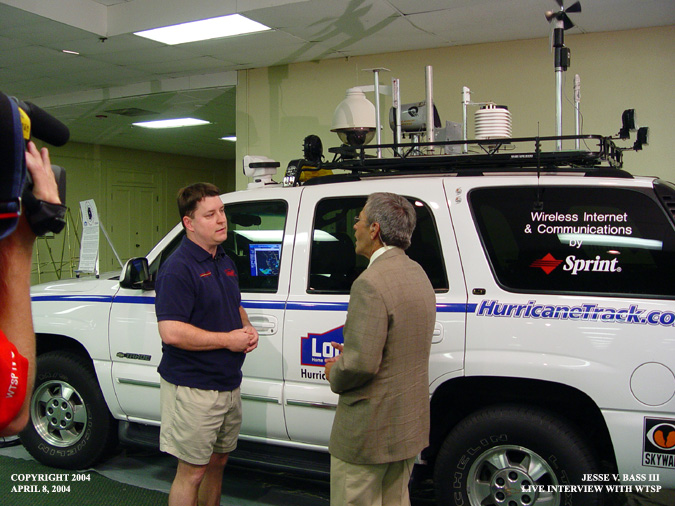
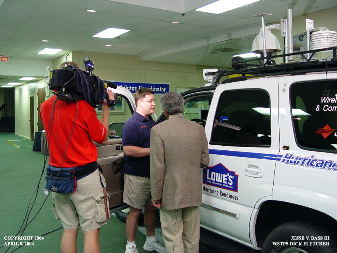
As the exhibits were closing, Mark did a live interview with Dick Fletcher with WTSP out of Tampa. Talking about the sponsor logos on the door and the roof setup.
Moving to the front of the vehicle, they quickly take a look at the live radar shot on the laptop. Another nice plug for the Sprint connection card.
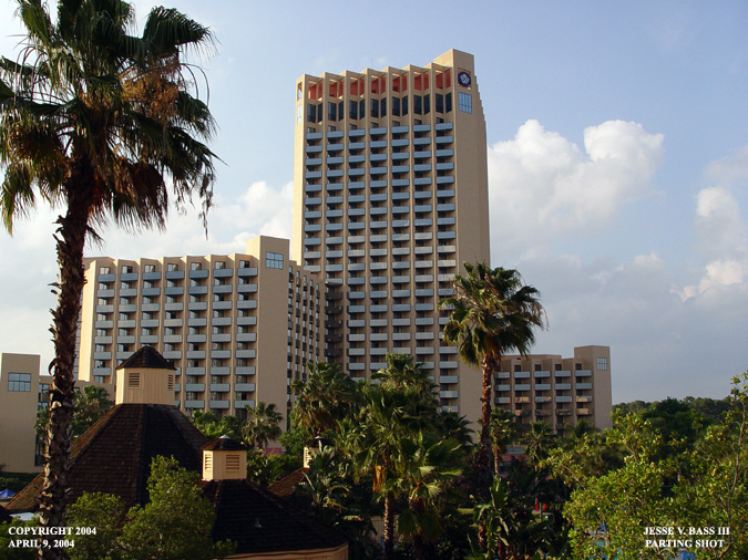
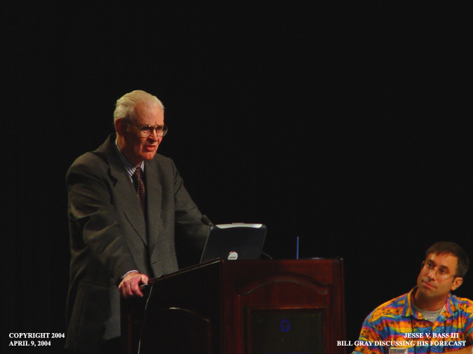
Here is a daytime photo of the hotel on Friday, the last day of the conference. We were getting ready to listen to Dr. Bill Gray's forecast.
Chris Landsea, one of Bill Gray's forecast team members was up first. He described what it has been like working with Dr. Gray over the past several years and how the forecast process has changed.
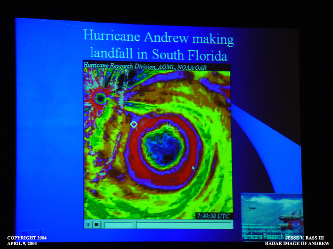
Chris talked about his experience with Hurricane Andrew in 1992.
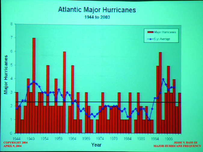
This graph shows the number of major hurricanes in the Atlantic since 1944. You would think that we would be well above average, but looking here, it appears that we are only slightly above.
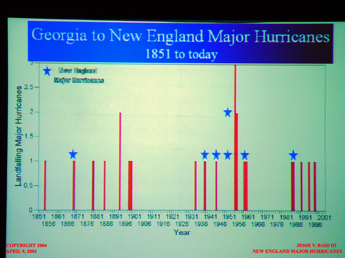
Here is a chart that shows the number of major hurricanes to affect New England since 1851. Even New England cannot escape the wrath of hurricanes.
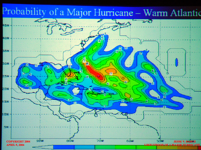
During warm periods in the Atlantic such as we are in now, you can see the probability of a major hurricane nearing the U.S. coastline.
This pretty much says it all. Welcome to Hurricane Alley!!!
Dr. Bill Gray telling the crowd on hand what he expects for the 2004 Atlantic hurricane season. If you don't like hurricanes, it is an ominous forecast.
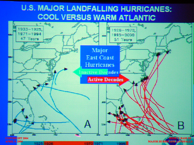
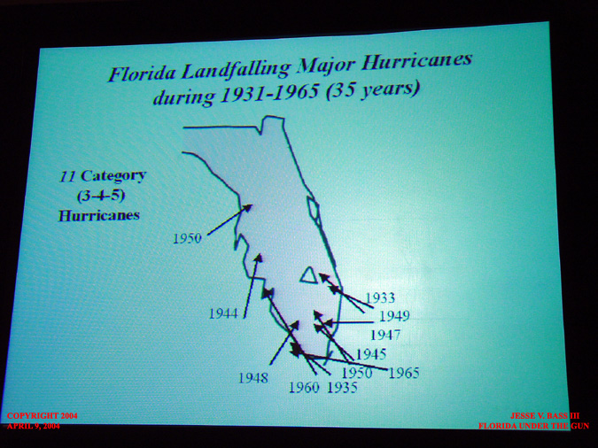
Florida has a major hurricane problem. In 35 years from 1931-1965 there were 11 major hurricanes to hit the Florida coastline.
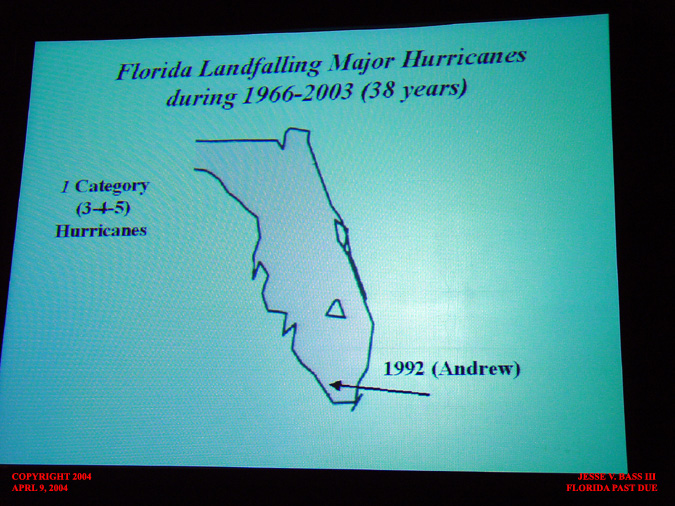
Since 1965 there has only been 1 major hurricane, Hurricane Andrew in 1992. The basic feeling we were getting from the conference this year was that Florida is WAY past due for a major hurricane to slam ashore. As Dr. Gray said, "This good luck cannot last."
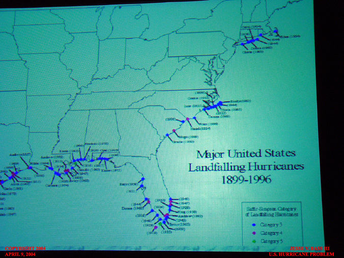
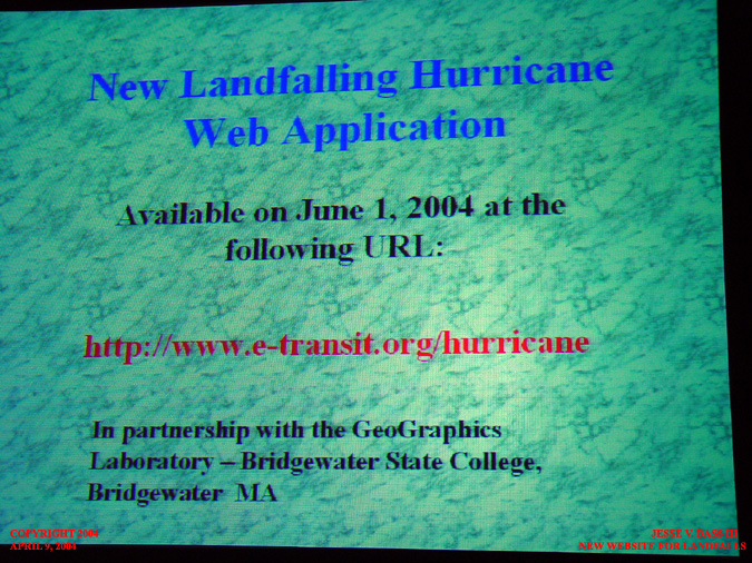
Dr. Gray also introduced a new website where you will be able to click on a map and see the major hurricane landfalls across the U.S. You will be able to zoom in on your city or town and see how close one of the major storms passed to you.
And here is the link to the webpage. It will be available June 1, just in time for the start of the season.
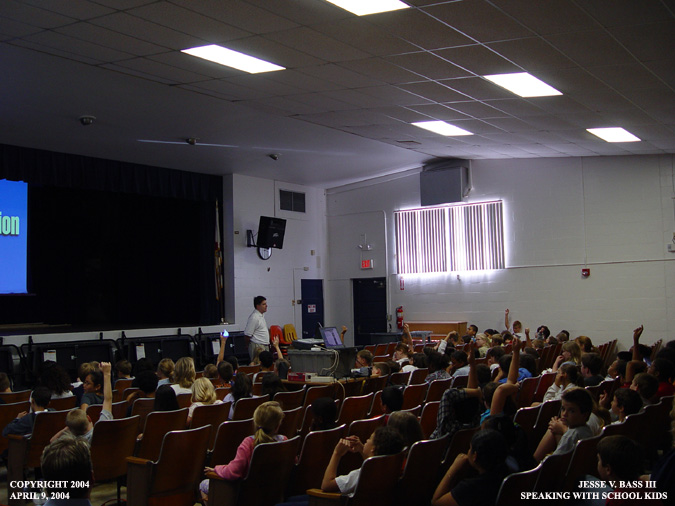
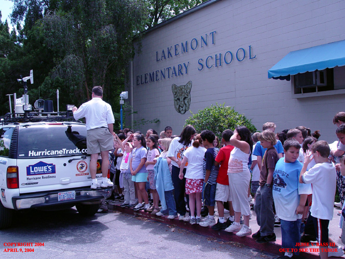
After the conference, Mark and I went to speak to an elementary school near Orlando. The kids were very excited to see the video and had some great questions.
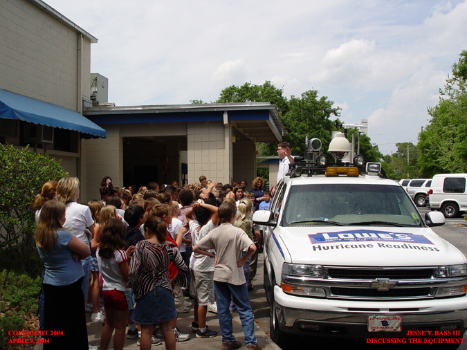
After the presentation, we all headed out to see the Tahoe. Here Mark is talking about all of the equipment that we use and what it is all for.
It was a great group of kids who were very interested in the hurricane phenomenon. The teachers and staff were great and all showed great hospitality to H.I.R.T. Now is the time for you to start planning for the start of the season. We are less than 25 days away from June 1st. Don't let a hurricane catch you off guard. Plan now and begin stocking up on supplies you may need should a hurricane come knocking on your door step. Back to Homepage
All Images Copyright Jesse V. Bass III and VaStormphoto.com Copyright 2004 All Rights Reserved
|