|
|
|
|
|
HURRICANE ISABEL: THE AFTERMATH SEPTEMBER 16-20, 2003 After leaving Atlantic Beach and getting into New Bern, I could see just a few small trees in the median of the road blown over. Power was out across the area and the wind and rain were still going full blast. Some rain rates near 1 inch an hour and the wind was blowing still in gusts to 50-60mph. As I headed north up route 17 and reached Washington, known in the area as Little Washington, there was some storm surge across the road. It was receding quickly and the traffic was moving through with little problems. However, there were large trees down along with power lines and poles in the city. Isabel's eye had passed right over Little Washington and there were real signs of damage now. I continued north on an obstacle course of downed large trees across Rt. 17. In some cases, I could barely make it up the road. It was getting dark quickly and this was becoming a real problem. Power was out all over the region. Not a light to be seen anywhere. As I passed through some of the neighborhoods along the way, you could hear a few generators running and see the flicker of candles and flashlights everywhere. With a spotlight in my hand hanging out the driver side window, I had to carefully make my way north avoiding sparking power lines a large limbs in the road. Near midnight I reached the state line near the Dismal Swamp. Here is where my journey would come to a screeching halt. The road was completely blocked off through the Swamp. No one had been through to cut a path. Unlike the other areas I had just driven through where the people living in the area had gotten out with chainsaws a cut paths so they could get out of the neighborhoods and let emergency vehicles through. No one lives in this area of Rt. 17. I turned around and headed south back towards Elizabeth City and figured I would just cut through the city heading east and pick up Rt. 158 north. That is a four lane road that takes you from Virginia to Nags Head and the rest of the Outer Banks. As I turned east to head through town, another screeching halt. There was about a 4-5 foot storm surge in the heart of Elizabeth City. I was cut off from home. I saw a volunteer fire station back on 17 so I decided to stop there for a rest, get something to drink and see if I could call home. The guys at the station were very tired, wet, but excited non the less to see me come in. They had watched some of the coverage on CNN and MSNBC during the height of the storm. They offered me a couch to sleep on and said I might as well get some rest. I would not make out until morning. Once the sun came up I thanked them and headed out. I drove back to the center of town thinking maybe the water had receded. Not the case. The photos below will tell the rest of the story...
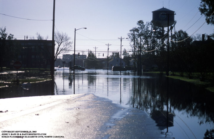
Here is a shot looking east through Elizabeth City of the storm surge still blocking the road the next morning. Several cars tried to make it through but were unsuccessful.
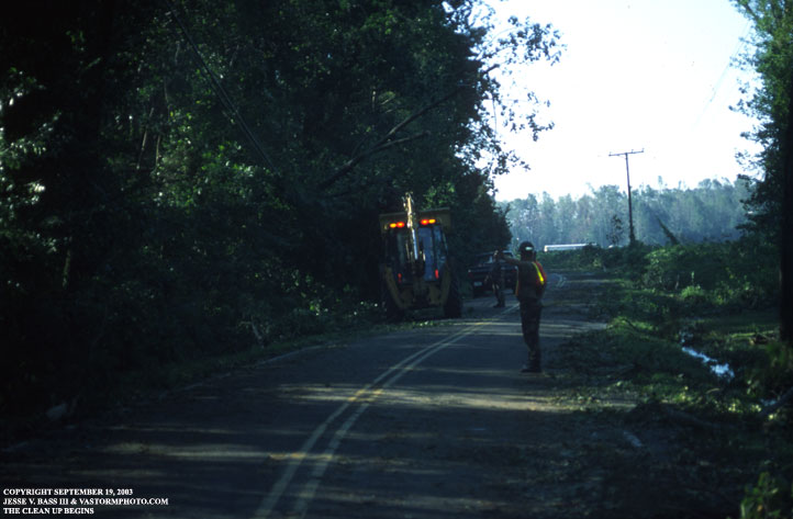
After turning back around and going north on Rt. 17 and making it across the state line, Rt. 17 was still blocked. But I was able to turn onto Ballahack Rd. The clean up was well under way.
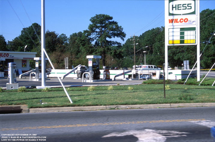
Once I made it back to Portsmouth, I saw a gas station awning that had blown over in Isabel's strong winds. When it fell over, it knocked over a few gas pumps as well.
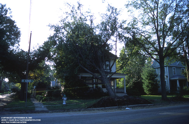
This dentist office was feeling the pressure of this large oak tree that feel in the early stages of the storm.
Getting into my own neighborhood was a task. Trees were everywhere and we were without power for about five days. Other areas went much longer. We were lucky to have gotten it back so soon.
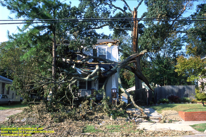
This house was condemned due to the tree puncturing the roof and walls. It is still under some repair almost 11 months later.
This is the amphitheater in downtown Portsmouth. The tarp roof was supposed to with stand some 110mph winds if I am correct. As you can see here is ripped to shreds in about 80mph gusts. This had become a big debate over the past few months on who was responsible for its failure. It will cost tax payers several hundreds of thousands of dollars to replace.
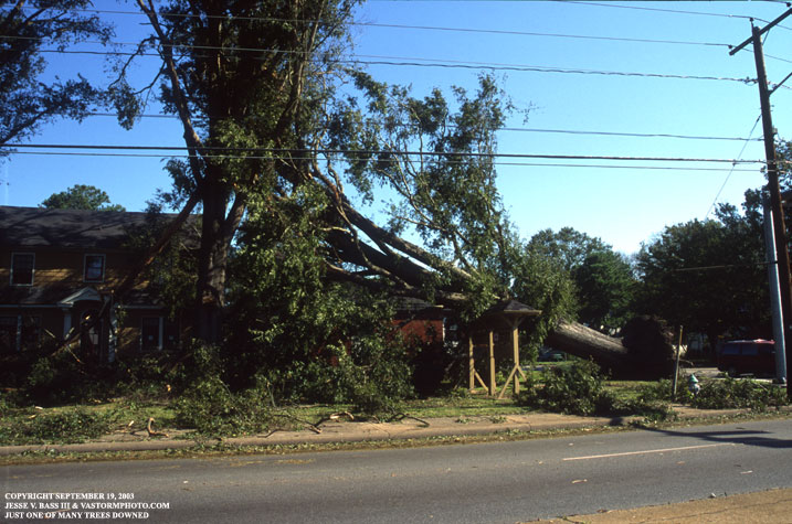
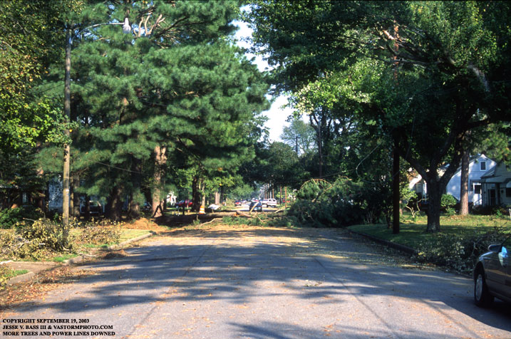
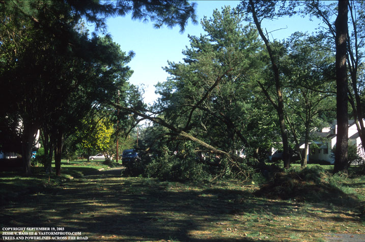
All I can say is this was an all to common site across Hampton Roads.
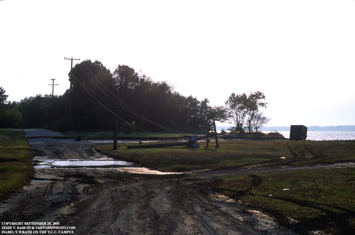
I decided to head into work to check out the campus and see how well it faired. It did not do to well. Since the Portsmouth campus of T.C.C. sits on so much land, the amount of trees downed was the equivalent of a small or medium sized neighborhood. We had roughly 40-50 trees that we would have to cut up and dispose of over the next few weeks. This photo is down by the pier where I have taken a lot of lightning photos from. You can see the sludge and mud where the storm surge washed over the bank and onto the road.
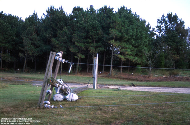
Another angle shows where the surge washed to. All the way up into the tree line in the background. We are guessing that the high winds broke the power pole. I am estimating that the surge was about 4-6 feet right here along the Elizabeth and James Rivers.
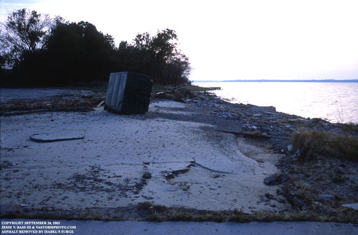
The storm surge washed away the asphalt parking lot down near the pier.
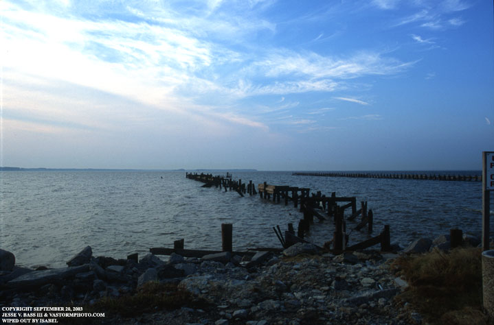
As you can see, there is not much left of the fishing pier. It was completely destroyed by the wind and waves thanks to Isabel.
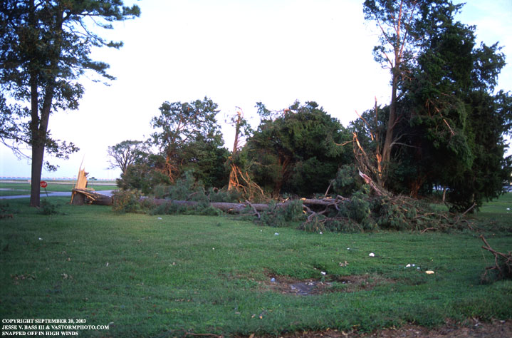
Looking at some of the tree damage on campus, I noticed how some of the trees in one area were broken off, snapped and not completely blown over. Some of the trees here showed signs of maybe twisting winds that snapped the tops right out of the trees. There were several more to the left of the photo as well.
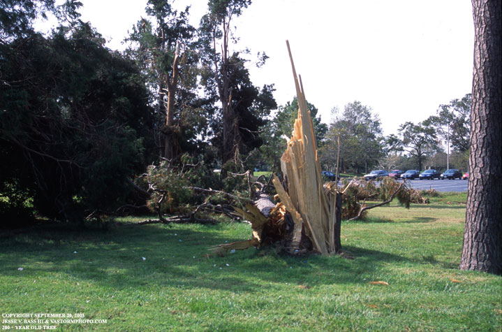
This was just a massive pine tree that was snapped in the wind. I remember someone saying they quiet counting the rings in the tree after 150. That put them about half of the way through the trunk. Isabel was the worst case scenario for Hampton Roads. The area remained in the right front quadrant through most of the storm's landfall. This also helped to push the storm surge into many areas inland along the rivers. The Mid-Town Tunnel was closed for weeks after the storm due to a surge washing over and into the tunnel and filling it up with 14 feet of water. It had been 70 years since the area saw a hurricane take that approach to the coastline. The last was 1933 when it pushed a storm surge near 9.7 feet into downtown Norfolk and Portsmouth. We were luckier with Isabel. Even though she was stronger than the '33 storm, she made landfall much further south. There are still signs of Isabel's visit through out the area eve today. Now, we need t be ready for what mother nature may throw our way this hurricane season!!
|