|
|
|
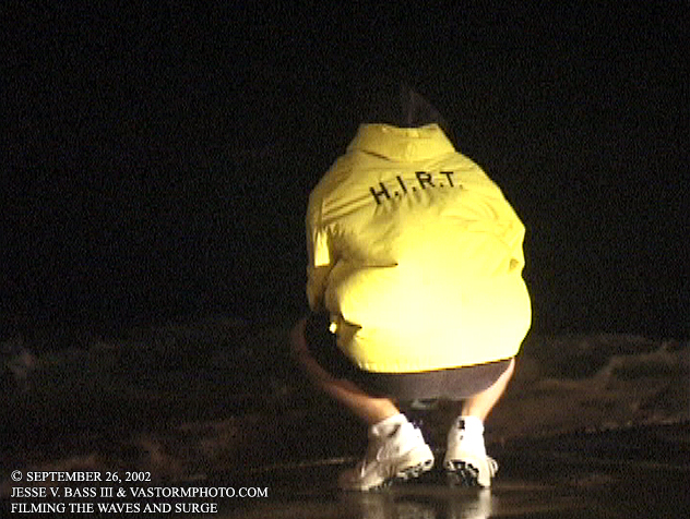
TROPICAL STORM ISIDORE, GULFPORT, MISSISSIPPI September 26, 2002 After Tropical Storm Gustav on the Outer Banks, Tropical Storm Hanna developed in the Gulf and made landfall near the Mississippi, Alabama border on September 14th with winds near 50mph. Later that same day, the first advisory was written on Tropical Depression 10. This would soon become Tropical Storm Isidore. Isidore formed from a tropical wave that was pretty far south and very close to the northern coast of South America near the islands of Trinadad and Tobago. At 2am on the morning of the eighteenth, the Hurricane Hunters found that T.D. 10 had become Tropical Storm Isidore. By 11pm on the nineteenth, Isidore had become an 85mph hurricane just southeast of the western tip of Cuba and the Isle of Youth. Once across the Cuban coast, Isidore would begin to rapidly intensify as it headed into the Gulf Of Mexico. It's winds would increase to 125mph as it turned and headed towards the Yucatan peninsula where it came ashore on the northern coast for some time. the forward speed had decreased and the storm seemed to have stalled there as it started to weaken. The NHC felt confident that it would get back over the open waters of the gulf and threaten the U.S. gulf coast, and that's just what it did. Mark and I headed south and west toward Louisiana where landfall was being predicted. Once there, we watched the satellite images and radar images as Isidore approached and noticed how the circulation center had become lopsided with most of the activity off to the east. So we packed up and headed back east to Mississippi. We stopped in Gulfport and found a place that would allow us to get great wind data and possible storm surge should there be any. Urie Pier is a paved causeway or pier where people could drive out and fish with a yacht basin on one side. As night fell, the local police came out and told everyone out there they would have to leave by 10pm accept for us. they liked what we were doing and were able to come to us for updates on Isidore when they could not get them anywhere else. Once the real wind and rain began, we could not believe what we were seeing. Isidore had strengthened to 60mph with a minimum central pressure near 984 as it approached the Louisiana coast but to it's east where we were, we started seeing a 4-6 foot jump in the water level with large battering waves washing over the Urie Pier. We recorded a 58mph gust on the pier, but had some great video of the surge coming in overnight. Below are some video still frames of that night in Mississippi on Urie Pier. \ ISIDORE VIDEO CLIP: Still to come MARK SUDDUTH'S ISIDORE VIDEO CLIP: See his handheld video from the housing and from the roof cam.
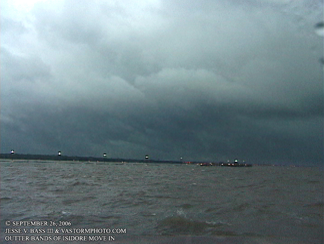
Just before sunset, the outer bands of Isidore begin to move into Gulfport, Ms.
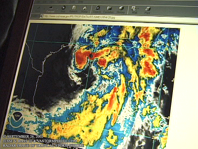
This was the last shot before the eclipse of the satellite. Still un-organized, Isidore looked to be a big rain maker.
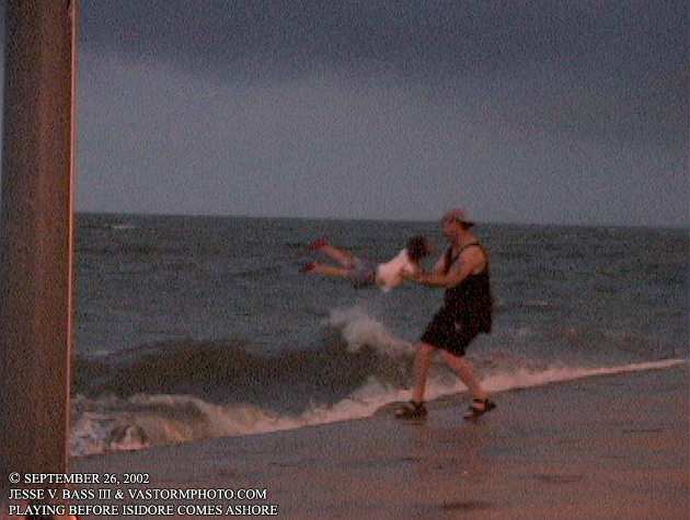
A dad and his daughter were walking on the pier looking at the waves when she wanted to be picked up and flung over the water and crashing waves. She could not quit laughing!
Here the waves were increasing in size and beginning to wash up on to the causeway as people started to leave the pier.
Using an underwater housing for his camcorder, Mark shoots some close-ups of the waves washing in.
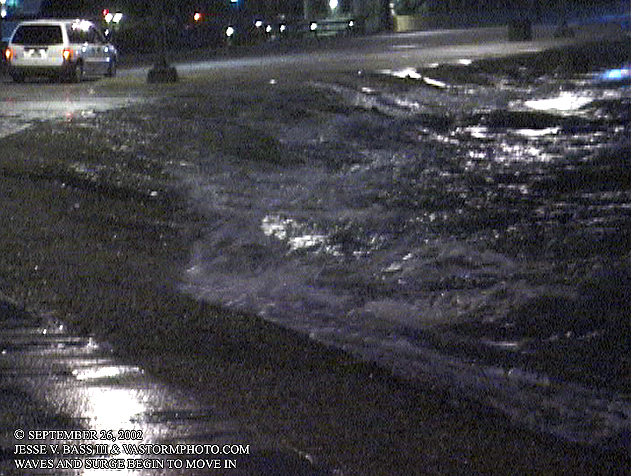
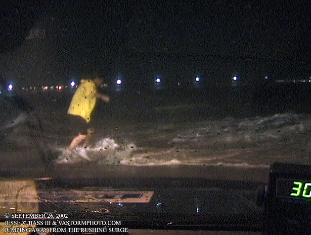
Before too long, the waves and surge were pushing their way onto the causeway. here Mark jumps out of the surge before grabbing the camera housing.
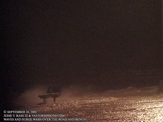
Surge moving in and waves washing over the benches that lined the causeway.
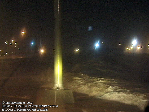
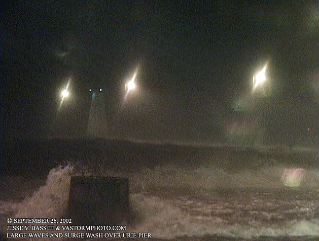
Waves, surge and wind continue to increase all along the area. This is about a four foot rise in water level to the top of the Urie Pier.
At it worst, water covered almost all of the pier. large waves were actually breaking on the roadway and washing into the yacht basin on the other side. The lighthouse at the end of the pier was taking a good beating at this time.
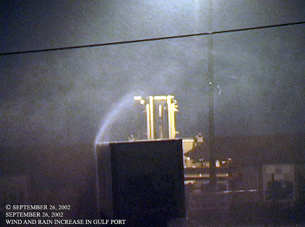
we did venture off the pier once or twice to see the rest of the area. We saw this trailer catching the wind and rain and stopped to shoot.
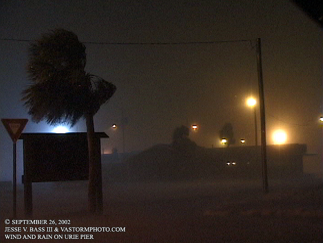
A shot of a restaurant or some other building on the pier. The wind blowing the palm tree and driving rain made this a neat looking shot. All of this in the photo here, is now gone!! Wiped clean by Hurricane Katrina in 2005. The lighthouse two photos above, gone as well. This area saw a twenty to twenty-eight foot surge during Katrina.
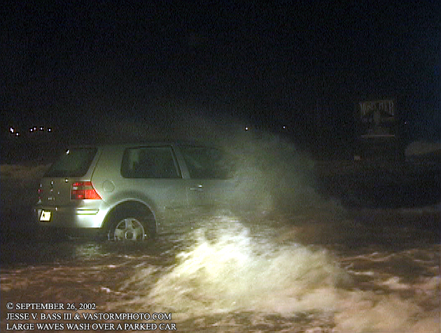
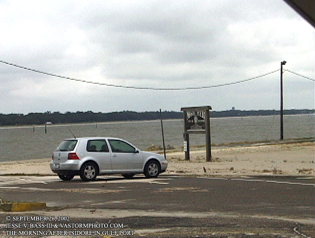
Someone left their car overnight on the pier next to the water and this is what happened. The large waves battered it for hours, washing over the roof. We thought a few times it would wash into the Gulf. But as you can see, it was still there in the morning. We slept at the Holiday Inn just down the road from here as the storm began to wind down. Katrina virtually destroyed that hotel and everything around it in 2005. To see some incredible photos and video of that day, visit Mike Theiss' page.
All Images Copyright Jesse V. Bass III and VaStormphoto.com |