|
|
|
COASTAL STORM OFF CAPE HATTERAS! LATER NAMED ANDREA! May 6, 2007 Another coastal storm developed over the weekend off the coast of North Carolina. This system quickly developed through the day Sunday the 6th as it drifted south southwest. A large high pressure dropping in from Canada helped to create a tight pressure gradient that helped to drive the winds up to sustained levels nearing 40mph in the Outer Banks with gusts nearing 60mph. Here in Virginia the winds were nearly the same with gusts reaching the 40's to near 50mph on Sunday morning and afternoon. I decided to head down to the Outer Banks in the afternoon Sunday to see what might be happening down there and see if we would see any over wash on Hwy. 12 down on Hatteras Island. After reaching the Outer Banks I hit the beach road and headed south looking for any water on the road and or sand that might be piled up. No water but I did see sand blowing across the road from the beach and a little starting to collect on the road. I shot a little video of it and moved on south towards Hatteras Island and Hwy. 12. I crossed the Bonner Bridge and at the highest point on the bridge I stopped to take a wind reading. I had a gust to 50mph at about 4:30pm. After moving on south and making the bend on Hwy. 12, I could see the usual spot filling with sand. The air was saturated with blowing sand in 40mph winds and what made this different was there was no rain falling. The past few times I have been through there during a storm, it was raining and it helped to knock down some of that sand. I drove further south with no luck of any over wash so I went to Avon to the fishing pier there and and shot some video on the beach. I shot some video of sand on the roads nearby and moved on north. I stopped once again on the Bonner Bridge and took another wind reading where I had a 60mph gust on top of the bridge. Later I went into Kitty Hawk and stopped by the Avalon Pier where foam was blowing into the air from the beach. Huge waves were hitting the pier and washing up onto the beach where that foam was blowing in the wind and into the air. A little later I went further north and found a house or cottage being "under washed" by the large waves washing ashore. It just did not appear to be making a huge push inland after high tide so I decided to head home. Later in the day on Monday the 7th, I have seen video and reports from the area where parts of Hwy. 12 had over washed from Rodanthe southward. Reports said that parts of Hwy. 12 were closed and would stay that way until the sand could be removed and that they were sure the water would not wash back over. Below are photos taken from video of the day and a link to that video. After this report was written and posted, this system was later named Sub-Tropical Storm Andrea, the first named storm of the year. It moved southward along the east coast and stalled a bit off Florida. The thought and hope for it to move close enough to bring rains to help with the fire situation did not come to pass. It quickly dissipated and lost the sub-tropical name and characteristics. COASTAL STORM VIDEO CLIP: See video of the day on the Outer Banks.
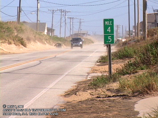
Once in the area and on the beach road, I saw sand blowing across the road and onto the roadway.
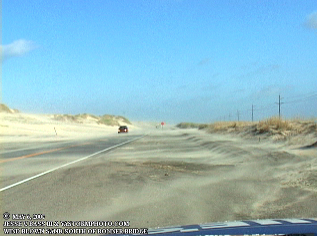
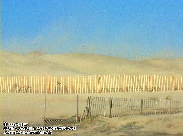
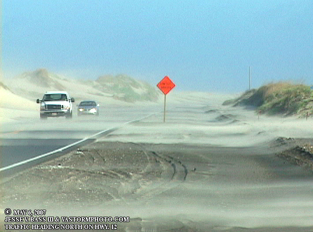
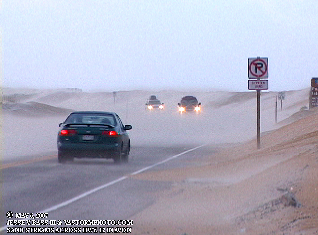
These three photos are just south of the Bonner Bridge where during hurricanes and tropical storms, I have seen this very scene. Tons of sand blowing into the air and on Hwy. 12. With no grass, weeds or bushes on the dunes to help hold that sand in place, it makes for a big mess.
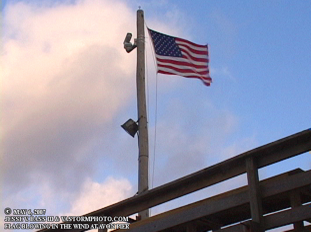
From the Avon Pier, Ol' Glory whips in the 40-50mph winds.
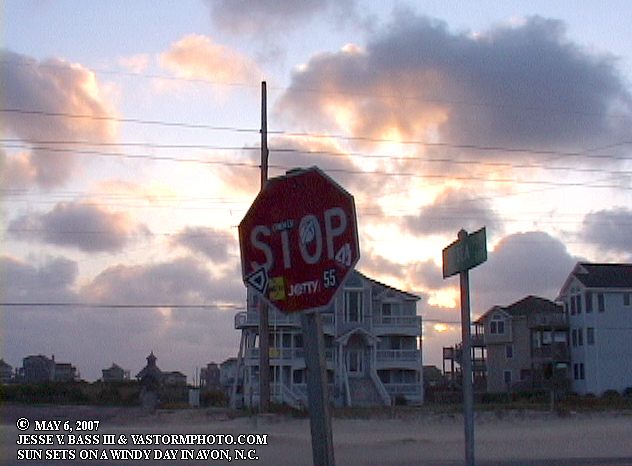
Still in Avon, the sun sets through some clouds with a 40mph wind screaming through. This sign was shaking in the wind.
More sand blowing on Hwy. 12 in Avon.
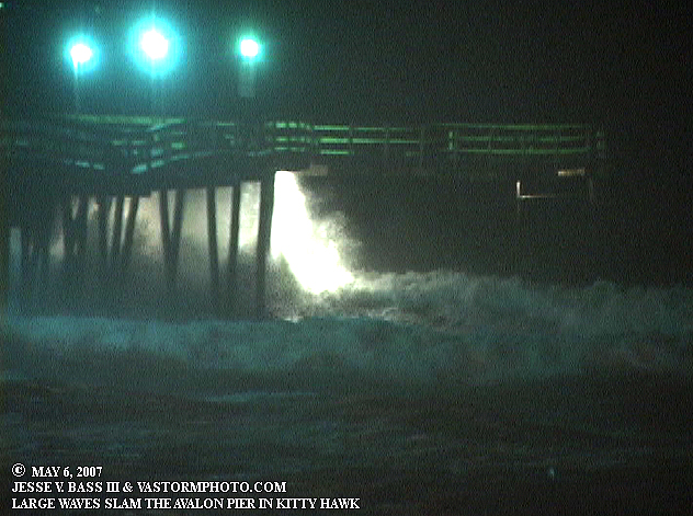
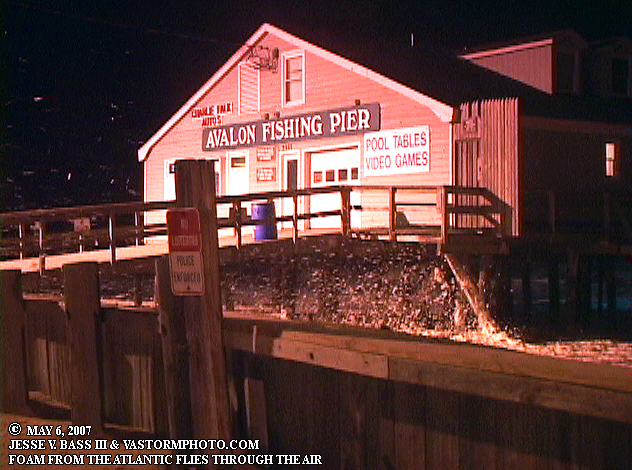
Huge waves slam the Avalon Pier in the dark at high tide.
Foam blowing up the beach from the large waves washing in
under the pier at high tide. All Images Copyright Jesse V. Bass III and
VaStormphoto.com Copyright 2007 All Rights Reserved
|