|
|
|
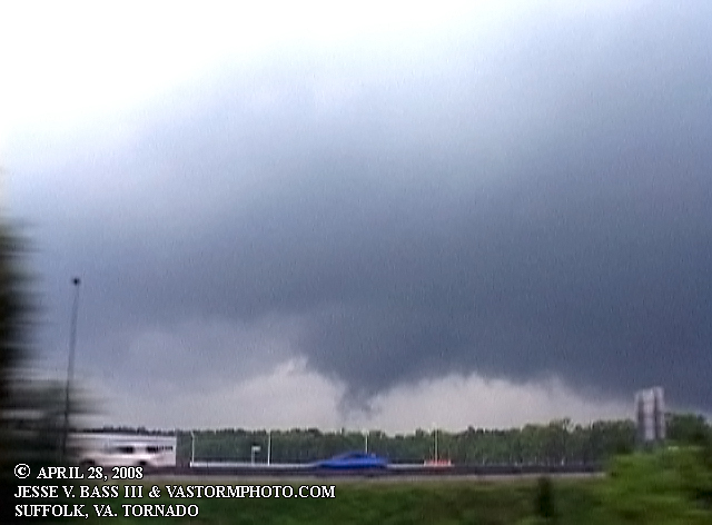
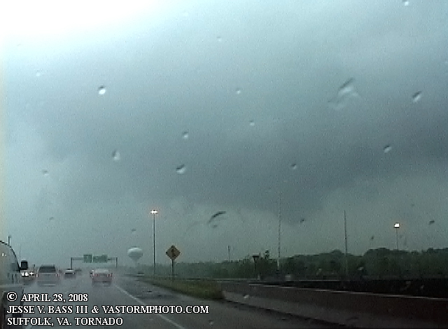
APRIL 28-29, 2008: SUFFOLK, VIRGINIA TORNADO!! April 28, 2008: The Storms Prediction Center (SPC) in Norman, Ok. had issued a slight risk of severe weather for portions of the east coast including Virginia for Monday April 28, 2008. Early in the morning there was fog and drizzle in the area with heavier showers moving in from the west and south. So I had pretty much written off the chance of severe weather for the day as there was little to no real sun shine and the temps were fairly cool most of the day. I didn't have access to any info during work and so I blew it off to say the least. Once back to the office I was able to look at a few things before leaving work but really didn't have much time to look things over before leaving. Radar showed some storms lining out west of I-95 and a few small isolated cells out ahead of that line. One of those cells had a tornado warning with it coming out of North Carolina. There appeared to be little to no lightning with the storms at the time. SO, I decided I had time and went to the gym. What a dork! After spending about an hour in the gym, I walked into the locker room to get my stuff and saw The Weather Channel was on and they had a crawl on the bottom of the screen with tornado warnings for several areas near in and near Suffolk. As I was leaving I told Julie and Matt at the front desk and headed to the Explorer. Once in the Explorer, where I left my phone, I saw that several people had been calling. My mom for one and my wife, and friend Bill Coyle who had called like 10 times. My mom told me about the warning and about where the storm was in relation to us. So I called Bill right away and he started filling me in on all the info. He gave me a location of the cell and told me it was looking like a big super cell was taking shape and was looking like a flying eagle. I headed south on I-664 to Rt. 58 where I pulled over at the small local airport there and tried to get a feel for what was going on. While there I looked at the radar on my Sprint cell phone and saw I was in a pretty good location for it come over me or just to my northwest. One of the local stations had a crew there and they wanted to do an interview with me to talk about what I was seeing and we might expect. My NOAA weather radio went off several times as the NWS office in Wakefield issued tornado warnings as the storm progressed northeastward at about 45mph at this point. At this time it was now about 4:00pm and the storm was pushing into central Suffolk. The warnings were now issued for northeastern Suffolk and northern Chesapeake, parts of Portsmouth and Norfolk as well as Hampton and Newport News. This is the time when the most damage was being done in Suffolk just a few minutes from where I was waiting. Had I traveled just a few miles west, I could have seen it as an EF-3 moving through north central Suffolk. Big bolts of lightning were now being seen and I started seeing the edge or backside of the meso to the northwest. I knew then that the "tornado" or circulation was going to pass me by and I would not be able to see much as the trees were now blocking it from view. I told the reporter that I had to go, filled them in on the info and bolted out onto Rt. 58 east back to I-664 north. Once I cleared some trees and got into an open area I could see the wall cloud and what looked to be a weak funnel working its way to the ground. I believe at this point it was entering the section of Suffolk known as Driver. I continued to head north and film as the storm moved quickly in my direction. Fearing that I might get caught on the interstate in a bad position I decided to get off at Pughsville Rd. There I was at the stop light at the bottom of the off ramp I got out of the truck and shot video looking west as the funnel crossed I-664 just to my west and north. I got back onto I-664 and headed back north where I was able to get close to the circulation and shoot the wall cloud as it pulled away. Once to College Dr. I headed south where I cleared another section of trees and saw a large wedge behind some trees throwing some debris into the air. Then I noticed that the debris seemed to change, looking like dirt or water. I believe it had then moved over the Elizabeth River and was a waterspout. It quickly went through several stages and changes before moving by Norfolk and towards the Eastern Shore. I dissipated before reaching the Eastern Shore over the Chesapeake Bay. It would not be until later in the evening when we saw the destruction that had taken place. I went straight to Bill's house in Virginia Beach where he helped me get the video cut and uploaded to the media outlets. At the same time, I went out in front of his house to shoot photos of the squall line that was now moving into Virginia Beach. The storms gusted out leaving nothing more than a small shelf cloud and heavy rains in the area. SUFFOLK, VIRGINIA TORNADO CLIP: See video of the tornado as it moved through the area. April 28, 2008: Video captures
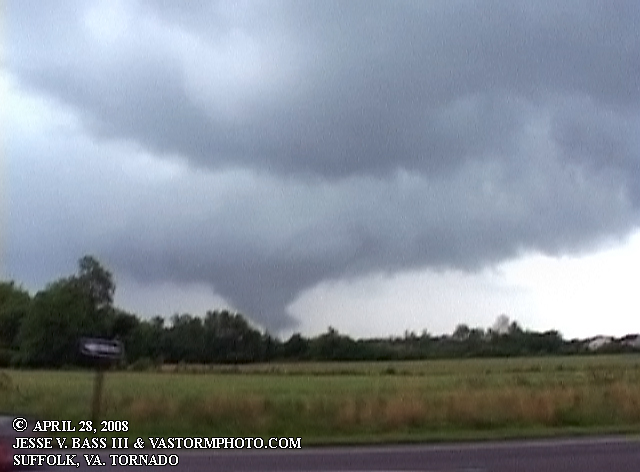
Here you can see the funnel as it was coming through the Driver section of Suffolk, Va.
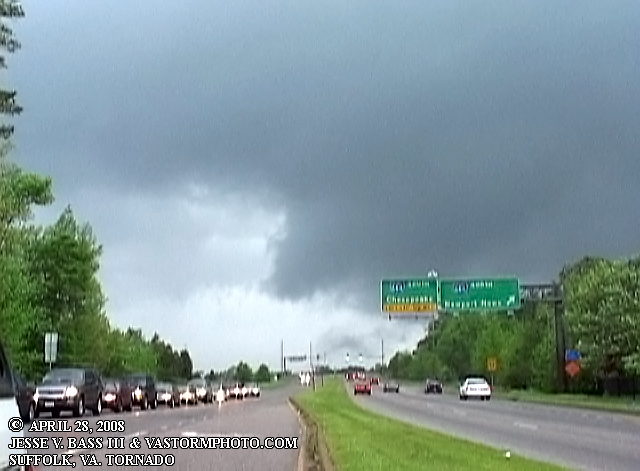
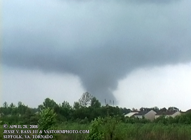
In these 2 frames, you can see the funnel passing the Pughsville Road exit on I-664 north.
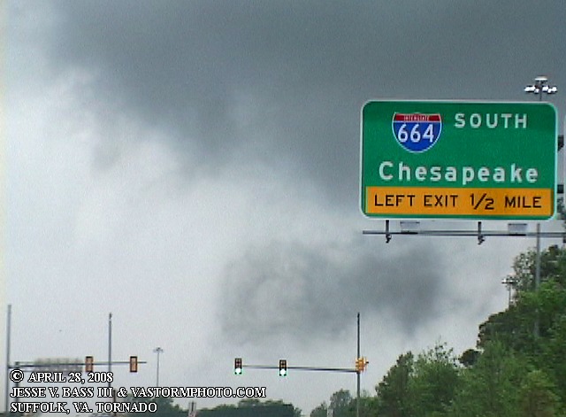
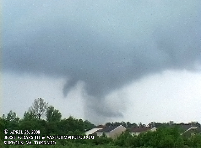
I-664 north, you can see the wall cloud just to the right and headed towards the Churchland area of Portsmouth.
Just as I cleared the trees, this is the time I think it was over Craney Island moving away quickly.
At this point, I believe it had moved out over the waters of the Elizabeth River headed to Norfolk.
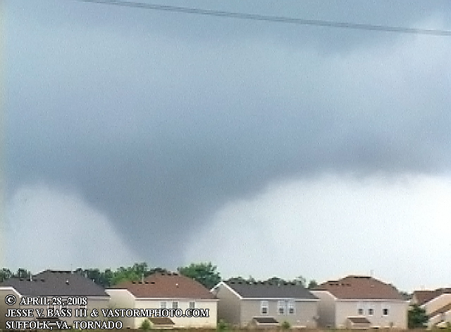
Here you can see several different smaller funnels in and around the main circulation.
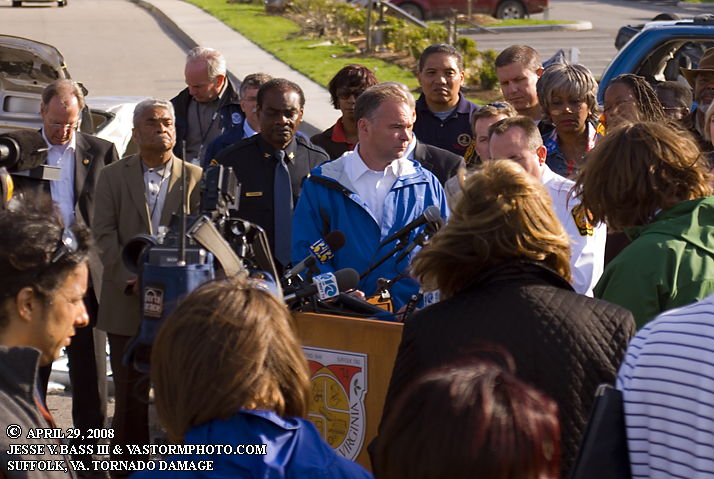
The tornado reformed and became a large wedge once again. APRIL 29, 2008: Damage photos from Driver and central Suffolk near Obici Hospital. I started out on Tuesday in the Driver section of Suffolk to survey and photo the damage. From there I would move to central Suffolk and be there for the press conference when they discussed their findings on the rating of the tornado. Governor Tim Kaine was here to survey the damage and it was noted that preliminary findings were a EF-3 with winds of 165mph. One mph short of an EF-4. It was also noted that the storm path was about 10 miles long where it did the most damage, but 22 miles or so altogether. The width was estimated to to be about 1/4 mile wide. Two hundered or people were injured, but NO ONE DIED! Estimates in damage are around $28.6 million. Here is a link to the NWS Wakefield report.
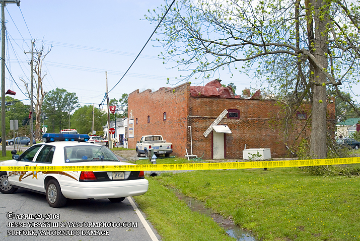
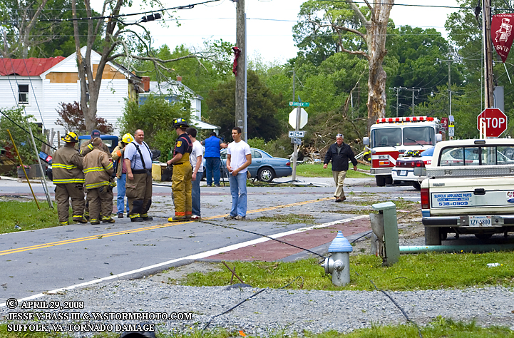
Driver in Suffolk blocked off as assessments and clean up begins. Roof damage to the brick building.
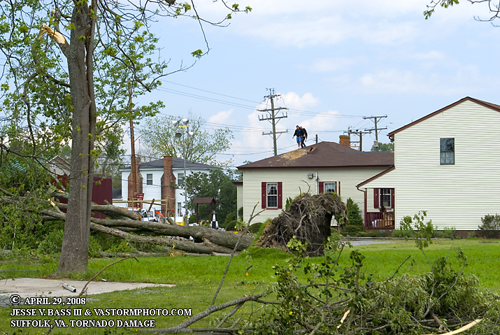
Trees down and more roof damage in the Driver section of Suffolk.
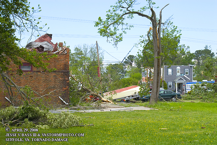
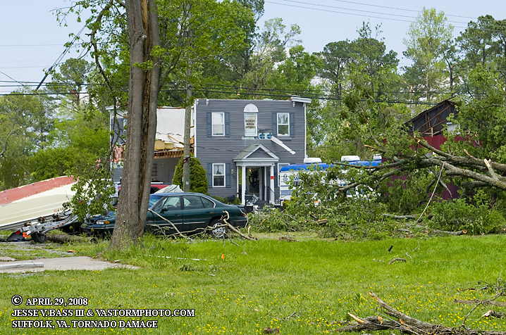
Trees and limbs down on cars, boat flipped. This just about the area where the tornado came through.
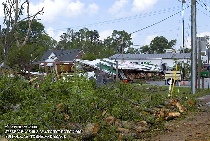
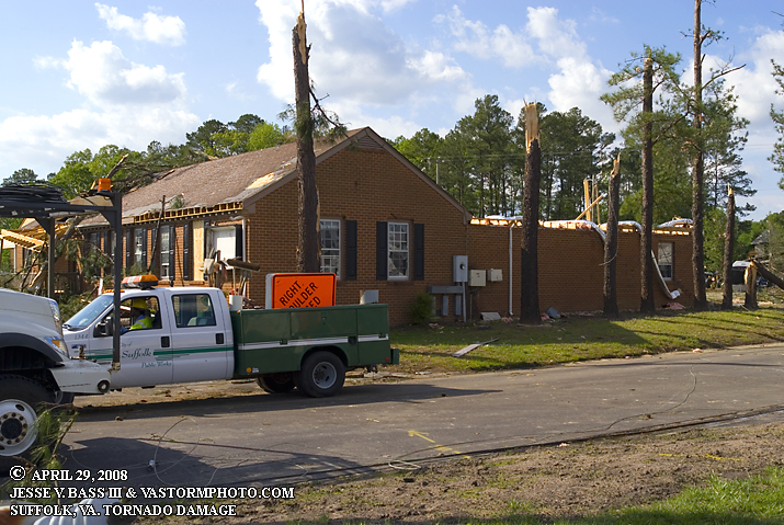
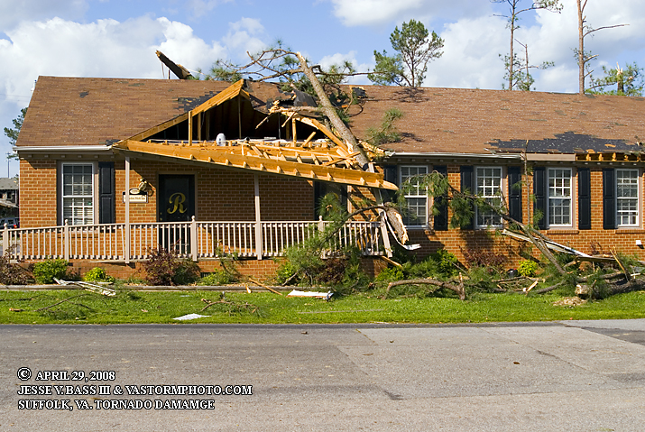
This building completely lost its roof. Most of these buildings have been here for many many years.
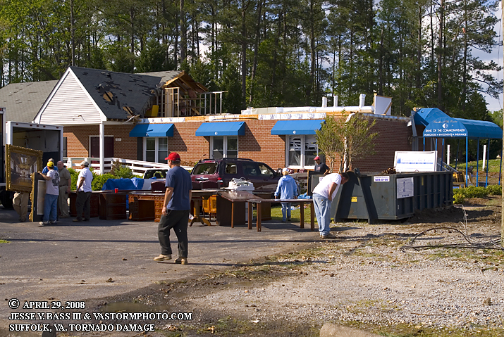
Clean up well underway in Driver. Fire fighters take a short break on what was a cool and breezy day.
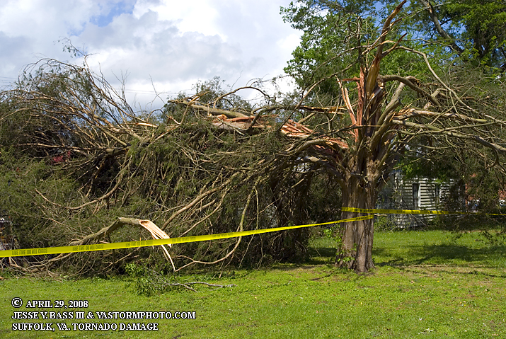
Tree split by the strong winds of the tornado. There was plenty of these type scenes everywhere you looked.
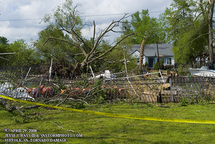
Fence blown over and property thrown about by the tornado.
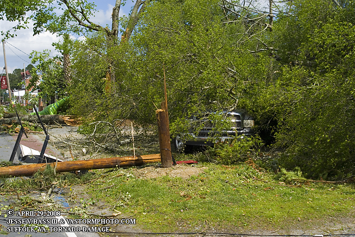
Downed limb rests on a car in Driver section of Suffolk.
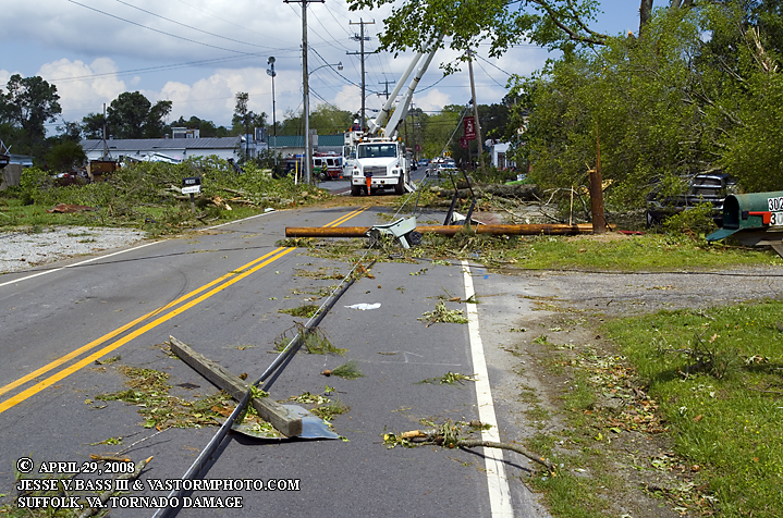
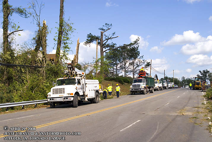
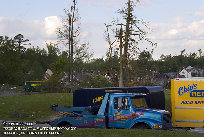
Power lines, power poles, street signs litter the road as the power company is hard at work restoring power to Drive.
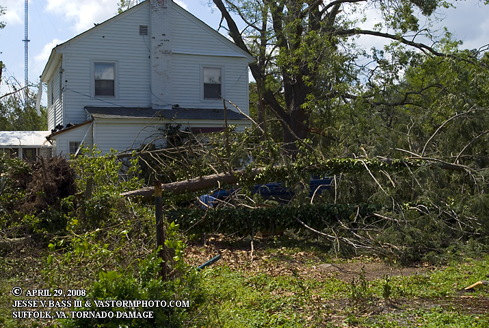
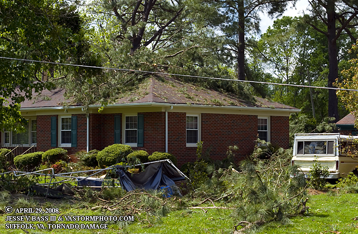
Large limb rests on the roof of this house. It appeared that this house may not have sustained much damage.
Power pole snapped off and a truck sits under a downed tree limb.
In the background you can see a small local store was pretty much flattened by the tornado. Tree limbs that had already been cut and moved from the streets rest in the foreground.
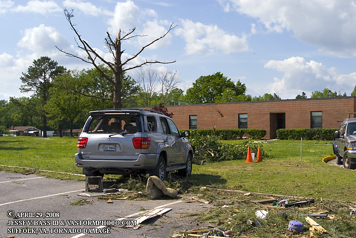
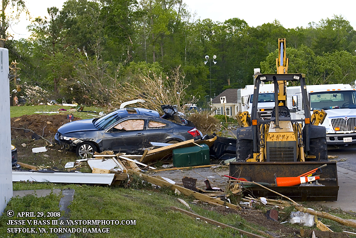
Now here on the southwest side of Rt. 58 near Obici Hospital, cars at this school had been blown around and windows shattered as the tornado began its destructive path.
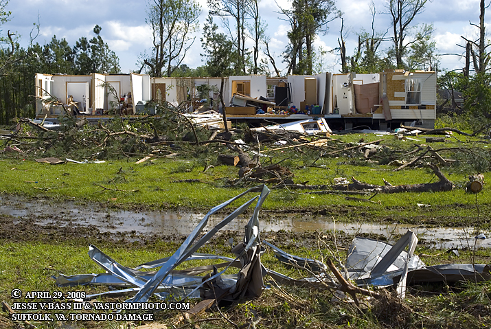
This trailer home was a complete loss as the tornado passed over.
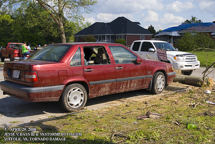
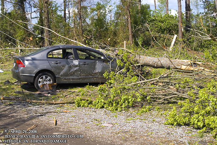
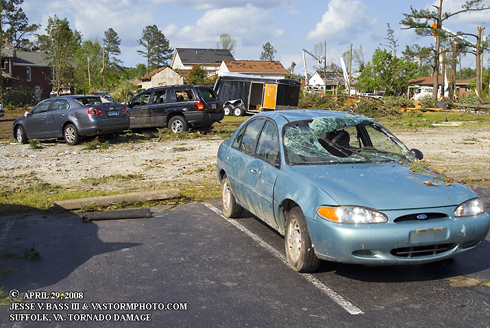
More car damage from debris and trees limbs near Obici Hospital.
A little further southwest of Rt. 58 power companies work hard to restore poles and power to the area as the clean up continues with bulldozers and backhoes in the streets.
Pine trees snapped off by the tornado. Part of the roof of this building was ripped off as well.
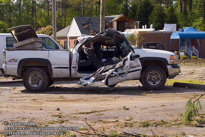
This truck looks like it may have been in the direct path as the tornado came through.
Another shot and angle of the roof ripped off a building above.
More cars blown around with windows blown out by debris.
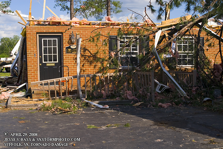
Another building with part of its roof completely ripped off by the tornado.
Missing shingles and a tree falling on the roof of this building causing a huge hole in the roof.
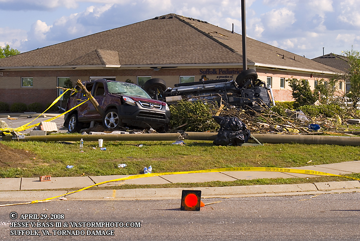
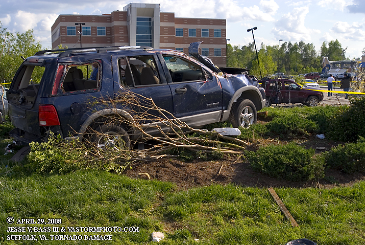
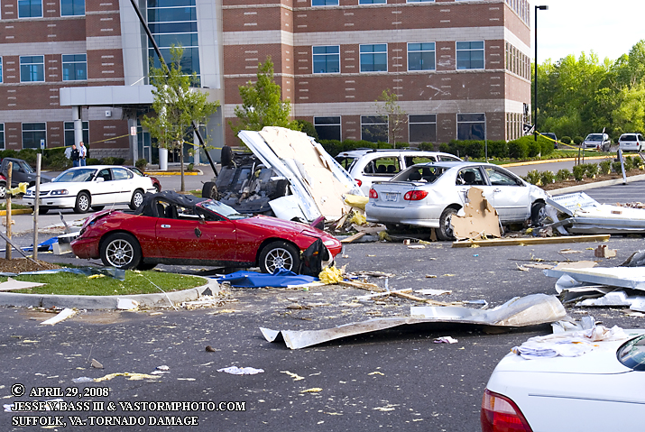
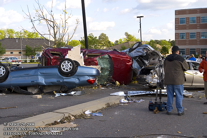
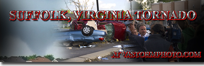
Now northeast of Rt. 58 at Obici Hospital, this where the tornado strengthened significantly and did the most damage. Cars were thrown around from every direction.
This was the typical scene in the area of the hospital and the new medical center in the background of this photo.
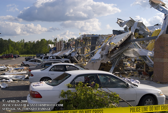
This strip mall was a total loss. There was a car inside the building hanging upside down from the rafters or something. I could not get a good enough angle to catch the car.
Look in the background at the medical building, the right side of the building. A car or truck had been thrown through the wall and the vehicle was now inside the building. More vehicles thrown around and destroyed.
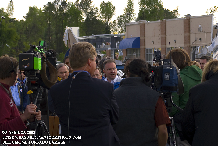
Virginia Governor Tim Kaine at a press conference describing the relief efforts, how more help was on the way and the discussion that preliminary estimates are of a strong EF-3 moving over this region.
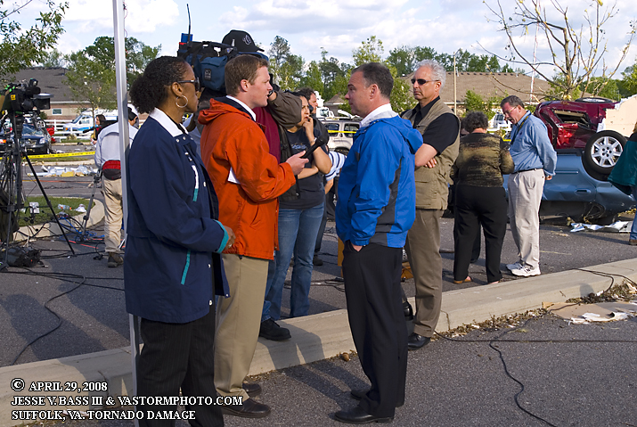
Governor Tim Kaine answers questions for the media after the press conference as Bill Sammler (in the light blue shirt) the Warning Coordination Meteorologist for Wakefield answers questions on the tornado's possible strength and path.
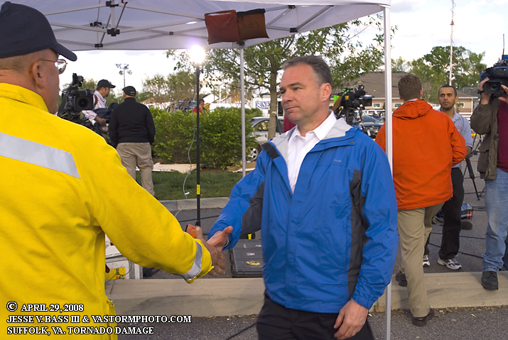
Governor Tim Kaine shakes hands with volunteers, rescue workers and local officials after the press conference.
More vehicles stacked on top of each other like toys at the medical center just across from Obici Hospital.
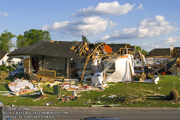
House completely destroyed by the tornado next to the medical center.
Looking northeast into the neighborhood that had been hit so hard and so many have seen photos and video of. This would be the neighborhood that had house whipped off their foundations. The area was blocked off and no one allowed in as the Governor was headed back into the area.
This car has an interesting story with it. The gentleman driving this vehicle was trying to out run the tornado when it was launched from the road a right good distance where it came to rest here. He jumped out and started to help other drivers get out of their vehicles that had been caught as well. Others started telling him he needed help as he had cuts all over his back. He had to have some 125 stitches to close those cuts. He appeared to have no other injuries. One lucky man.
|