|
|

|
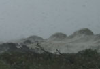
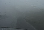
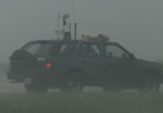
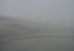
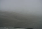
TROPICAL WEATHER VIDEO CLIPS PAGE 1, YEAR 2002 TROPICAL STORM GUSTAV ALONG THE OUTER BANKS OF NORTH CAROLINA: Tropical Storm Gustav formed on September 8th as a subtropical low south of Cape Hatteras. Later on the 8th, it was determined from a recon flight that it had become Subtropical Storm Gustav. By the 10th, Gustav had become a true Tropical Storm moving towards the north and the Outer Banks. Gustav's maximum sustained winds reached 60mph before grazing Cape Hatteras as he turned to the northeast. Gustav once past North Carolina became the seasons first hurricane. The Hurricane Intercept Research Team was there and recorded some great video. This is just a small sample with more to come. Most of the clips below show the impressive amount of sand being blown through the air with the rain coming down near an inch an hour at times. The highest wind gust we recorded was 66mph near the Bonner Bridge.
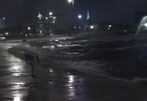
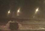
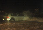
TROPICAL STORM ISIDORE FROM GULF PORT, MISSISSIPPI: Isidore formed from a tropical wave from the African coast on the 14th of September as it approached the Lesser Antillie island of Trinidad. On the 18th after being downgraded and re-classified it became a tropical storm. By the 19th it had become a hurricane with winds near 104mph. Isidore struck the western tip of Cuba on the 20th of September moving slowly to the west northwest. Isidore moved out over the Gulf gain strength as it turned to the southwest towards the Yucatan. Along the way, Isidore rapidly strengthened to near 130mph. But it would continue to move toward the Yucatan, making landfall on the 22nd. He remained inland for about 36 hours before moving off to the north and back into the Gulf. Isidore would never regain hurricane status but before it made landfall in the U.S. Tropical Storm Isidore gave it one last shot. In the early morning hours of the 26th of September, Isidore reached 60mph and a minimum central pressure of 984mb before striking the coast of Louisiana near Grand Isle. The circulation was broad and the strongest convection was well east of the center. We positioned ourselves in Gulf Port, Mississippi. Here we saw a wind gust near 58mph, but we had a storm surge at Urie Pier that was about 4-6 feet.
TROPICAL WEATHER CLIPS PAGE 2!!
All Images Copyright Jesse V. Bass III and VaStormphoto.com Copyright 2004 All Rights Reserved |