|
|
|
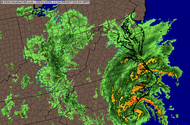
TROPICAL STORM ERNESTO: LANDFALL IN NORTH CAROLINA AND VIRGINIA FLOODING August 31-September 1, 2006: On August 24th, while we were still on the road in Mississippi, the NHC started advisories on the next tropical depression at 5pm. This system would later increase in intensity and become Tropical Storm Ernesto just twenty-four hours later. Ernesto would do battle with some dry air and shear but managed to become our first hurricane of the season on the 27th. The track would bring the center close to the Dominican Republic which helped to disrupt the circulation and weaken it back to tropical storm status before making landfall in Cuba. After spending time on the island of Cuba, Ernesto moved back over open waters and made its way toward Florida and the Keys. Mark left Wilmington with fellow team member James Lewis for Florida where they would work with another of our members- Mike Watkins. Ernesto struggled to maintain itself before making landfall in the Keys on August 29th. Ernesto would move inland and begin to turn to the northeast and head for the warm waters of the western Atlantic and the Gulf Stream. From there, Ernesto was due to make landfall once again the South Carolina, North Carolina area on Thursday. While on his way up the coast, Ernesto took advantage of the warm waters and somewhat favorable upper level conditions to strengthen. I left work at noon on August 31st to head south to Wilmington and meet Mark and team member-intern Todd Ferebee and prepare for Ernesto's next landfall. Once in the area, we headed to Carolina Beach and the Kure Beach area to take wind and pressure readings and shoot video as the winds were steadily increasing. Ernesto became a 70mph tropical storm before making landfall around 11:30pm on the 31st just missing the chance to become a hurricane once again. We worked the area shooting video and gathering data as Ernesto moved inland and Mark sent several reports to the NHC. We had several maximum gusts in the mid 60s as the center was crossing the coastline. Below are the photos and video stills from the evening. After landfall, I started making my way back to Virginia to be in place for the flooding that Ernesto's rains were forecast to bring. All along I-40 and I-95, the rain was extremely heavy and there were times I thought about pulling over and getting a room as it was late and the roads were very slick, wet and dangerous. I decided to keep driving and reached home around 4:30am. Since I had gone to work on the 31st, that was twenty-four hours straight that I had been up, talk about being tired. I felt I needed some sleep though to stay safe later in the day. I got up around 8:30am and headed back out to shoot stills and video of the flooding in the area. Many places were starting to flood badly at this point and the worst of the heaviest rains had not reached us yet. I started out in the Churchland area of Portsmouth at an area that is well known for flooding. From there I worked my way into the downtown Norfolk area to the normal flooding areas to shoot. I was going to go to Virginia Beach but the traffic was horrendous and getting worse by the minute. So I decided on Norfolk. I finished back in Portsmouth in an area where I had tried to get on the interstate with no luck as the on ramp was closed due to flooding. The area had a wide range of rainfall totals ranging from 5 inches to a little more than 10 inches. Those photos are on page 2 linked below! ERNESTO VIDEO CLIP: See video as Ernesto makes landfall in Wilmington and flooding in Virginia 14.4mb.
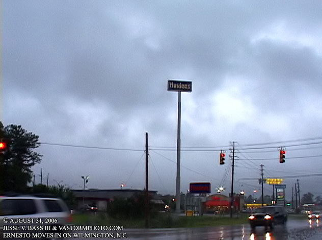
In Leland, N.C. we headed for a bite to eat and the dark clouds were racing overhead.
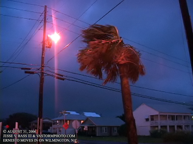
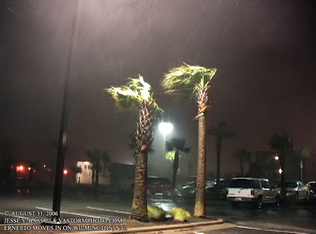
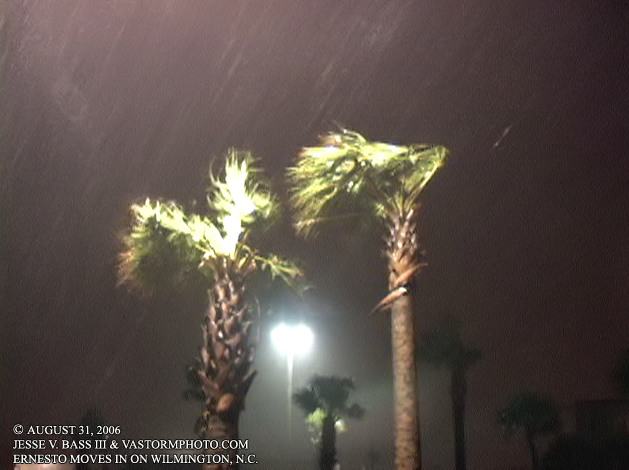
This palm tree was starting to take a beating as the wind was funneled between two buildings near by.
Shot of Mark and Todd as they were leaving a beach access after collecting some wind data.
Here you can see the winds and rains starting to really increase as a car goes by.
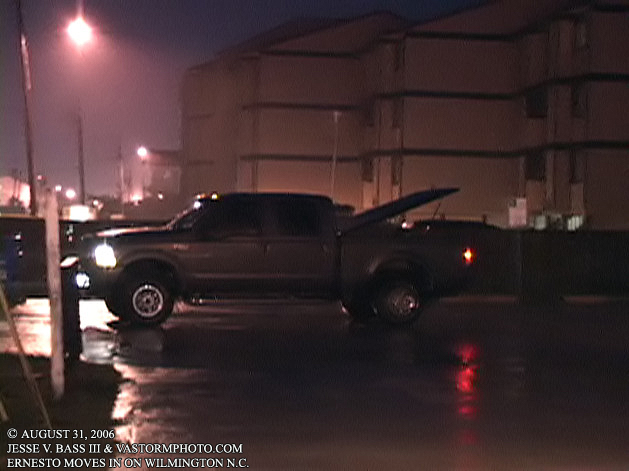
As this guy was leaving the beach access ramp, the wind caught his truck bed cover and blew it open in winds 30-45mph in gusts at this point.
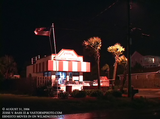
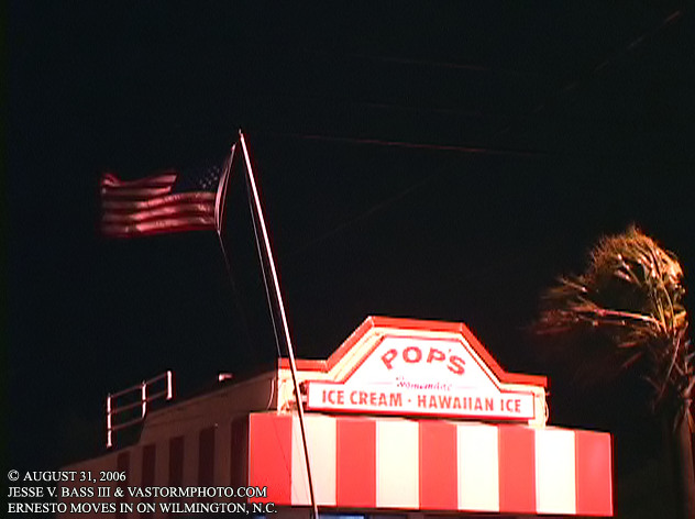
I stopped to catch the wind whipping Old Glory around at this ice cream hut in Carolina Beach.
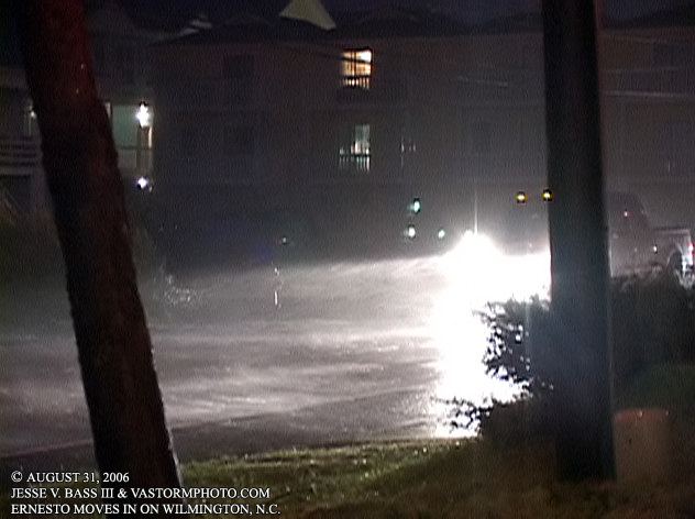
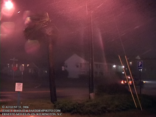
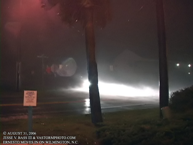
Here you can see strong winds driving the rain into the street as Ernesto moved inland. Winds were gusting to around 60mph by now.
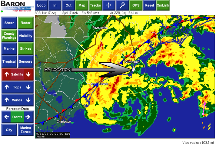
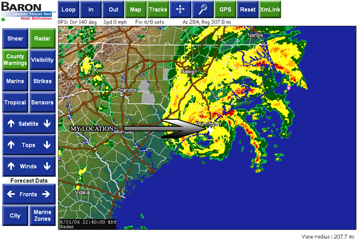
These two radar shots from the Mobile Threat Net show Ernesto closing in on the coast as well as my location to the center. My vehicle is in the little white square area that the arrow is pointing to.
This animation shows Ernesto crossing Cape Fear near Kure and Carolina Beach.
As the center closes in on our location, the winds are now sustained in the 40's with gusts consistently near or over 60mph.
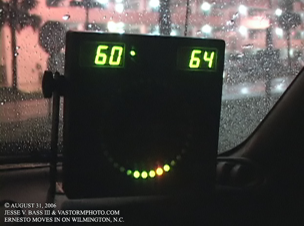
And here you see a gust to 64mph and a instant wind reading on the left to 60mph.
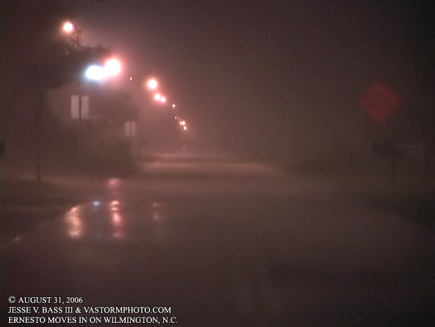
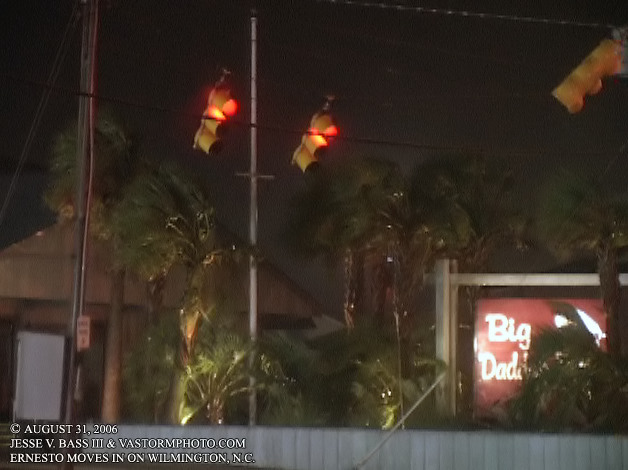
In the Kure Beach area, you can see the street lights swinging in the wind with the power still on in most of the area.
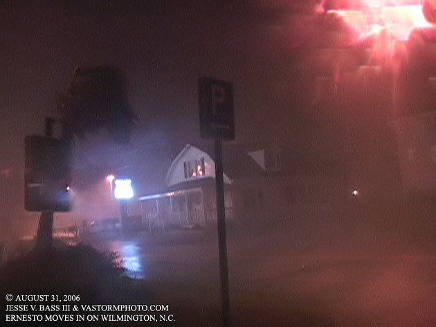
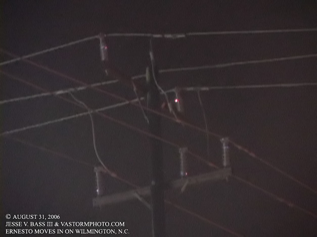
Here you can see the salt air and rain burning in the power lines as Ernesto comes ashore.
I followed the stronger bands northward from Kure Beach where you can see the wind was still in the 50's and 60mph range.
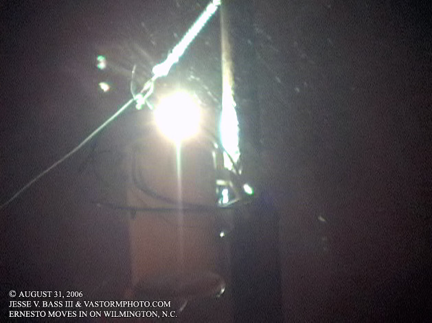
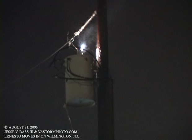
After driving back south, I saw this transformer sparking and arching in the wind and rain.
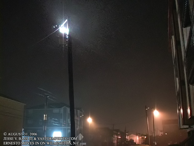
A wider shot of the transformer looking south. The complex directly to the left of the pole had its lights flickering on an off every time the transformer sparked. I never thought about finding an area to shoot video of that unfortunately.
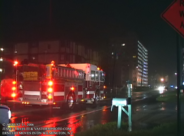
A little while later, a fire truck showed up to check out the situation. We waited for the transformer to finally blow or fall, but never did. There was not much the fire department could do with it either at this point. They had to wait for the power to be cut.
All Images Copyright Jesse V. Bass III and
VaStormphoto.com Copyright 2006 All Rights Reserved
|