|
|

|
HURRICANE FRANCES: CONTINUED
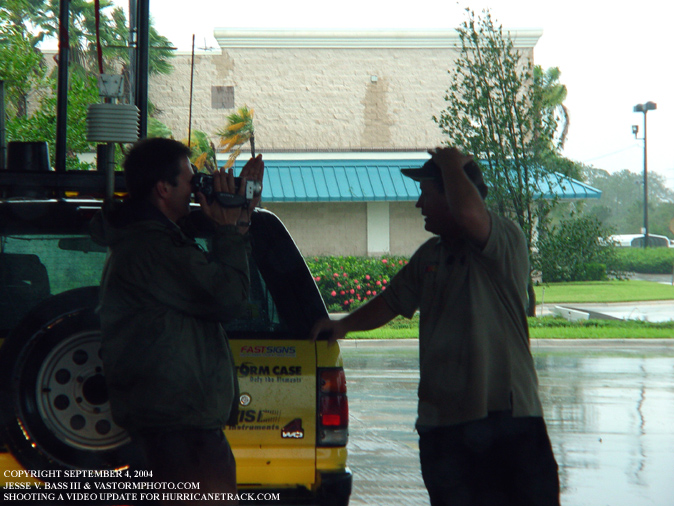
Here Jeff Flock shoots a video update with Mark as while we were at a Lowe's store near Hutchinson Island. We were preparing to find a spot to leave the Rodeo so it could collect the data and send it back to Hurricanetrack.com during the storm. The wind was already blowing 25-40mph sustained and there was damage evident all around. Some power lines were down a few small tree limbs and even a few trees closer to Hutchinson Island.
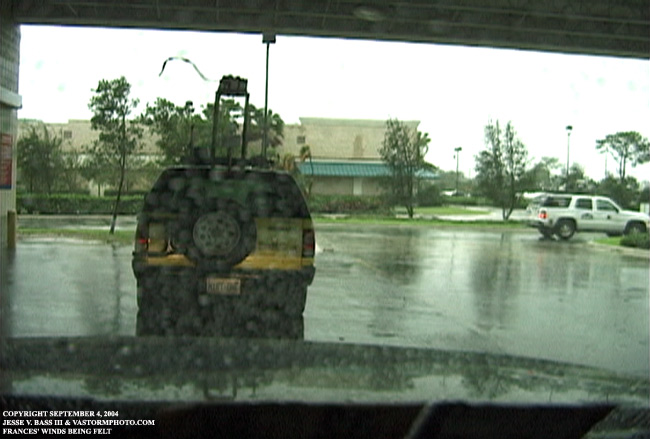
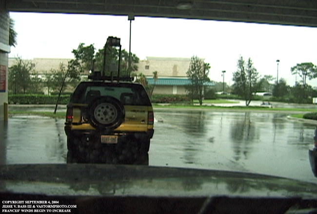
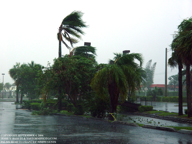
These two pics are video frame grabs as the wind gusted at the Lowe's store near Hutchinson Island. In the second photo compare the small tree to the left of the Rodeo to the photo just above. Notices how the tree was bending in the wind.
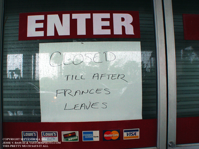
A sign on the door of Lowe's. Frances leaving would take some time since she was only moving at 4-6mph.
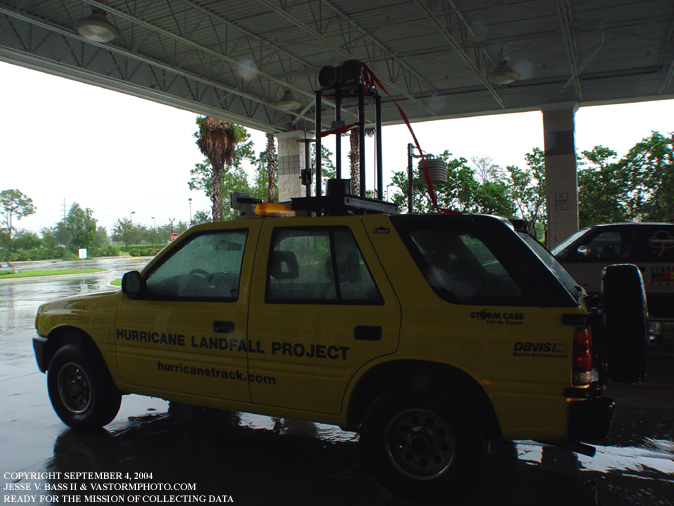
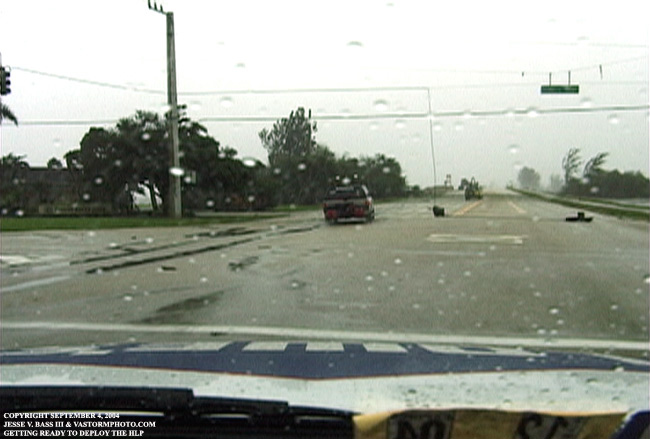
The Rodeo ready for deployment. The camera housings were strapped down on the platform and the only thing left to do was to place the nearly ten foot pole on the roof for the anemometer which would place it at about fifteen feet above the road.
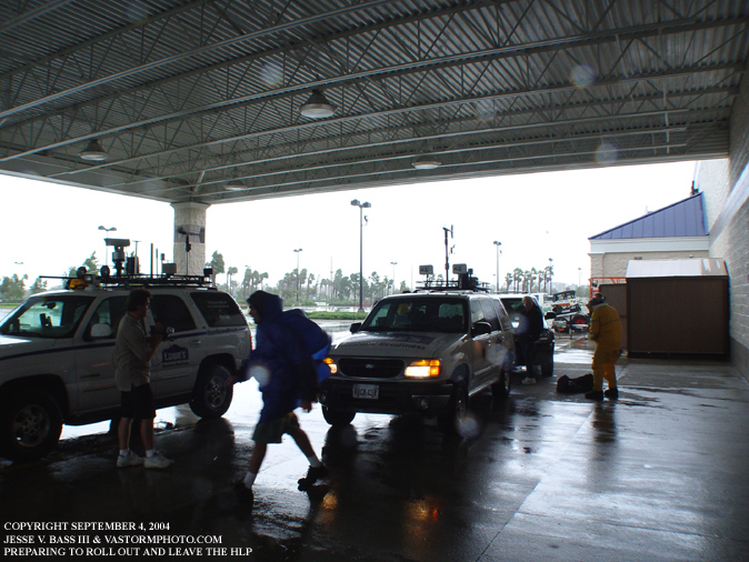
Here we are getting ready to deploy and find a secure location for the Rodeo out in the elements.
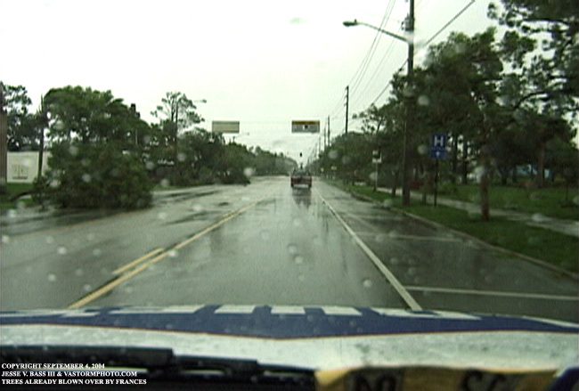
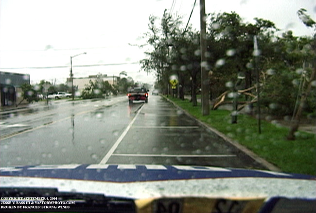
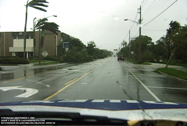
In these three video frame grabs, you can see how the wind had already caused some damage to trees along the road as we were headed for Hutchinson Island to leave the HLP. Winds were gusting to near 50-60mph at times.
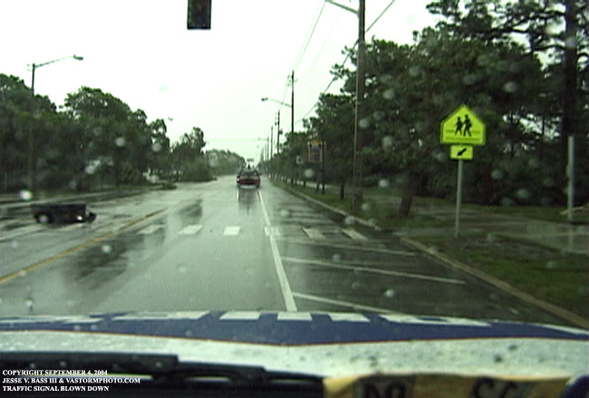
In these two video frame grabs, you will notice several traffic signal lights blown down by Frances' winds.
The rain was heavy and the wind was blowing nearly 50mph at this point. The crew left me behind to watch an area where some storm surge could cut off their path off Hutchinson. As they headed back I drove to this strip mall parking lot to take cover as debris was being blown in the air. John would meet me here and we would soon head back north up I-95 to the EOC in Fort Pierce.
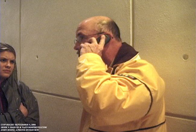
This frame grab is of John Van Pelt doing a phone interview with a TV station out of West Palm Beach as the reporter looks on. John talked about our plan for Frances and the rest of H.I.R.T.'s missions.
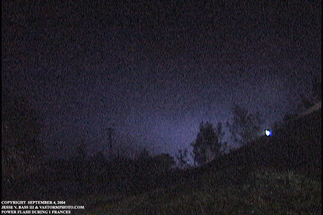
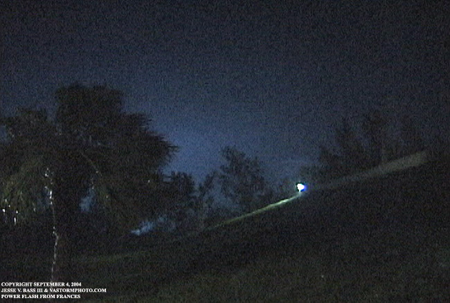
These two video frame grabs were taken after john and I made it to the EOC office in Fort Pierce. There were several bright blue explosions that lit up the night to our south as transformers were taken the brunt of Frances.
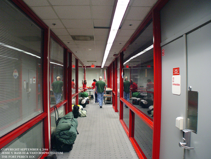
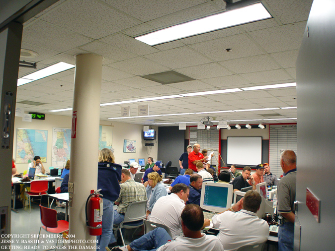
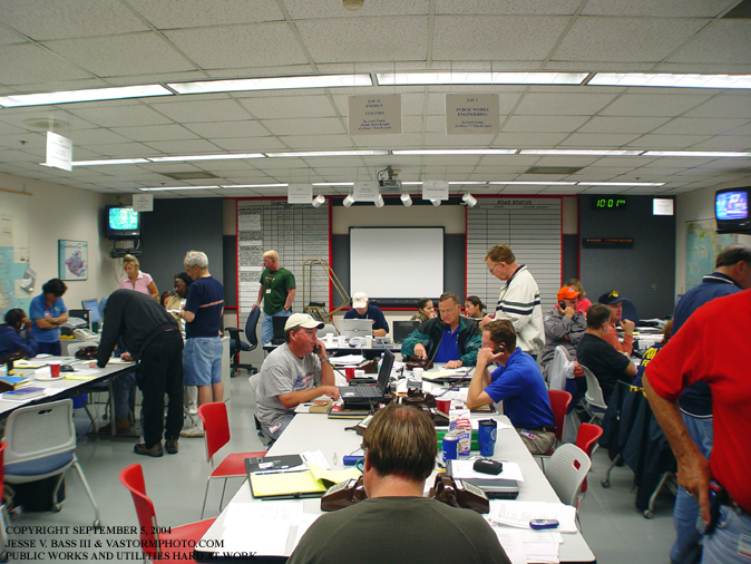
At the EOC in Fort Pierce, you can see where people were prepared to sleep in the narrow hallway during the night as Frances lumbered ashore.
The next morning the office was busy with phone calls from people asking about when the storm would pass, when their power would be restored and a few calls on what to do because their homes had sustained roof damage and some flooding from surge and rain. In the left hand corner of the room the media was preparing to do a news conference from the EOC by phone because the winds were to strong to raise the satellite dishes on the sat trucks.
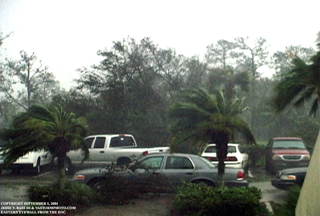
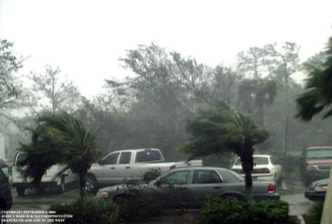
These two photos are from video taken in the morning after Frances had come ashore. These are from the EOC as the backside of Frances' eastern eyewall moved through.
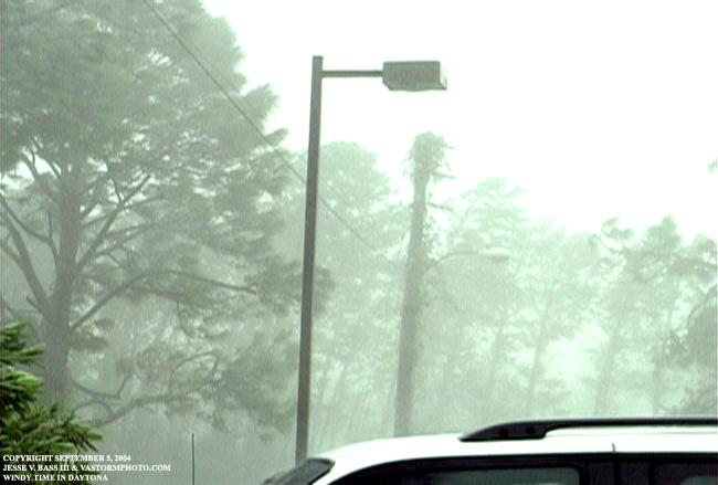
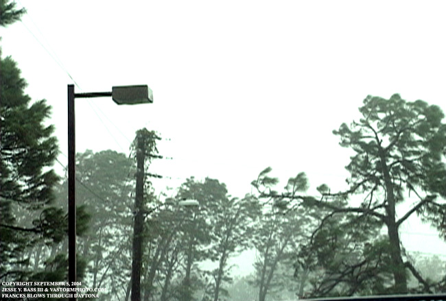
And here are two more photos from video once we reached Daytona. The wind was gusting in the upper 40's to low 60's at times. The wind would lessen with time of course but continued to gust into the 40's overnight.
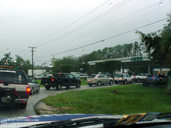
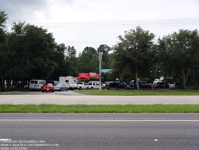
Here we get in line to get gas so we could get out of the state of Florida. The gas would quickly run out and not everyone on the team or documentary crew were able to fill up.
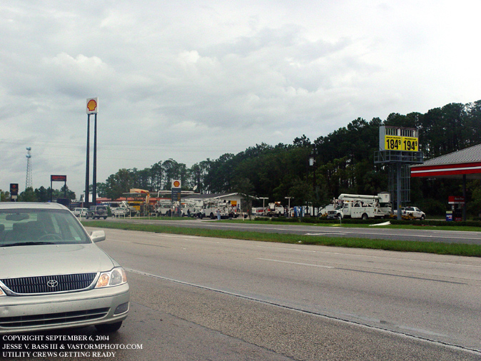
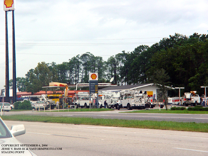
While I waited for Mark, John and the Towers Production crew to get gas from another station, I noticed a staging area for some power crews across the street at another gas station that was closed. I am sure these crews were already tired from dealing with Charley's aftermath. It would become much longer after Frances with the approach of Hurricane Ivan which would affect the panhandle and Hurricane Jeanne who would come ashore in the same area as Frances just weeks later.
The gas station where John, Mark and the documentary crew were able to fill up before heading north. They were lucky this time, the station had enough gas for them to fill up.
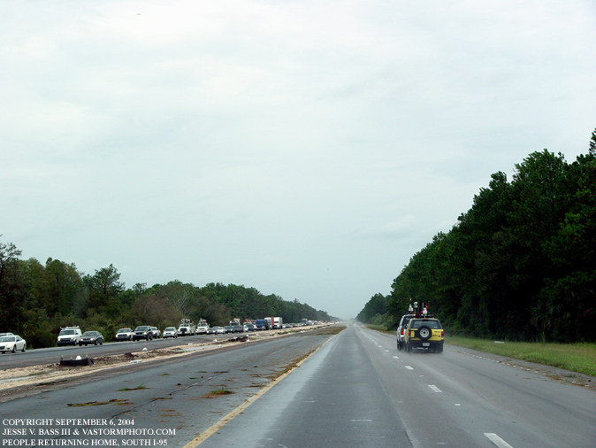
Heading north on I-95 it was just the opposite of when we came into the state. This time the southbound lanes were clogged with traffic and evacuees trying to get back to their homes after Frances relentlessly pounded the area with 105mph winds.
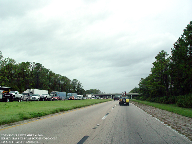
In some areas of I-95 traffic was at a stand still. Several accidents helped to make the southward drive a slow go but with so many people trying to get home, it was virtually a parking lot once again.
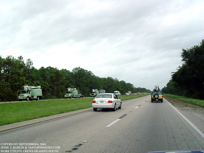
Here are more out of state utility trucks coming into the state to help with the clean up efforts. We saw several hundred of them from different states coming south as we drove through Georgia, South Carolina and North Carolina. Who would have thought that with Hurricane Charley, a category 4 hurricane with winds of 145mph sustained and Hurricane Frances, a category 2 hurricane with winds of 105mph sustained that the state of Florida would have to deal with two more hurricane within 2 weeks of Frances. Ivan would make landfall in Gulf Shores, Alabama where the HLP vehicle saw its last mission. The storm surge and high winds would lash the Florida panhandle where many houses and businesses would e destroyed. Some areas saw a 10-16 foot storm surge along the coast. As the clean up efforts continued from all three hurricanes, Hurricane Jeanne would slam ashore along the same stretch of coastline that Frances had just pounded three weeks earlier. The devastation of Florida is certainly something no one could have imagined at the beginning of the season. Mark and I had gone to the National Hurricane Conference in April in Orlando, Florida where the feeling we got from the conference was that Florida may have been under the gun for the 2004 season. There was a lot of talk about how Florida had dodged so many hurricanes since Andrew in 1992 and that "Florida's good luck can't last." And that it didn't. The state was affected by four hurricanes, three making landfall in the state and a tropical storm in 2004. Lets hope that this will be it for awhile for Florida as it will take years to fully recover from this onslaught from the tropics. For a look back at the conference write up, click here and see where the call was made for Floridians to be prepared for the 2004 hurricane season. Frances would be the last hurricane of the season for me. I was unable to get away for Ivan. As for Jeanne, Mark bought me a ticket to fly from Norfolk to Atlanta and then onto Daytona where he and Eddie Smith would pick me up that evening before Jeanne came ashore. The flight was cancelled from Atlanta to Daytona and I missed out on Jeanne. Since Jeanne it has been pretty quiet across the Atlantic basin until the week of October 3-9th. Tropical Storm Matthew would develop and make landfall in Louisiana as a weak tropical storm. And on October 10th, we had our first sub-tropical system of the year. Nicole was named in the early morning hours and was expected to remain a sub-tropical system as it passed Bermuda to the west.
All Images Copyright Jesse V. Bass III and VaStormphoto.com Copyright 2004 All Rights Reserved |