|
|
|
|
|
ATLANTIC BEACH, NORTH CAROLINA & PORTSMOUTH, VIRGINIA SEPTEMBER 16-20, 2003 A large tropical wave had moved off the western coast of Africa and became a tropical depression on September 6, 2003. This depression would quickly grow to tropical storm status where it would earn the name Isabel later that day. By 11am on September 7, 2003, Isabel would become the fourth hurricane of the season. Little did we know Isabel would grow into one of the strongest hurricanes in the Atlantic ocean in several years. She would grow to become a cat. 5 hurricane with winds in excess of 160mph on September 11, 2003 around 5pm. This intensity was verified by a Hurricane Hunter Aircraft. By 5am on the thirteenth she had weakened a bit to 150mph sustained. However, just twelve hours later Isabel would once again become a dangerous cat 5 with winds near 160mph. By 11am on the fourteenth, Isabel had weakened once again and this trend would continue as she approached the east coast of the United States. By the fifteenth of September, it was becoming increasingly clear that Isabel was going to impact the coastline somewhere from the Carolinas to southern New England. At the 11am advisory The National Hurricane Center posted a Hurricane Watch from Little River Inlet, South Carolina to Chincoteague, Virginia. Then by 11pm on the sixteenth they had issued a Hurricane Warning for Cape Fear, North Carolina to the Virginia Carolina state line. By this time, Isabel had weakened considerable from her category 5 status to a cat. 2 with winds near 110mph. Now it was not a question of if Isabel would strike, but where. The NHC started issuing for the first time a 5 day forecast in 2003 and we had some idea that it would be close to the Atlantic Beach area. The forecast track had changed from Cape Hatteras, N.C. southward to Atlantic Beach in the 11am advisory on the sixteenth and would remain the forecast landfall point until a few hours before Isabel came ashore. She would eventually come ashore just south of Ocracoke Island, N.C. with winds near 100mph. For the Hurricane Intercept Research Team, we would begin getting things together to intercept Isabel on the fourteenth and deciding on where we should be. Jeff Flock from CNN would contact Mark and tell him they wanted to follow the team to the Outer Banks and cover our mission of Isabel. After the forecast track changed to Atlantic Beach, Mark called and got us several rooms reserved for us and the CNN crew. I rolled into Atlantic Beach in the early evening and Mark and John were doing a live shot with Jeff at 5pm. It would be a very busy couple of days for us, and the rest of the story is laid out below with each photo. ISABEL VIDEO CLIP: See the trip to Atlantic Beach as well as the day of landfall and destruction around Hampton Roads MARK SUDDUTH'S ISABEL CLIP: See time lapse of Isabel's outer bands, strong winds and large waves
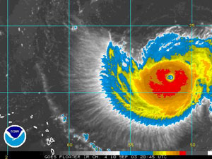
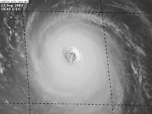
Here is a satellite photo of Hurricane Isabel on here way to category 5 status. Here her winds were 140mph.
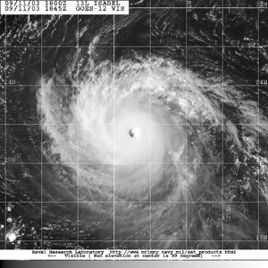
Theses two photos are of Isabel at new category 5 status. Her winds were near 160mph.
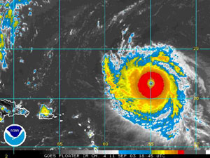
Here Isabel had re-strengthened to 160mph. Note the swirls inside the eye. This is the a good sign of an intense hurricane.
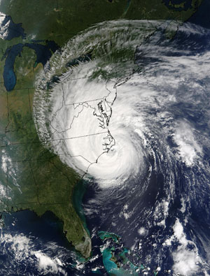
And here is a satellite photo of Hurricane Isabel nearing landfall on North Carolina.
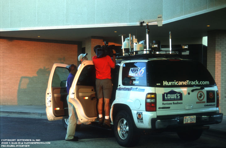
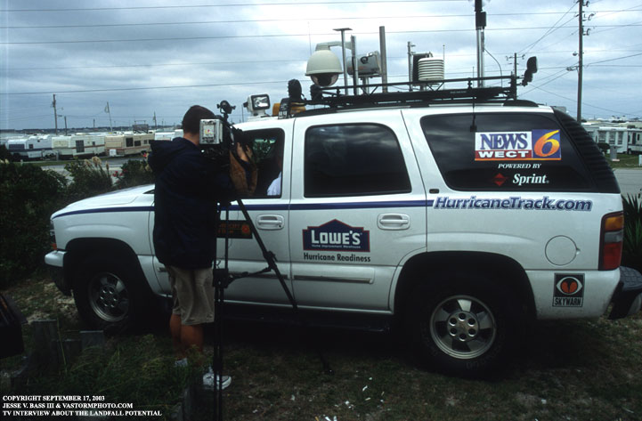
At the Sheraton Hotel, the news media saw the Chevy Tahoe and came over to ask if they could interview Mark. Here is a photo before we ever checked in to the hotel of that interview. This scene would be replayed over and over the next few days.
Once in our room we rushed out to the balcony to set up video cameras to do some time lapse. It was such a beautiful and calm evening. You would have never thought a hurricane was lurking off shore.
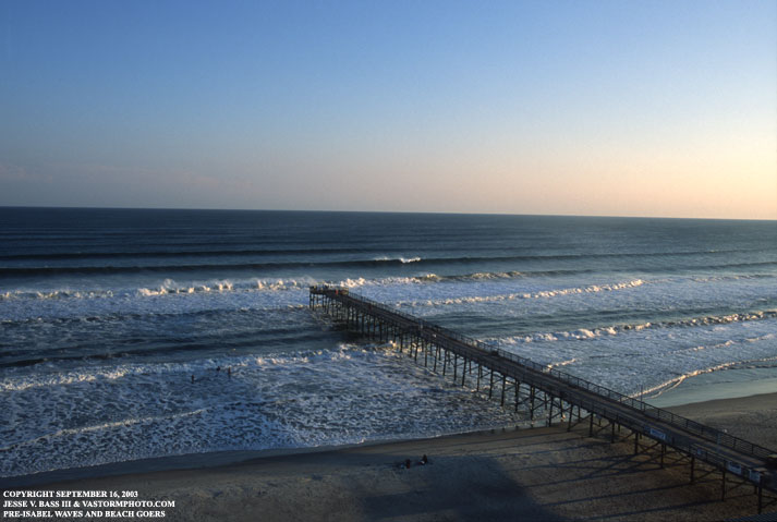
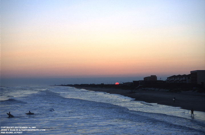
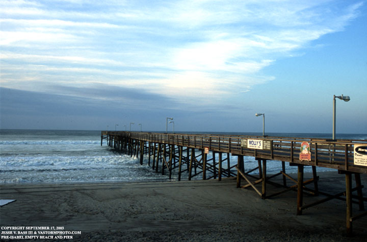
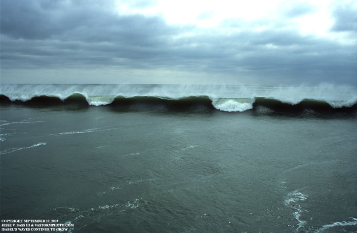
We headed down to the ocean front and onto the pier in the photo above to see and hear the large waves slamming ashore from Isabel's winds. Does not look like a hurricane sky with this beautiful sunset.
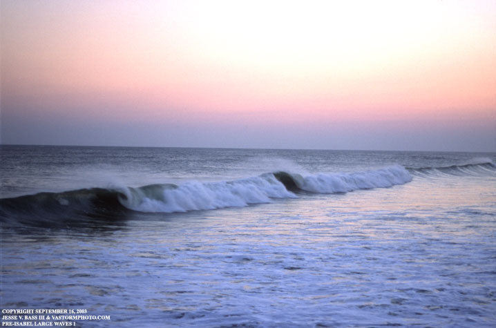
The large waves pushed out ahead of Isabel make their way on shore. The water was very calm for a category 2 hurricane to be headed this way. The waves were running about 10 foot plus.
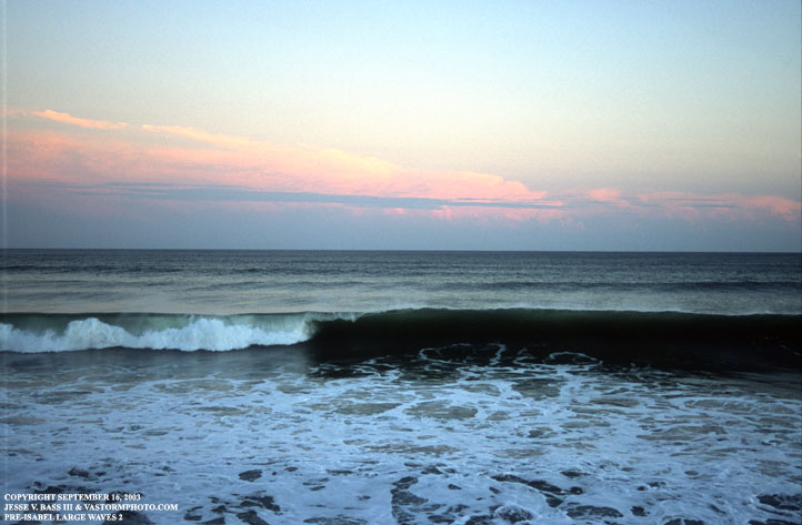
From the end of the pier looking southeast the clouds in the background are thunderstorms over the Gulf Stream not clouds from Isabel. As these waves hit the pier, it would sway back and forth and some spray would leap up between the boards.
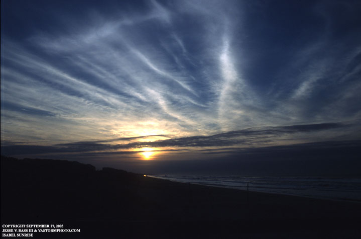
Early the next morning, we had to be up and ready to do a live interview with ABC's Good Morning America. From the beach I shot this photo of the sunrise behind the counter clock-wise motion of Isabel's outer bands (low level clouds) and the clock-wise outflow (upper level clouds).
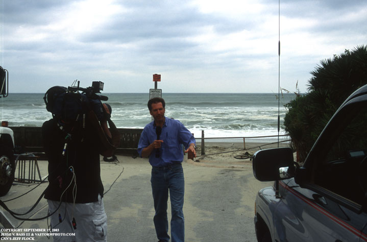
After we taped the piece for ABC, we headed back to the hotel to get ready for several live shots on the beach with Jeff Flock and CNN. This was taken at the base of the same pier as before. You can see thick heavy cloud deck of Isabel getting ready to move onshore.
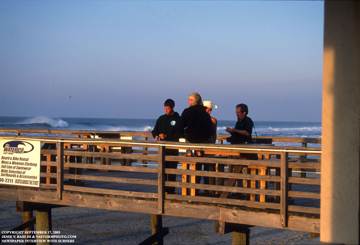
Several surfers came by to check out the surf that morning and talk with all types of media. A reporter/photographer from a Carolina news paper shot some photos and talked with a few of the surfers hanging out on the pier.
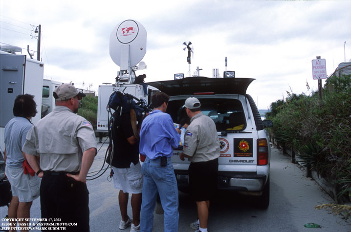
Later in the morning, it was time to meet with Jeff and do the first of several live shots on the beach for CNN. Jeff started out talking about the vehicles we had with us and the equipment and sponsor logos on each. Lowe's and Sprint's logos got plenty of air time. The truck to the right is team member John Van Pelt's Dodge pickup.
Mark and Jeff in the second live shot started talking about the print media that Mark produces for several TV and radio stations as well as businesses and local counties. Here Mark is talking about the storm surge maps he produced for the North Carolina Outer Banks area and what we could expect there in Atlantic Beach.
After the CNN live shots, we found out that the Sheraton was closing and it's people were going to evacuate the area. We went down for one more look at the ocean from the end of the pier. The waves had grown much larger than the night before. Some appeared to be larger than 15 feet. But as you can see, an off shore wind continued to keep the water fairly calm.
Worried about where we would stay, Mark posted a message on his website, HurricaneTrack.com, asking if there was anyone in the area that planned to ride out Isabel. Well the great people that own and run the Sea Gull Motel just east of the Sheraton by a mile or two sent an email and found Mark's number on the website to say we were more than welcome there. We were not there more than twenty minutes when the media found us once again, many of which were staying in the motel or another one just up the street.
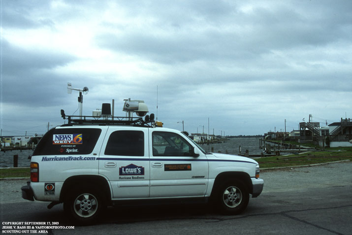
After the media interviews, we went down the road to a convenient store for some drinks and junk food, we stopped by the marinas just across the street from the motel. There were mobile homes boarded up and we surely figured this area would be underwater from the storm surge during Isabel's arrival. This would also be a good open area to take wind readings during the height of the storm.
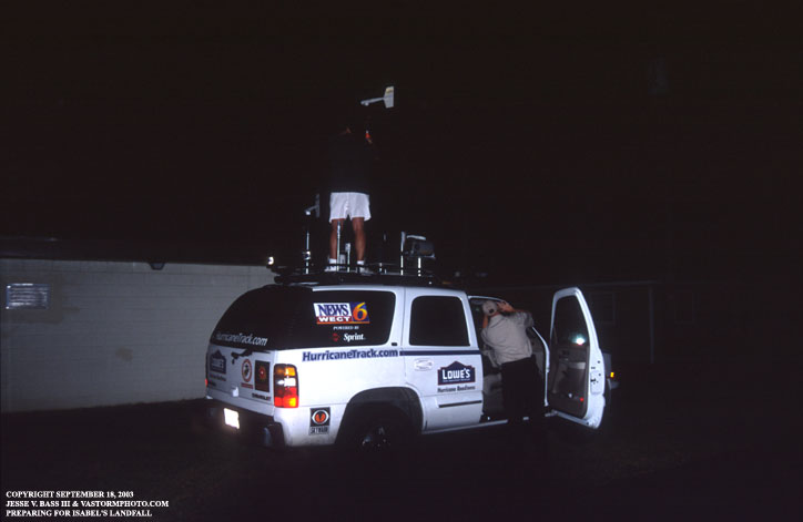
After trying un-successfully to get some sleep the night of the seventeenth, around 3am on the eighteenth we could hear the winds increasing outside as trash-cans left outside blew over and the trees outside our window continued to bang against the building with every wind gust. We decided to get up and get the Tahoe ready for Isabel's arrival by getting the anemometer on another pole to raise it to 15 feet. This way it would have less chance of getting a blast of wind off the windshield and getting a false reading. Here Mark is on the roof adjusting the anemometer while John was tucked away the cables.
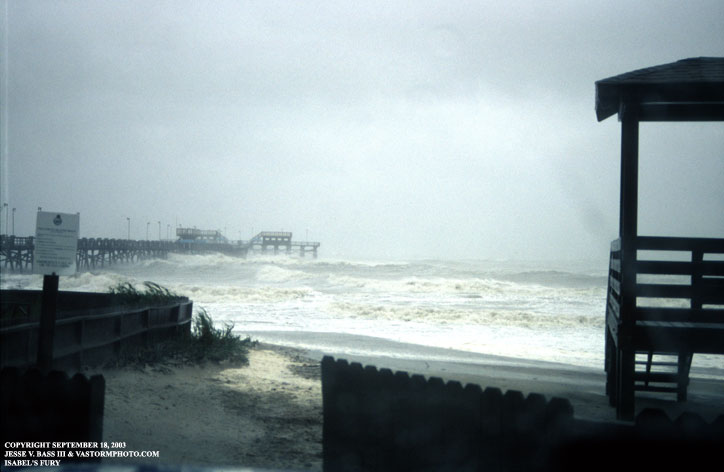
As the sun came up and Isabel continued her path towards the Outer Banks, I shot this photo of the Triple S Pier in Atlantic Beach with the large waves battering the pier and the ocean had become increasingly violent.
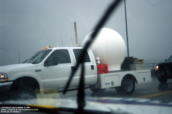
As the eyewall nearing our location, or what was left of it, we drove up to the bridge that connects Atlantic Beach to the mainland. On top of this bridge we hoped to be high enough and in the clear to get a good wind reading during Isabel's worst on the southern Outer Banks. The highest gust we recorded was 69mph. Just after that gust, a DOW (Doppler On Wheels) vehicle and several support vehicles came over the hill from New Bern. They stopped and asked what our highest wind was and confirmed that they had a 68mph a few moments before.
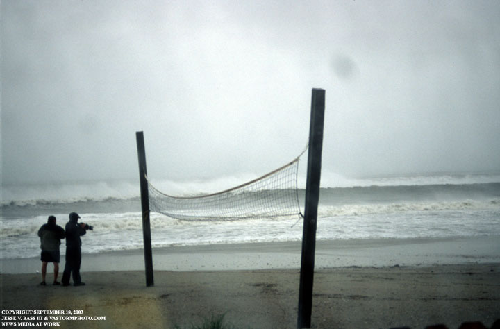
Back at the pier while waiting to do another CNN live update, we could see some reporters and camera people walking around on the beach at the height of the storm shooting video and doing live reports.
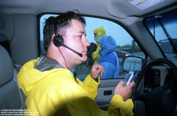
Mark Sudduth doing one of many, many cell phone interviews through the day. It all started around 4:30am when he received a call from a radio station in Dublin, Ireland. From there we all did interviews. Many radio stations here in the U.S. as well as Germany, England and Australia to name a few. I would leave Atlantic Beach and head home around 6pm. It is about a 2 1/2 -3 hour drive to Portsmouth, Va. What was waiting for me up route 17 would surprise me and everyone on the team. That story and photos on
|